Home
States
Colorado
Connecticut
Maine
Massachusetts
New Hampshire
New York
Rhode Island
Utah
Vermont
View All
Lists
NE 4,000 Footers
NE 100 Highest
NH 4,000 Footers
NH 100 Highest
NH 52 With A View
NH Belknap Range
NH Ossipee 10
Links
Trail Conditions
Trip Log
Sunrises
Sunsets
About
|
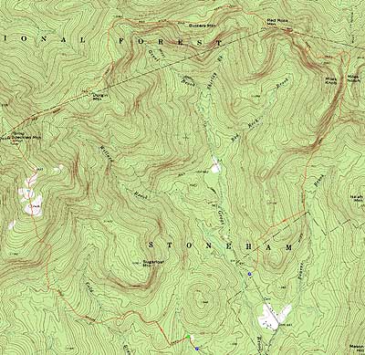
Speckled Mountain, Durgin Mountain, Butters Mountain, Red Rock Mountain
Stoneham, ME, Mason, ME
Trailheads, measurements, times, distances, and maps are all approximate and relative to the hike(s) as shown below.
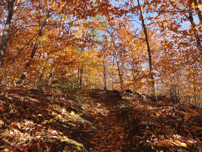
Looking up the Cold Brook Trail on the way to Speckled Mountain
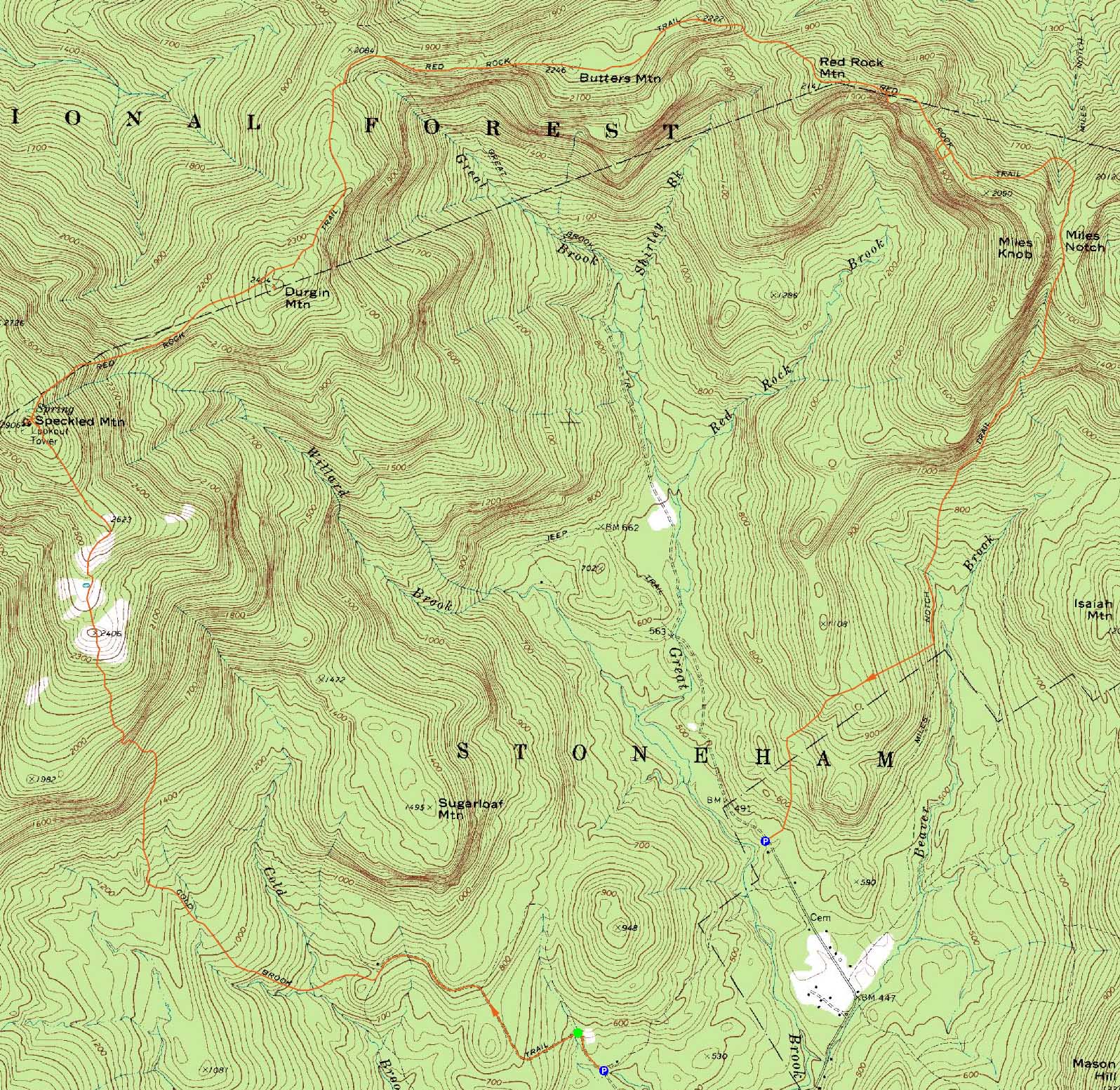
Route: Cold Brook Trail, Bickford Brook Trail, (Speckled Mountain), Bickford Brook Trail, Red Rock Trail, bushwhack, (Durgin Mountain), bushwhack, Red Rock Trail, (Butters Mountain), Red Rock Trail, (Red Rock Mountain), Red Rock Trail, Miles Notch Trail
Having long wanted to hike Red Rock Mountain, it appeared to be a good day for it. After spending a few minutes finding the likely Miles Notch Trail trailhead, we spotted a vehicle there and headed over to the Cold Brook Trail, parking about .4 miles up the roadwalk, just past a marsh.
From there, we continued on foot along dirt/logging roads, turning left at the Cold Brook Trail sign. Shortly after passing an old house on the right, we took a left onto another logging road, then beared right downhill at another junction - neither junction had any visible hiking trail signs. Above five minutes beyond the house, the active logging road ran out and we found ourselves on an older road bed, bearing at another snowmobile trail junction. Soon thereafter, we arrived at the Evergreen Link junction - I'd probably take the Evergreen Link next time and save the extra fraction of a mile.
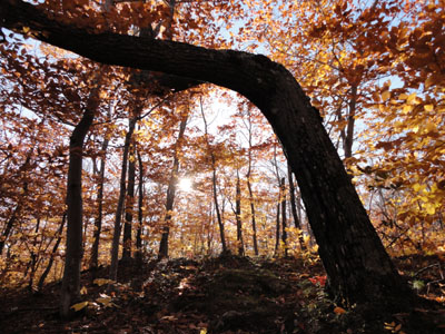
From there, the Cold Brook Trail was more of a traditional trailwalk. Steepening up around the wilderness boundary, we observed the first patches of ice.
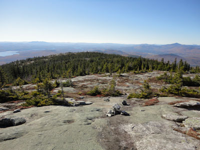
Eventually reaching the open ledges of the Cold Brook Trail, we had superb views in three directions, including snow covered Presidentials engulfed in clouds.
After ducking back into the woods, we soon arrived at the summit ledges of Speckled Mountain. Prior to touching the highpoint adjacent the old tower footings, we headed to a nice eastern viewpoint just a bit off trail.
Though the directional views from the summit were nice, it was a bit windy and cold. Thus we didn't linger long and instead headed down the Red Rock Trail.
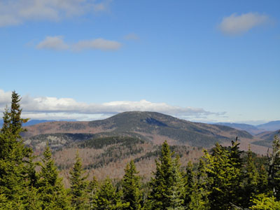
After dropping somewhat steeply off Speckled, the trail moderated as we worked our way to Durgin. Reaching a ledgy area, we first explored the northern ledges just off trail, finding a decent viewpoint of the Mahoosucs and points east. We then crossed over the trail and bushwhacked through generally open softwoods to what appeared to be the highpoint. There appeared to be evidence of an old trail routing or two in these woods, which would perhaps explain the slight difference between the USGS and AMC maps.
The walk between Durgin and Butters was through fairly nice woods with decent footing, though the trail was hard to find in places, especially after the Great Brook Trail junction. With a leaf covered footbed and minimal blazing, as well as numerous minor to moderate blowdowns in generally open hardwoods, there were multiple times in which care had to be taken to find the trail.
Eventually reaching Butters Mountain, the highpoint appeared to be alongside the trail. There didn't appear to be any views anywhere near the summit.
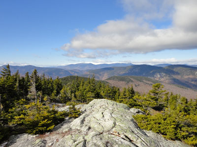
Beyond Butters, the nice woods continued, as well as the sometimes vague nature of the trail. After passing over multiple nice view ledges, we eventually reached the ledgy summit of Red Rock Mountain, where we had good views to the north. A few minutes past the summit, we followed a herdpath south to vast open ledges and cliffs - certainly not a good place to be in slippery conditions.
After taking in the views for awhile, we headed back to the trail and continued east, then bushwhacked off the trail again to another set of southern cliffs, from where we had excellent views of the previous stop.
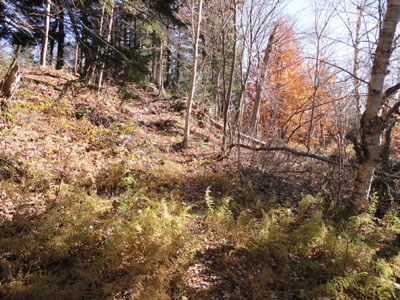
Back on the trail, we eventually dropped down the back side of Miles Knob and then climbed up to the Miles Notch Trail and, up once again, to Miles Notch proper. The trail was at this point, and all the way downhill and partway back up another ridge, very vague and minimally maintained - lots of blowdowns, very few blazes, brush growing into the airway, and no visible footbed. Not only that, but the footing was less than optimal - not terrible, but a stark contrast to the smooth footing on the Red Rock Trail.
Eventually bottoming out, we had to climb multiple hundred vertical feet to get over a ridge and down to Hut Road. Passing through a maze of snowmobile trails (basically heading downhill at the junctions), we arrived at the unmarked trailhead where we had spotted a vehicle earlier in the day.
| Hike Ratings |
|
Getting To Trailhead: |
Moderate |
| Destination: |
Speckled Mountain |
|
Length: |
Moderate |
|
Steepness: |
Moderate |
|
Navigation: |
Moderate |
|
Views: |
Excellent |
|
Crowds: |
Minimal |
| Destination: |
Durgin Mountain |
|
Length: |
Moderate |
|
Steepness: |
Difficult |
|
Navigation: |
Easy |
|
Views: |
Excellent |
|
Crowds: |
Minimal |
| Destination: |
Butters Mountain |
|
Length: |
Difficult |
|
Steepness: |
Difficult |
|
Navigation: |
Moderate |
|
Views: |
Minimal |
|
Crowds: |
Minimal |
| Destination: |
Red Rock Mountain |
|
Length: |
Difficult |
|
Steepness: |
Difficult |
|
Navigation: |
Moderate |
|
Views: |
Excellent |
|
Crowds: |
Minimal |
|
| Hike Stats |
|
Date Hiked: |
Saturday, October 23, 2010 |
| Hike Commenced: |
8:02 AM |
| Parking Elevation: |
510' |
| Destination: |
Speckled Mountain |
| Ascent Commenced: |
8:06 AM |
| Summit Reached: |
10:14 AM |
| Time Elapsed: |
02:08 |
| Trailhead Elevation: |
570' |
| Summit Elevation: |
2,906' |
| Vertical Gain: |
2,536' |
| Destination: |
Durgin Mountain |
| Ascent Commenced: |
10:21 AM |
| Summit Reached: |
11:17 AM |
| Time Elapsed: |
00:56 |
| Trailhead Elevation: |
2,906' |
| Summit Elevation: |
2,404' |
| Distance: |
1.2 miles |
| Vertical Gain: |
224' |
| Destination: |
Butters Mountain |
| Ascent Commenced: |
11:31 AM |
| Summit Reached: |
12:37 PM |
| Time Elapsed: |
01:06 |
| Trailhead Elevation: |
2,404' |
| Summit Elevation: |
2,246' |
| Distance: |
1.9 miles |
| Vertical Gain: |
366' |
| Destination: |
Red Rock Mountain |
| Ascent Commenced: |
12:37 PM |
| Summit Reached: |
1:30 PM |
| Time Elapsed: |
00:53 |
| Trailhead Elevation: |
2,246' |
| Summit Elevation: |
2,141' |
| Distance: |
1.3 miles |
| Vertical Gain: |
271' |
|
|
| Hike Ended: |
4:26 PM |
| Hike Time Elapsed: |
8:24 |
| Hike Vertical Gain: |
4,297' |
|
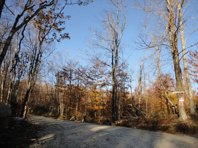
The Cold Brook Trail turnoff
Looking down the Cold Brook Trail on the way to Speckled Mountain
The Presidentials as seen from Speckled Mountain
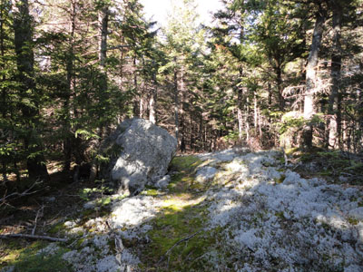
The Red Rock Trail on the way to Durgin Mountain
The Caribou Mountain as seen from the Durgin Mountain ledges
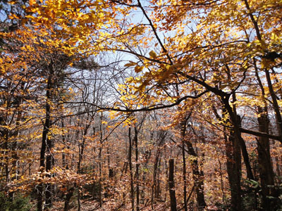
The Red Rock Trail on the way to Butters Mountain
A lack of views from Butters Mountain
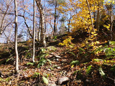
The Red Rock Trail on the way to Red Rock Mountain
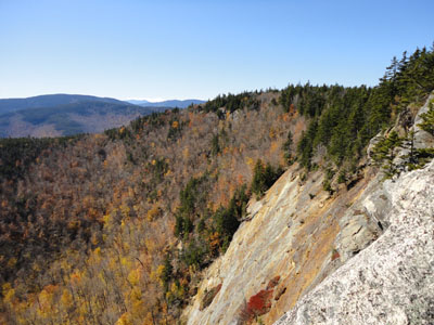
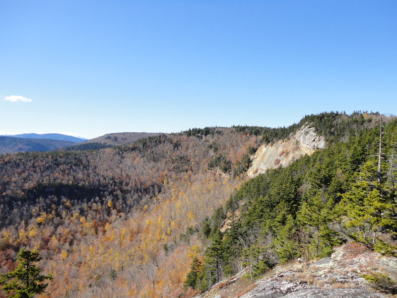
Looking west from the ledges east of the summit of Red Rock Mountain
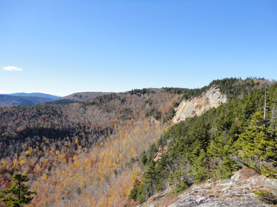
Looking at the east Red Rock ledges from ledges east of those east ledges
The Miles Notch Trail on the way to Hut Road

Directions to trailhead: Take Route 5 north from Lovell, Maine. Take a left onto West Stoneham Road. Hut Road will eventually be on the right - take this road to get to the Miles Notch Trail trailhead. Unsigned in fall 2010, the trailhead was located past the national forest boundary, shortly after a slight dip in the road, on the right, with a small, mowed parking area on the left. To get to the Cold Brook Trail, continue on West Stoneham Road past Hut Road, then bear right at the next curve. Shortly thereafter, the Cold Brook Trail sign will be on the right at another curve. In fall 2010, one could continue 0.4 miles down the road/trail, just past a marsh, and park off the side of the road on the right, or perhaps further. The next Cold Brook Trail is located a few minutes beyond the marsh, on the left.
Back to Speckled Mountain Profile
Back to Durgin Mountain Profile
Back to Butters Mountain Profile
Back to Red Rock Mountain Profile
|