Home
States
Colorado
Connecticut
Maine
Massachusetts
New Hampshire
New York
Rhode Island
Utah
Vermont
View All
Lists
NE 4,000 Footers
NE 100 Highest
NH 4,000 Footers
NH 100 Highest
NH 52 With A View
NH Belknap Range
NH Ossipee 10
Links
Trail Conditions
Trip Log
Sunrises
Sunsets
About
|
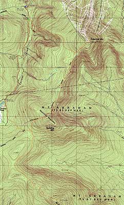
Sugarloaf Mountain, Spaulding Mountain, Mt. Abraham
Carrabassett Valley, ME, Mt. Abraham, ME
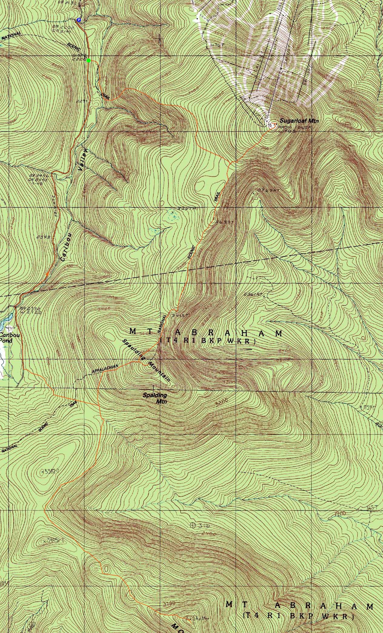
Trailheads, measurements, times, distances, and maps are all approximate and relative to the hike(s) as shown below.
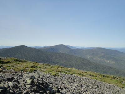
Looking down the Appalchian Trail (the Crockers in the distance) on the way to Sugarloaf Mountain
Route: Caribou Valley Road, Appalachian Trail, Sugarloaf Side Trail, (Sugarloaf Mountain), Sugarloaf Side Trail, Appalachian Trail, Spaulding Mountain Side Trail, (Spaulding Mountain), Spaulding Mountain Side Trail, Appalachian Trail, Mt. Abraham Side Trail, (Mt. Abraham), Mt. Abraham Side Trail, Appalachian Trail, bushwhack, various logging roads, Caribou Valley Road
With a nice day forecasted, the long drive to the Carrabassett Valley area seemed worth it.
Heading up the aging Caribou Valley Road, we opted to park between the steel grate and subsequent eroded wooden bridge, perhaps half a mile before the Appalachian Trail crossing.
The crossing was marked with a simple cairn. The trail dropped down to the water crossing (rock hoppable in conjunction with a board), then gradually worked its way uphill for a bit. Shortly thereafter, the trail steepened up and climbed up the side of Sugarloaf, ascending some slight scrambles along the way.
Reaching the top of the steeps, the trail turned into a nice ridge walk with excellent views for awhile, eventually ducking back into the woods and gradually working its way to the Sugarloaf Side Trail junction.
After heading up the steady Sugarloaf Side Trail, we arrived at the open, but cluttered Sugarloaf summit. With clear skies overhead, we were able to see the Presidentials to the southwest and, just barely, Mt. Katahdin to the northeast (as well as other larger peaks to the southwest of it).
After a snack break, we turned around and headed back down the side trail to the Appalachian Trail, then continued over the ups and downs and finally the steep climb up to Spaulding Mountain. Taking a left onto the side trail, we reached the summit, where we had limited directional views.
After another snack break, we headed back to the Appalachian Trail and down to the Spaulding Campsite. A bit beyond there, we hit a split in the trail where white blazes went in two directions. Perhaps part of an upcoming reroute, the two branches rejoined after about one hundred yards.
Awhile later, we reached the Mt. Abraham Side Trail junction. Interestingly enough, it was actually a four way junction - the Appalachian Trail heading straight, the Abraham Side Trail to the left, and an unmarked trail heading to the right (perhaps to the logging roads to the south or west).
After a break, we headed up the Mt. Abraham Side Trail. Starting off as a gentle walk through open woods, the trail eventually reached a series of subpeaks and scree fields. Finally reaching the summit, we had superb views in all directions (though not as far reaching as earlier in the day).
After another snack break, we headed back to the Appalachian Trail, then past the campsite. A few minutes past it, we followed a prominent herdpath west a minute or two, until it dead-ended in thick spruce. Our original plan had been to go direct from the campsite (prior to seeing the herd Path) - though it was tempting to go back and look for better woods there, we pushed west through a variety of stands of spruce - some thick, others not. After about twenty to thirty minutes, we reached our target, an old logging landing. From there, we followed increasingly used logging roads, eventually reaching Caribou Valley Road after about 20 minutes. From there, it was about forty minutes to get back to the Appalachian Trail crossing, then just over five minutes back to where we parked.
| Hike Ratings |
|
Getting To Trailhead: |
Difficult |
| Destination: |
Sugarloaf Mountain |
|
Length: |
Moderate |
|
Steepness: |
Difficult |
|
Navigation: |
Easy |
|
Views: |
Excellent |
|
Crowds: |
Moderate |
| Destination: |
Spaulding Mountain |
|
Length: |
Moderate |
|
Steepness: |
Difficult |
|
Navigation: |
Easy |
|
Views: |
Excellent |
|
Crowds: |
Minimal |
| Destination: |
Mt. Abraham |
|
Length: |
Difficult |
|
Steepness: |
Moderate |
|
Navigation: |
Moderate |
|
Views: |
Excellent |
|
Crowds: |
Minimal |
|
| Hike Stats |
|
Date Hiked: |
Thursday, August 19, 2010 |
| Hike Commenced: |
9:35 AM |
| Parking Elevation: |
2,220' |
| Destination: |
Sugarloaf Mountain |
| Ascent Commenced: |
9:41 AM |
| Summit Reached: |
11:43 AM |
| Time Elapsed: |
02:02 |
| Trailhead Elevation: |
2,220' |
| Summit Elevation: |
4,250' |
| Distance: |
2.9 miles |
| Vertical Gain: |
2,130' |
| Destination: |
Spaulding Mountain |
| Ascent Commenced: |
12:06 PM |
| Summit Reached: |
1:40 PM |
| Time Elapsed: |
01:34 |
| Trailhead Elevation: |
4,250' |
| Summit Elevation: |
4,010' |
| Distance: |
2.8 miles |
| Vertical Gain: |
825' |
| Destination: |
Mt. Abraham |
| Ascent Commenced: |
1:56 PM |
| Summit Reached: |
4:08 PM |
| Time Elapsed: |
02:12 |
| Trailhead Elevation: |
4,010' |
| Summit Elevation: |
4,050' |
| Distance: |
3.7 miles |
| Vertical Gain: |
1,100' |
|
|
| Hike Ended: |
7:58 PM |
| Hike Time Elapsed: |
10:23 |
| Hike Vertical Gain: |
4,285' |
|
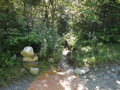
The Appalachian Trail crossing on Caribou Valley Road

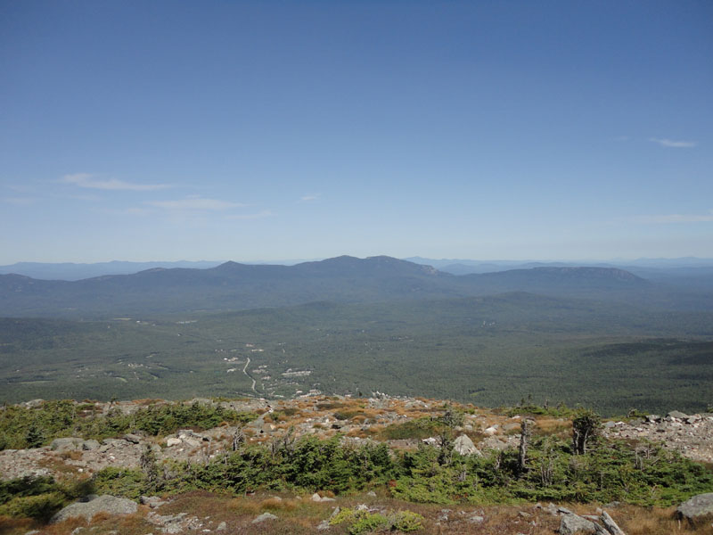
The Bigelows as seen from Sugarloaf Mountain
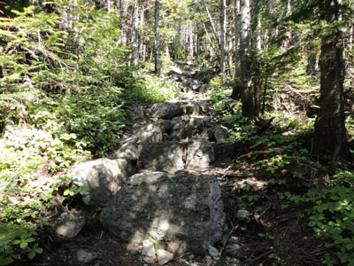
The Sugarloaf Side Trail on the way to Spaulding Mountain
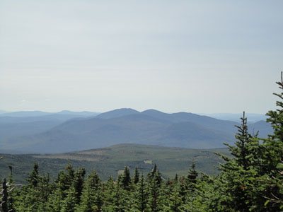
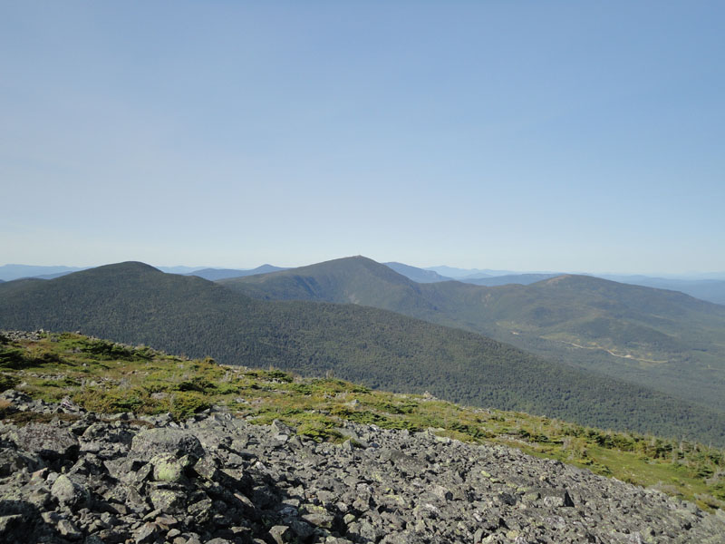
The Saddlebacks as seen from Spaulding Mountain
The Mt. Abraham Side Trail on the way to Mt. Abraham
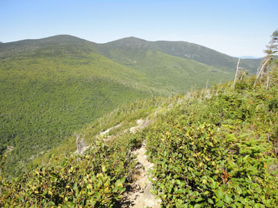
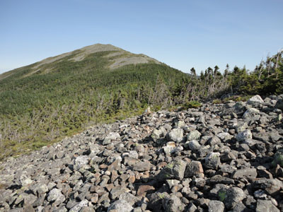
Spaulding and Sugarloaf as seen from Abraham

Directions to trailhead: Take Route 27 northwest from the entrance to Sugarloaf USA ski area. Just after passing a transfer station on the right (on an uphill), Caribou Valley Road (makeshift Caribou Pond Road sign, summer 2010) will be on the left. As of summer 2010, vehicles with low clearance will not want to attempt this road. Non off-road-capable vehicles will want to park just before the metal grate bridge. The Appalachian Trail crossing is awhile beyond this bridge and a very dicey wood bridge (there is also parking on the left just before the dicey wood bridge). A small parking area will be on the right, just before the unsigned trail crossing.
Back to Sugarloaf Mountain Profile
Back to Spaulding Mountain Profile
Back to Mt. Abraham Profile
|