Home
States
Colorado
Connecticut
Maine
Massachusetts
New Hampshire
New York
Rhode Island
Utah
Vermont
View All
Lists
NE 4,000 Footers
NE 100 Highest
NH 4,000 Footers
NH 100 Highest
NH 52 With A View
NH Belknap Range
NH Ossipee 10
Links
Trail Conditions
Trip Log
Sunrises
Sunsets
About
|
Borden Mountain
Savoy, MA
Trailheads, measurements, times, distances, and maps are all approximate and relative to the hike(s) as shown below.
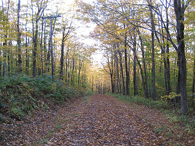
Tower Road to Borden Mountain summit
The Tower Road hike is a fairly easy one, as the road is still used by authorized vehciles. To get to the gate, you'll want an offroad vehicle. If you do not have an offroad vehicle, you may want to park a bit west of the gate at the trailhead, as the access road is not well maintained.
| Hike Ratings |
|
Getting To Trailhead: |
Difficult |
| Destination: |
Borden Mountain |
|
Length: |
Easy |
|
Steepness: |
Easy |
|
Navigation: |
Easy |
|
Views: |
Excellent |
|
Crowds: |
Minimal |
|
| Hike Stats |
|
Date Hiked: |
Thursday, October 5, 2006 |
| Hike Commenced: |
5:27 PM |
| Parking Elevation: |
2,229' |
| Destination: |
Borden Mountain |
| Ascent Commenced: |
5:27 PM at Tower Road gate |
| Summit Reached: |
5:35 PM |
| Trailhead Elevation: |
2,235' |
| Summit Elevation: |
2,505' |
| Vertical Gain: |
270' |
| Hike Ended: |
6:40 PM |
| Hike Vertical Gain: |
276' |
|
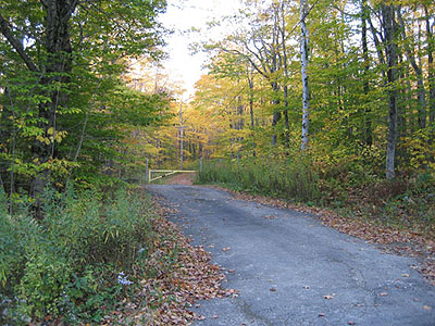
Tower Road gate
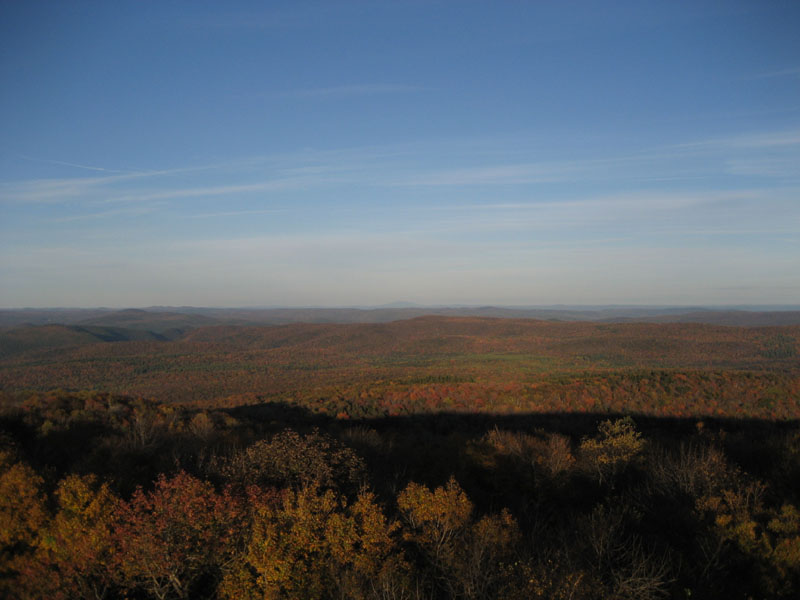
Looking Northeast at the Cold River Valley and in the distance, Mt. Monadnock

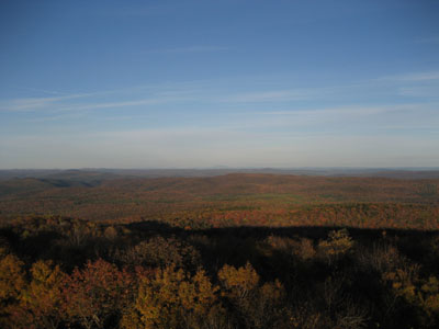
Sunset over the Taconic Range, looking southwest
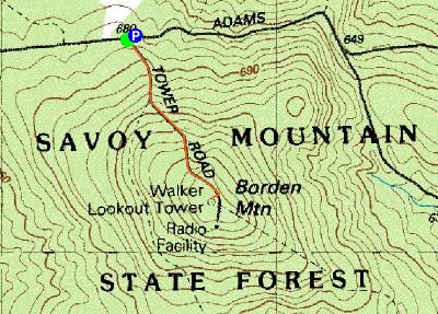

Directions to trailhead: Adams Road is a few minutes from downtown Savoy on Route 116. While there is room to park near the beginning of Tower Road, the dirt roads that access it are in terrible shape.
Back to Borden Mountain Profile
|