Home
States
Colorado
Connecticut
Maine
Massachusetts
New Hampshire
New York
Rhode Island
Utah
Vermont
View All
Lists
NE 4,000 Footers
NE 100 Highest
NH 4,000 Footers
NH 100 Highest
NH 52 With A View
NH Belknap Range
NH Ossipee 10
Links
Trail Conditions
Trip Log
Sunrises
Sunsets
About
|
High Ledge
Massaemett Mountain
Shelburne, MA
Trailheads, measurements, times, distances, and maps are all approximate and relative to the hike(s) as shown below. "Summit" photos may in fact not be at the actual summit - but instead at the best nearby vista.
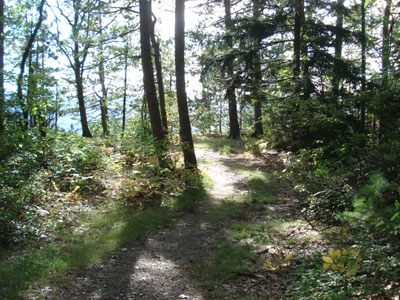
Trail near High Ledge summit
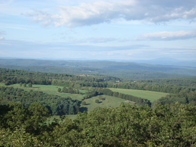
High Ledges and Massaemett Mountain overlook Shelburne Falls, MA and the surrounding valleys. On a moderately clear day Mt. Greylock is visible from the High Ledge while both that and Mt. Monadnock are visible from the fire tower on Massaemett. While the High Ledges hiking has a fairly natural feel (being a wildlife sanctuary and all), the last leg of the Massaemett hike is filled with towers and powerlines. Nonetheless, the stone tower and abundant views from it make up for the modernization.
| Hike Ratings |
|
Getting To Trailhead: |
Easy |
| Destination: |
High Ledge |
|
Length: |
Easy |
|
Steepness: |
Easy |
|
Navigation: |
Easy |
|
Views: |
Excellent |
|
Crowds: |
Moderate |
| Destination: |
Massaemett Mountain |
|
Length: |
Easy |
|
Steepness: |
Easy |
|
Navigation: |
Moderate |
|
Views: |
Excellent |
|
Crowds: |
Minimal |
|
| Hike Stats |
|
Date Hiked: |
Monday, August 21, 2006 |
| Hike Commenced: |
5:04 PM |
| Parking Elevation: |
1,326' |
| Destination: |
High Ledge |
| Ascent Commenced: |
5:06 PM at High Ledges gated trailhead |
| Summit Reached: |
5:18 PM |
| Trailhead Elevation: |
1,312' |
| Summit Elevation: |
1,268' |
| Vertical Gain: |
114' |
| Destination: |
Massaemett Mountain |
| Summit Reached: |
5:42 PM |
| Summit Elevation: |
1,577' |
| Vertical Gain: |
339' |
| Hike Ended: |
6:22 PM |
| Hike Vertical Gain: |
485' |
|
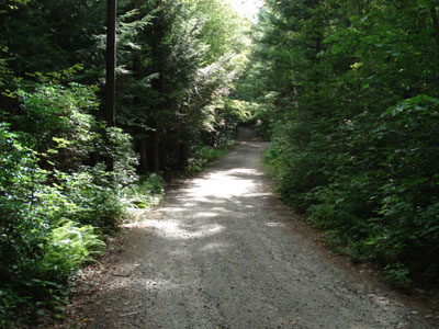
Looking down the road from the parking area to the gate/trailhead
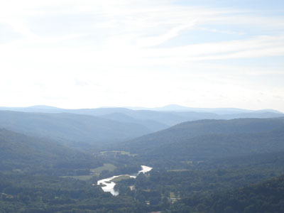
View from High Ledge looking west at the Deerfield River Valley and Mt. Greylock
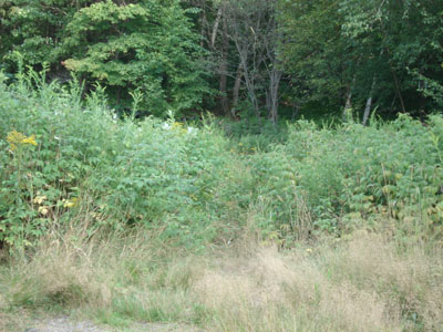
Looking at the barely visible Massaemett trailhead through the meadow at the old High Ledges parking lot
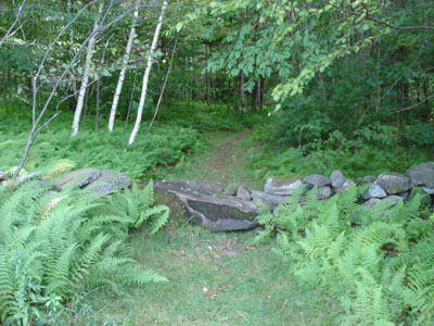
Trail to Massaemett from High Ledges
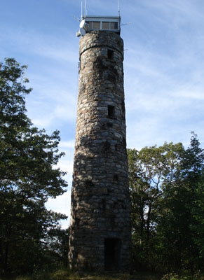
Rock fire tower on Massaemett summit
View from Massaemett fire tower looking northeast at Mt. Monadnock
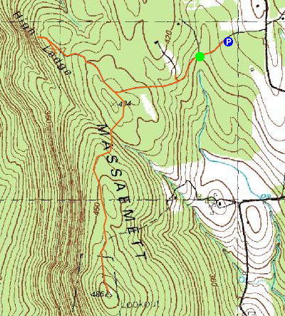

Directions to trailhead: Take Patton Hill Road northwest from Tower Road. Look for High Ledges sign on left side of road. Parking lot located a few hundred feet down the road.
Back to High Ledge Profile
Back to Massaemett Mountain Profile
|
