Home
States
Colorado
Connecticut
Maine
Massachusetts
New Hampshire
New York
Rhode Island
Utah
Vermont
View All
Lists
NE 4,000 Footers
NE 100 Highest
NH 4,000 Footers
NH 100 Highest
NH 52 With A View
NH Belknap Range
NH Ossipee 10
Links
Trail Conditions
Trip Log
Sunrises
Sunsets
About
|
Mt. Toby
Sunderland, MA
Trailheads, measurements, times, distances, and maps are all approximate and relative to the hike(s) as shown below.
The Robert Frost Trail (prior following the power lines to the summit)
Having previously biked/hiked the access road up Mt. Toby in May, I became interested in hiking a proper trail to the summit. The Robert Frost Trail would be my route.
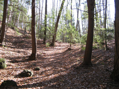
The trail starts fairly gradually, before meeting with the power lines and embarking on a moderate pitched ascent to the fire tower.
Despite some haze, the views were still fairly strong - Mt. Greylock, Mt. Snow, Mt. Monadnock, Wachusett Mountain, and Mt. Tom were all visible.
| Hike Ratings |
|
Getting To Trailhead: |
Easy |
| Destination: |
Mt. Toby |
|
Length: |
Moderate |
|
Steepness: |
Moderate |
|
Navigation: |
Easy |
|
Views: |
Excellent |
|
Crowds: |
Moderate |
|
| Hike Stats |
|
Date Hiked: |
Saturday, November 25, 2006 |
| Hike Commenced: |
11:55 AM |
| Parking Elevation: |
425' |
| Destination: |
Mt. Toby |
| Ascent Commenced: |
11:56 AM |
| Summit Reached: |
12:34 PM |
| Trailhead Elevation: |
405' |
| Summit Elevation: |
1,269' |
| Vertical Gain: |
914' |
| Hike Ended: |
1:11 PM |
| Hike Vertical Gain: |
964' |
|
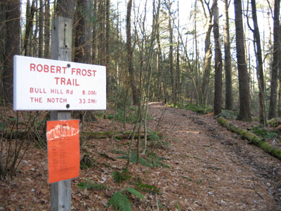
Robert Frost Trail
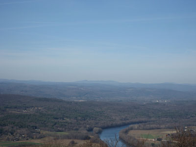
Looking at Haystack and Mt. Snow from the Mt. Toby firetower
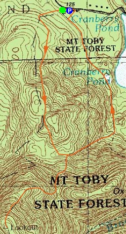

Directions to trailhead: Take Route 47 to Reservation Road. Parking at trail map. The Robert Frost Trail breaks off to the right at the gate.
Back to Mt. Toby Profile
|

