Home
States
Colorado
Connecticut
Maine
Massachusetts
New Hampshire
New York
Rhode Island
Utah
Vermont
View All
Lists
NE 4,000 Footers
NE 100 Highest
NH 4,000 Footers
NH 100 Highest
NH 52 With A View
NH Belknap Range
NH Ossipee 10
Links
Trail Conditions
Trip Log
Sunrises
Sunsets
About
|
Mt. Toby
Sunderland, MA, Leverett, MA
Trailheads, measurements, times, distances, and maps are all approximate and relative to the hike(s) as shown below.
Tower Road
Route: Roaring Falls Trail, Tower Road, (Mt. Toby), Tower Road, Roaring Falls Trail
While I was planning to hike Mt. Toby via Tower Road, a map at the trailhead showed the location of the Roaring Falls Trail trailhead. Thus, I headed over to Route 63 and soon found the quasi-unmarked parking area.
Starting as a woods road of some sort, I had a friendly neighborhood cat following me for a bit. Nearing the high tension line area, the cat turned back and I continued alone, soon crossing railroad tracks.
Shortly thereafter, I arrived at Roaring Falls - sort of. While the falls area looked impressive, there was no water anywhere.
The trail continued steeply up to the right of the falls, passing some impressive boulders. A short distance thereafter, the trail reached Tower Road.
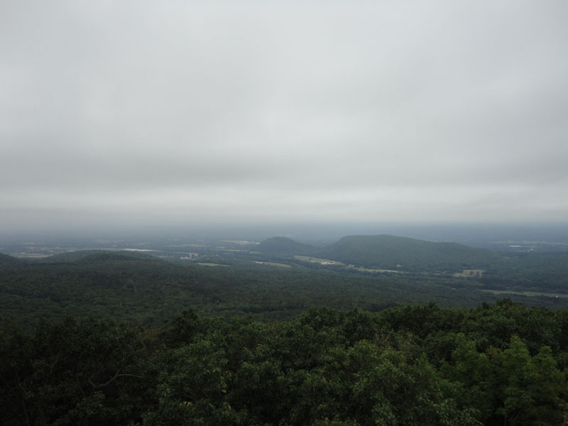
Heading up Tower Road, I was a bit surprised to see the destruction on either side of it, presumably from the recent ice storm. Eventually reaching the summit, I climbed the tower for views. Unfortunately, the views were tremendous, as rain was moving into the area. Nonetheless, I could see the Sugarloaves, as well as points to the east.
Shortly after starting back downhill, the rain started to sprinkle. Never picking up too much, it was still a fairly dry descent.
| Hike Ratings |
|
Getting To Trailhead: |
Moderate |
| Destination: |
Mt. Toby |
|
Length: |
Moderate |
|
Steepness: |
Difficult |
|
Navigation: |
Easy |
|
Views: |
Excellent |
|
Crowds: |
Minimal |
|
| Hike Stats |
|
Date Hiked: |
Sunday, August 22, 2010 |
| Hike Commenced: |
8:04 AM |
| Parking Elevation: |
390' |
| Destination: |
Mt. Toby |
| Ascent Commenced: |
8:04 AM |
| Summit Reached: |
8:46 AM |
| Time Elapsed: |
00:42 |
| Trailhead Elevation: |
390' |
| Summit Elevation: |
1,269' |
| Vertical Gain: |
939' |
|
|
| Hike Ended: |
9:35 AM |
| Hike Time Elapsed: |
01:31 |
| Hike Vertical Gain: |
999' |
|
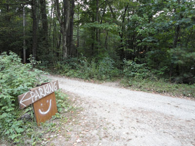
The Roaring Falls Trail trailhead
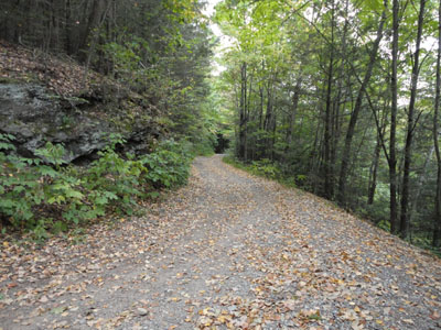
Wildflowers along Tower Road
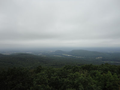
Looking southwest at South and North Sugarloaf from the Mt. Toby firetower
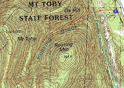

Directions to trailhead: From the Reservation Road area in Sunderland, take Route 63 south. Shortly after passing Montague Road on the left, the two entrances to the Roaring Falls Trail dirt parking lot will be on the right (the first is part of a residential driveway). The Roaring Falls Trail starts on the driveway side of the parking lot.
Back to Mt. Toby Profile
|