Home
States
Colorado
Connecticut
Maine
Massachusetts
New Hampshire
New York
Rhode Island
Utah
Vermont
View All
Lists
NE 4,000 Footers
NE 100 Highest
NH 4,000 Footers
NH 100 Highest
NH 52 With A View
NH Belknap Range
NH Ossipee 10
Links
Trail Conditions
Trip Log
Sunrises
Sunsets
About
|
Mt. Tom
Holyoke, MA
Trailheads, measurements, times, distances, and maps are all approximate and relative to the hike(s) as shown below.
The B17 Walking Trail
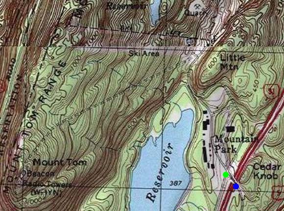
Route: Herd path, Reservoir Loop Trail, B17 Walking Trail
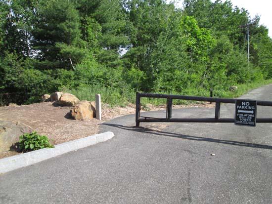
From the three gates at the far end of the bridge, I went through the left one, then took a right at the next gate onto an unmarked trail that followed the fence line of Mountain Park, then dropped onto the Reservoir Loop Trail. I beared right onto that, then at the next left turn in the trail, I took a right onto another unmarked trail, which brought me up to the transformer on the old ski area access road.
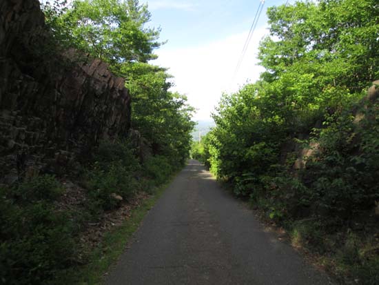
Immediately to the left is the paved service road to the summit, which had a posted sign, as well as a B17 Hiking Trail, at own risk sign. Considering the latter sign and that people were out there, I jogged up the service road/B17 trail without issue (in hindsight, I read somewhere online that the posted signs on gates are only intended for vehicular traffic). Surprisingly quiet on the summit (great cliff views south-west-north).
On the descent, I stopped at the B17 1946 crash memorial (partway down the service road), which was impressive.
After poking around the base of the defunct Mt. Tom ski area (buildings still standing, but lifts long gone), I retraced my steps to the Reservoir Loop, sticking with this to the proper spur trail/road back to the gate.
| Hike Ratings |
|
Getting To Trailhead: |
Easy |
| Destination: |
Mt. Tom |
|
Length: |
Moderate |
|
Steepness: |
Moderate |
|
Navigation: |
Difficult |
|
Views: |
Excellent |
|
Crowds: |
Moderate |
|
| Hike Stats |
|
Date Hiked: |
Saturday, June 6, 2015 |
| Parking Elevation: |
360' |
| Destination: |
Mt. Tom |
| Time Elapsed: |
00:31 |
| Trailhead Elevation: |
360' |
| Summit Elevation: |
1,202' |
| Vertical Gain: |
892' |
|
|
| Hike Time Elapsed: |
01:15 |
| Hike Vertical Gain: |
902' |
|
The Metacomet Monadnock Trail trailhead for Mt. Tom on Route 141

The B17 Memorial Trail
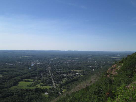
Looking northwest from near the summit of Mt. Tom

Directions to trailhead: Take Interstate 91 to Exit 17, then take Route 141 southeast to US 5. Take Us 5 North, then take a left onto Mountain Park Road. There is limited room to park on the side of the road immediately before or immediately after the overpass bridge. Immediately after the bridge, the gated road to the left leads to the reservoir trails.
Back to Mt. Tom Profile
|

