Home
States
Colorado
Connecticut
Maine
Massachusetts
New Hampshire
New York
Rhode Island
Utah
Vermont
View All
Lists
NE 4,000 Footers
NE 100 Highest
NH 4,000 Footers
NH 100 Highest
NH 52 With A View
NH Belknap Range
NH Ossipee 10
Links
Trail Conditions
Trip Log
Sunrises
Sunsets
About
|
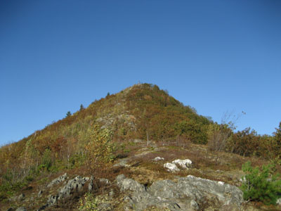
Negus Mountain
Rowe, MA, and Charlemont, MA
Trailheads, measurements, times, distances, and maps are all approximate and relative to the hike(s) as shown below.
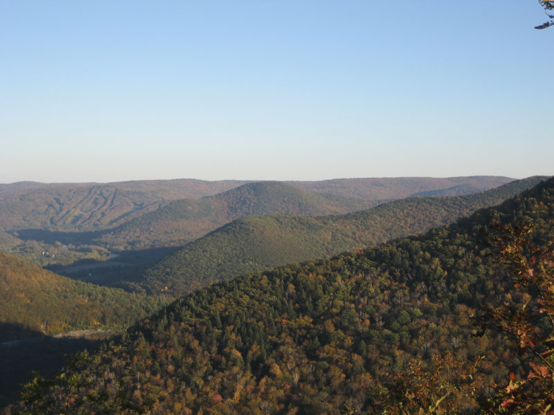
Heading up Negus Mountain, looking at the middle third of the hike.
This was a perfect fall day - clear sky, mild temperature, near-peak foliage The trail is not marked and at times hard to follow.
| Hike Ratings |
|
Getting To Trailhead: |
Moderate |
| Destination: |
Negus Mountain |
|
Length: |
Moderate |
|
Steepness: |
Difficult |
|
Navigation: |
Moderate |
|
Views: |
Excellent |
|
Crowds: |
Minimal |
|
| Hike Stats |
|
Date Hiked: |
Monday, October 9, 2006 |
| Hike Commenced: |
4:33 PM |
| Parking Elevation: |
750' |
| Destination: |
Negus Mountain |
| Ascent Commenced: |
4:35 PM |
| Summit Reached: |
5:03 PM |
| Trailhead Elevation: |
755' |
| Summit Elevation: |
1,705' |
| Vertical Gain: |
970' |
| Hike Ended: |
5:53 PM |
| Hike Vertical Gain: |
992' |
|
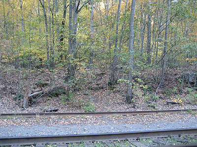
Trailhead across the railroad tracks

Below the south peak summit, looking southeast at (left to right) Mt. Institute, Mt. Peak, Hawks Mountain, and Todd Mountain.
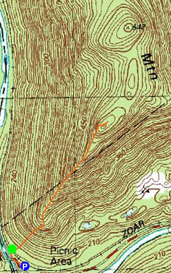

Directions to trailhead: Take Zoar Road to Zoar Gap. Parking is available on both sides of the road. Walk down the dead end road with the yellow fence at the end, cross the railroad tracks - the trailhead should be right there.
Back to Negus Mountain Profile
|