Home
States
Colorado
Connecticut
Maine
Massachusetts
New Hampshire
New York
Rhode Island
Utah
Vermont
View All
Lists
NE 4,000 Footers
NE 100 Highest
NH 4,000 Footers
NH 100 Highest
NH 52 With A View
NH Belknap Range
NH Ossipee 10
Links
Trail Conditions
Trip Log
Sunrises
Sunsets
About
|
Negus Mountain
Rowe, MA, and Charlemont, MA
Trailheads, measurements, times, distances, and maps are all approximate and relative to the hike(s) as shown below.
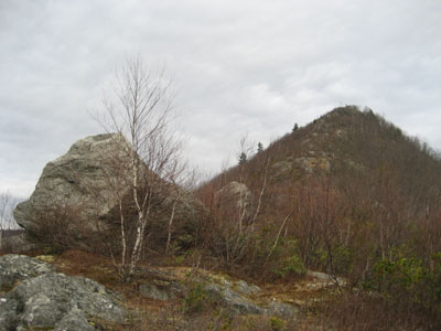
Looking up toward the middle third of the ascent
I find it hard to get the motivation to hike on a cloudy day. Nonetheless, Negus is nice enough to inspire me to hike in less than ideal weather.
After looking at a topographical map of the area a few weeks prior, I realized that I had no in fact summited Negus in my previous two hikes - the true summit is down the ridge a bit more. One knows s/he is near the true summit when fourwheeler/four wheel drive road turnaround is visible - the actual high point (no view) is a few hundred yards of bushingwacking from this.
Having been to the true summit, I can say that the southern peak, though lower, provides better views.
| Hike Ratings |
|
Getting To Trailhead: |
Moderate |
| Destination: |
Negus Mountain |
|
Length: |
Moderate |
|
Steepness: |
Difficult |
|
Navigation: |
Moderate |
|
Views: |
Excellent |
|
Crowds: |
Minimal |
|
| Hike Stats |
|
Date Hiked: |
Sunday, December 17, 2006 |
| Hike Commenced: |
12:52 PM |
| Parking Elevation: |
750' |
| Destination: |
Negus Mountain |
| Ascent Commenced: |
12:54 PM |
| Summit Reached: |
1:36 PM |
| Trailhead Elevation: |
755' |
| Summit Elevation: |
1,773' |
| Vertical Gain: |
1,118' |
| Hike Ended: |
2:23 PM |
| Hike Vertical Gain: |
1,260' |
|
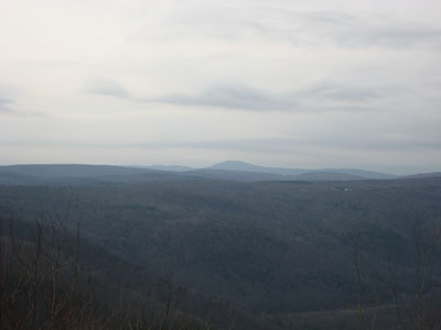
Looking west at Mt. Greylock from the Negus Mountain summit


Directions to trailhead: Take Zoar Road to Zoar Gap. Parking is available on both sides of the road. Walk down the dead end road with the yellow fence at the end, cross the railroad tracks - the trailhead should be right there.
Back to Negus Mountain Profile
|

