Home
States
Colorado
Connecticut
Maine
Massachusetts
New Hampshire
New York
Rhode Island
Utah
Vermont
View All
Lists
NE 4,000 Footers
NE 100 Highest
NH 4,000 Footers
NH 100 Highest
NH 52 With A View
NH Belknap Range
NH Ossipee 10
Links
Trail Conditions
Trip Log
Sunrises
Sunsets
About
|
Pocumtuck Mountain
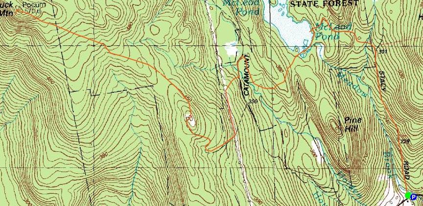
Colrain, MA, Heath, MA, and Charlemont, MA
Trailheads, measurements, times, distances, and maps are all approximate and relative to the hike(s) as shown below.
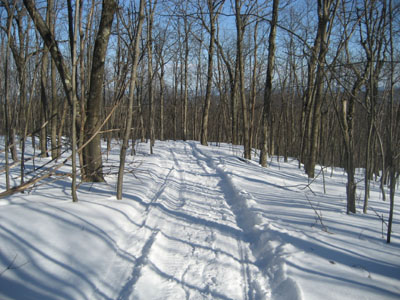
Trail near Pocumtuck summit
Though I have hiked Pocumtuck many times, today was a series of firsts - first time hiking it from Stacy Road, first time hiking it mid-winter, and first time snowshoeing it.
Initially I had planned to park as far up South Catamount or Stacy Road as possible. Upon arriving, I realized that would actually mean parking at the beginning of one or the other. Since South Catamount Road has no parking signs all over the area near the snowbank, process of elimination chose Stacy Road as my route.
After building my own parking spot in a snowbank (thank you Toyota Off Road Package!), I put on my running snowshoes and headed up Stacy Road (due to the length of the hike, I only used them for running/jogging a few times).
Stacy Road was well packed by snowmobile traffic, making the snowshoes pointless. Upon reaching McLeod Pond and seeing some ice fishers and snowmobilers on it, I decided to go right across the pond. After about five or ten steps, I looked to my left and saw slush poking through the snow. Not wanting to go swimming, I made like the French military and gave up on crossing the pond.
This is where the snowshoes came in handy. Due to wind, the trail around the south side of the pond was essentially unbroken. Though some exposed parts had only a few inches of snow, one section was easily 3 feet deep.
The rest of the hike to Pocumtuck was packed due to recent snowmobile traffic. The obstructed views on the knob southeast of Pocumtuck were surprisingly good - Mt. Greylock and Mt. Monadnock were visible in the distance.
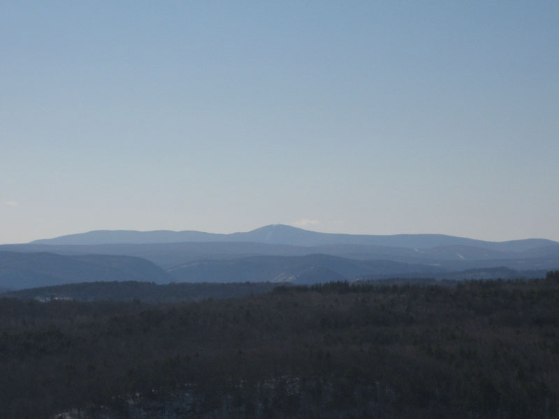
The views from the ledge on Pocumtuck were amazingly strong - better than my last half dozen or so visits. The towers on top of Mt. Greylock and Borden Mountain were visible, as well as the radar bubble thing in Cummington, and the towers of the University of Massachusetts in Amherst.
| Hike Ratings |
|
Getting To Trailhead: |
Easy |
| Destination: |
McLeod Pond |
|
Length: |
Moderate |
|
Steepness: |
Moderate |
|
Navigation: |
Moderate |
|
Views: |
Excellent |
|
Crowds: |
Minimal |
| Destination: |
Pocumtuck Mountain |
|
Length: |
Moderate |
|
Steepness: |
Moderate |
|
Navigation: |
Difficult |
|
Views: |
Excellent |
|
Crowds: |
Minimal |
|
| Hike Stats |
|
Date Hiked: |
Wednesday, February 28, 2007 |
| Hike Commenced: |
1:09 PM |
| Parking Elevation: |
570' |
| Destination: |
McLeod Pond |
| Ascent Commenced: |
1:13 PM at Stacy Road trailhead |
| Pond Reached: |
1:43 PM |
| Time Elapsed: |
00:30 |
| Trailhead Elevation: |
577' |
| Pond Elevation: |
1,115' |
| Vertical Gain: |
588' |
| Destination: |
Pocumtuck Mountain |
| Summit Reached: |
2:59 PM |
| Time Elapsed: |
01:16 |
| Trailhead Elevation: |
1,115' |
| Summit Elevation: |
1,872' |
| Vertical Gain: |
1,027' |
|
|
| Hike Ended: |
4:52 PM |
| Hike Time Elapsed: |
03:41 |
| Hike Vertical Gain: |
1,942' |
|
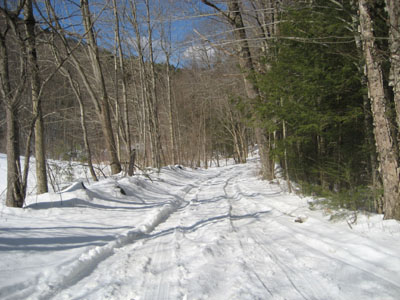
Stacy Road trailhead
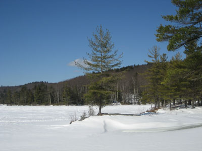
McLeod Pond, mostly frozen over
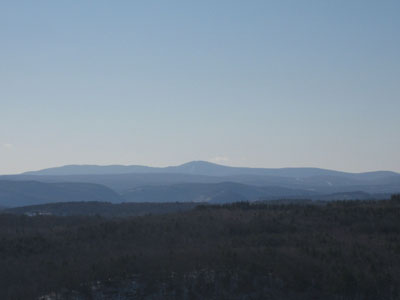
Pocumtuck Mountain summit, looking west at Mt. Greylock
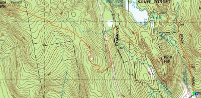

Directions to trailhead: Take Route 112 to North River Road, take a right onto Colrain Road. Stacy Road is on the left. There is limited parking on the side of the road.
Back to Pocumtuck Mountain Profile
|