Home
States
Colorado
Connecticut
Maine
Massachusetts
New Hampshire
New York
Rhode Island
Utah
Vermont
View All
Lists
NE 4,000 Footers
NE 100 Highest
NH 4,000 Footers
NH 100 Highest
NH 52 With A View
NH Belknap Range
NH Ossipee 10
Links
Trail Conditions
Trip Log
Sunrises
Sunsets
About
|
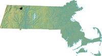
Pocumtuck Mountain
Charlemont, MA

Pocumtuck Mountain as seen at sunrise from Massaemett Mountain
Summary
 Pocumtuck Mountain, one of Franklin County's highest points at 1,872', used to be the location of Catamount Old Home Days in the late 1800s. The mountain was crowded with residents as well as honored guests, including a Massachusetts Governor at one point.
Jeeps took their toll on the land in the 1980s and part of the 1990s, however since their banning, Pocumtuck has become forgotten. More recently, the summit of the mountain has been closed to the public by the controversial owner.
Summit Elevation
1,872'
Summit Facilities
None.
Relics
Remnants of house near summit ledge, numerous old roads and cellar holes in the Catamount area east of the summit. Rumored World War II-era air field southeast of summit.
Trip Reports:
Click on the date for photos, timestamps, and maps.
More Information
- Catamount State Forest - FranklinSites.com
- Pocumtuck Mountain - Wikipedia
|
