Home
States
Colorado
Connecticut
Maine
Massachusetts
New Hampshire
New York
Rhode Island
Utah
Vermont
View All
Lists
NE 4,000 Footers
NE 100 Highest
NH 4,000 Footers
NH 100 Highest
NH 52 With A View
NH Belknap Range
NH Ossipee 10
Links
Trail Conditions
Trip Log
Sunrises
Sunsets
About
|
Sachem Head
Greenfield, MA
Trailheads, measurements, times, distances, and maps are all approximate and relative to the hike(s) as shown below.
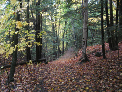
Looking down Sachem's Run
Route: Sachem's Run, Pocumtuck Ridge Trail
In Greenfield with a few minutes to spare, Sachem Head looked like a good destination.
Starting on Sachem's Run from the parking lot near the pond, we followed the rolling, somewhat wet trail to the stairway. At the top of the stairway, we took our time climbing up the short but steep ledge area - the wet rock made for a tricky time.
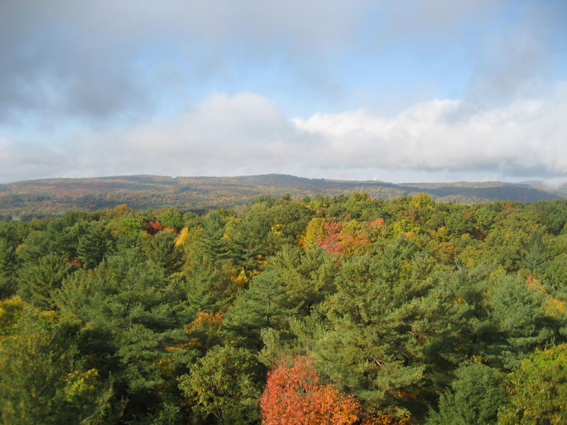
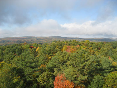
Though there were still some clouds lingering from the recent rain, the views from the top were great - east to the Turners Falls, south to Deerfield and the Pocumtuck Range, and west over Greenfield to western Franklin County.
All in all, Sachem Head is a good place to go for a short, pretty easy hike in the Greenfield area.
| Hike Ratings |
|
Getting To Trailhead: |
Easy |
| Destination: |
Sachem Head |
|
Length: |
Easy |
|
Steepness: |
Difficult |
|
Navigation: |
Moderate |
|
Views: |
Excellent |
|
Crowds: |
Moderate |
|
| Hike Stats |
|
Date Hiked: |
Saturday, October 20, 2007 |
| Hike Commenced: |
9:25 AM |
| Parking Elevation: |
305' |
| Destination: |
Sachem Head |
| Ascent Commenced: |
9:26 AM |
| Summit Reached: |
9:34 PM |
| Time Elapsed: |
00:08 |
| Trailhead Elevation: |
310' |
| Summit Elevation: |
452' |
| Vertical Gain: |
162' |
|
|
| Hike Ended: |
9:50 AM |
| Hike Time Elapsed: |
00:25 |
| Hike Vertical Gain: |
187' |
|
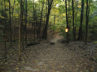
Sachem's Run trailhead
Looking north over Greenfield from Sachem Head
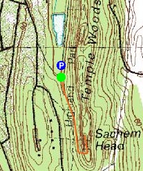

Directions to trailhead: Take Highland Avenue to Parkway Street. Parking lot just before pond.
Back to Sachem Head Profile
|