Home
States
Colorado
Connecticut
Maine
Massachusetts
New Hampshire
New York
Rhode Island
Utah
Vermont
View All
Lists
NE 4,000 Footers
NE 100 Highest
NH 4,000 Footers
NH 100 Highest
NH 52 With A View
NH Belknap Range
NH Ossipee 10
Links
Trail Conditions
Trip Log
Sunrises
Sunsets
About
|
Saddle Ball Mountain
New Ashford, MA
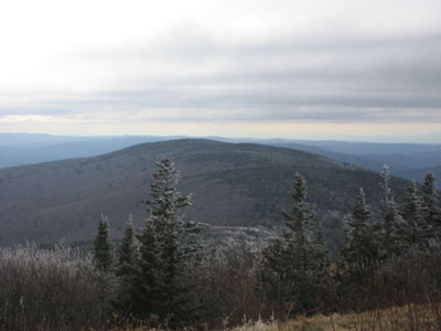
Saddle Ball Mountain as seen from Mt. Greylock
 Summary Summary
Located south of Mt. Greylock, Saddle Ball Mountain is the second highest point in all of Massachusetts at 3,238 feet (according to the older topographic maps - its also referred to as 3,247 on the Massachusetts DCR map). Though there is a look out on the north and south side of the mountain, there are no views at the summit.
Summit Elevation
3,238 feet
Summit Facilities
None.
Trip Reports:
Click on the date for photos, timestamps, and maps.
More Information
- Saddleball Mountain - New England's Cancelled Ski Areas
- Massachusetts DCR Trail Map
|
