Home
States
Colorado
Connecticut
Maine
Massachusetts
New Hampshire
New York
Rhode Island
Utah
Vermont
View All
Lists
NE 4,000 Footers
NE 100 Highest
NH 4,000 Footers
NH 100 Highest
NH 52 With A View
NH Belknap Range
NH Ossipee 10
Links
Trail Conditions
Trip Log
Sunrises
Sunsets
About
|
South Sugarloaf Mountain
North Sugarloaf Mountain
South Deerfield, MA
Trailheads, measurements, times, distances, and maps are all approximate and relative to the hike(s) as shown below.
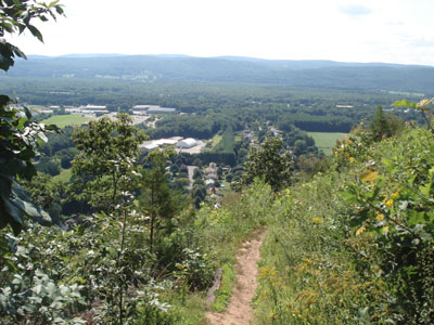
Pocumtuck Ridge Trail to Sugarloaf Mountain summit
Sugarloaf is a tiny but nonetheless scenic little 'mountain' in South Deerfield, MA. While only a few hundred vertical feet, it is a challenging short hike if the Pocumtuck trail is taken from base to summit.
North Sugarloaf is a very challenging short hike if pursued from the south side. The trail itself is somewhat hard to find, as it isn't consistantly marked. Technically, it appears to be the Pocumtuck trail, however I think the direct route I took bypassed a significant portion of it. The ascent is steep and narrow and the footing is very poor - the descent is hair-raising in places (or toupee raising, whichever you possess). While the views from North Sugarloaf are decent, the views are just as good from the southern peak - yet much easier to access.
| Hike Ratings |
|
Getting To Trailhead: |
Easy |
| Destination: |
Sugarloaf Mountain |
|
Length: |
Easy |
|
Steepness: |
Difficult |
|
Navigation: |
Easy |
|
Views: |
Excellent |
|
Crowds: |
Moderate to Heavy |
| Destination: |
North Sugarloaf Mountain |
|
Length: |
Easy |
|
Steepness: |
Very Difficult |
|
Navigation: |
Difficult |
|
Views: |
Excellent |
|
Crowds: |
Minimal |
|
| Hike Stats |
|
Date Hiked: |
Sunday, August 6, 2006 |
| Hike Commenced: |
3:22 PM |
| Parking Elevation: |
189' |
| Destination: |
Sugarloaf Mountain |
| Ascent Commenced: |
3:23 PM at Pocumtuck Ridge trailhead |
| Summit Reached: |
3:33 PM |
| Trailhead Elevation: |
225' |
| Summit Elevation: |
652' |
| Vertical Gain: |
427' |
| Destination: |
North Sugarloaf Mountain |
| Ascent Commenced: |
4:02 PM |
| Summit Reached: |
4:15 PM |
| Trailhead Elevation: |
315' |
| Summit Elevation: |
743' |
| Vertical Gain: |
428' |
| Hike Ended: |
4:56 PM |
| Hike Vertical Gain: |
855' |
|
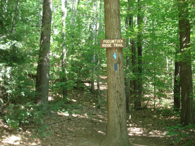
Pocumtuck Ridge Trail trailhead (to Sugarloaf Mountain Summit)
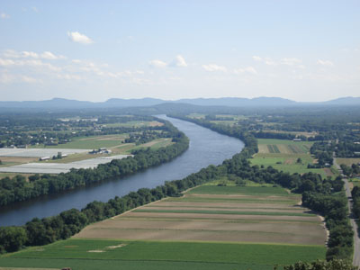
Sugarloaf Mountain summit (looking south)
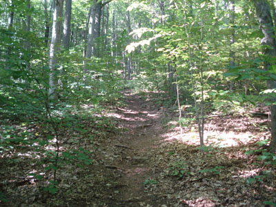
North Sugarloaf Mountain trailhead (Pocumtuck Ridge Trail)
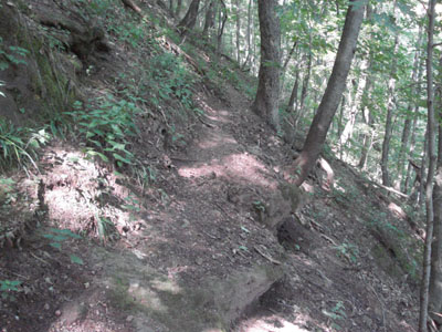
Steep, dangerous ascent to North Sugarloaf Mountain summit

The view from the lookout near the North Sugarloaf Mountain summit (looking west)
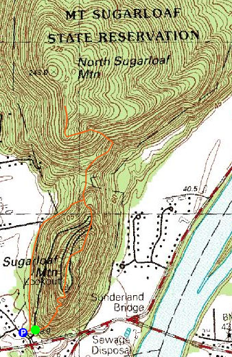

Directions to trailhead: Take Route 116 to South Deerfield - first set of lights west of Connecticut River (or first set of lights east of the Route 5/Route 116 junction near Exit 24).
Back to South Sugarloaf Mountain Profile
Back to North Sugarloaf Mountain Profile
|