Home
States
Colorado
Connecticut
Maine
Massachusetts
New Hampshire
New York
Rhode Island
Utah
Vermont
View All
Lists
NE 4,000 Footers
NE 100 Highest
NH 4,000 Footers
NH 100 Highest
NH 52 With A View
NH Belknap Range
NH Ossipee 10
Links
Trail Conditions
Trip Log
Sunrises
Sunsets
About
|
Spruce Hill
Adams, MA, Florida, MA
Trailheads, measurements, times, distances, and maps are all approximate and relative to the hike(s) as shown below.
Busby Trail
I find the whole 'Spruce' name a bit confusing in the Hoosac region of Western Massachusetts. Within just a few miles, there is a Spruce Mountain and two Spruce Hills. As a result, when I saw references to 'Spruce Hill,' I figured they were in regard to the smaller Spruce Hill a few miles to the east of my destination in this hike.
The weather forecasts I had seen said 'mostly sunny.' During the hike, I would say there was maybe a minute or two in which the sun was shining on me. The rest of the time there was heavy cloud cover and even the occasional snow flurry.
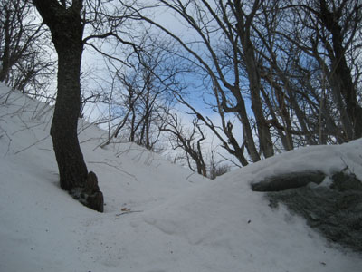
The beginning of the Busby Trail was broken by cross country skiers (and earlier, prior to the recent snow/rain, snowshoers and cross country skiers). Approaching the actual vertical of the hike, the recent tracks ended, leaving only the vague trace of someone snowshoeing to the summit.
The hike itself is rather gradual with the exception of the last ascent to the top of the ridge. The views from the summit stretch north into Vermont, west into New York, south toward I-90, and east into Franklin County.
| Hike Ratings |
|
Getting To Trailhead: |
Moderate |
| Destination: |
Spruce Hill |
|
Length: |
Easy |
|
Steepness: |
Moderate |
|
Navigation: |
Easy |
|
Views: |
Excellent |
|
Crowds: |
Minimal |
|
| Hike Stats |
|
Date Hiked: |
Sunday, March 11, 2007 |
| Hike Commenced: |
2:00 PM |
| Parking Elevation: |
1,885' |
| Destination: |
Spruce Hill |
| Ascent Commenced: |
2:02 PM |
| Summit Reached: |
2:46 PM |
| Trailhead Elevation: |
1,885' |
| Summit Elevation: |
2,566' |
| Vertical Gain: |
736' |
| Hike Ended: |
3:43 PM |
| Hike Vertical Gain: |
791' |
|
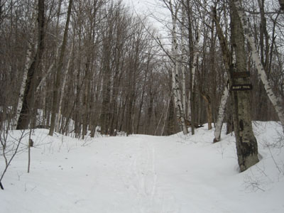
Busby Trail trailhead on Old Florida Road
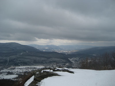
Looking west at Berlin Mountain and Mt. Raimer
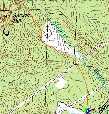

Directions to trailhead: Take Central Shaft Road south from Route 2. Go past the Savoy Mountain State Forest garage. Trailhead and some room for parking just before the swamp on the right.
Back to Spruce Hill Profile
|

