Home
States
Colorado
Connecticut
Maine
Massachusetts
New Hampshire
New York
Rhode Island
Utah
Vermont
View All
Lists
NE 4,000 Footers
NE 100 Highest
NH 4,000 Footers
NH 100 Highest
NH 52 With A View
NH Belknap Range
NH Ossipee 10
Links
Trail Conditions
Trip Log
Sunrises
Sunsets
About
|
Bald Knob
Moultonborough, NH, Tuftonboro, NH
Trailheads, measurements, times, distances, and maps are all approximate and relative to the hike(s) as shown below.
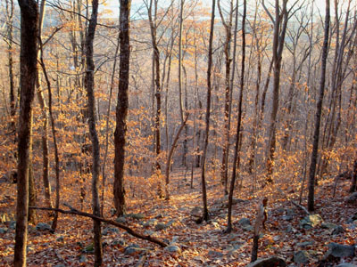
Looking down the Bald Knob Trail
Route: Bald Knob Trail
With some junk weather moving in, it was time to get out and do a sunset hike! Since the days continue to get shorter, I decided to hike even closer to home - Bald Knob!
I started at Route 171 again, heading up the Bald Knob Trail. As in the spring, the trail was not too well marked - it takes some looking around to figure out exactly where it goes once it reapproaches the brook on the steeps...when in doubt, head uphill!
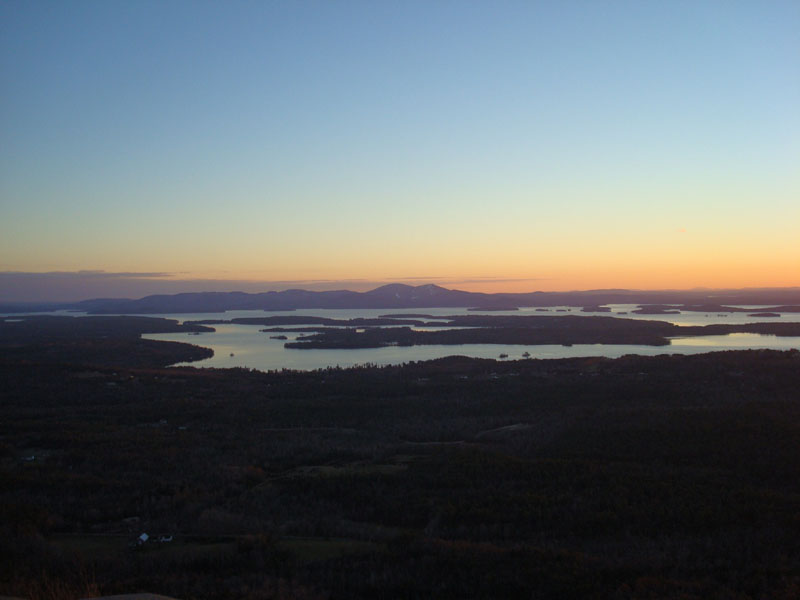
I had the knob all to myself - and the sunset was already in progress due to a cloudbank in the horizon. The colors were decent - improving a lot after the sun was down. The lights across the lake, especially those at Gunstock Ski Area, made the views especially interesting.
In checking my times when I returned, I was shocked to find out that they were identical to those in the spring - the same start time and the same summit reached time! The bad news was that in the spring I had continued uphill a bit, so my place this time around was slower - I'll blame the leaves.
| Hike Ratings |
|
Getting To Trailhead: |
Easy |
| Destination: |
Bald Knob |
|
Length: |
Moderate |
|
Steepness: |
Difficult |
|
Navigation: |
Moderate |
|
Views: |
Excellent |
|
Crowds: |
Minimal |
|
| Hike Stats |
|
Date Hiked: |
Monday, November 19, 2007 |
| Parking Elevation: |
710' |
| Destination: |
Bald Knob |
| Time Elapsed: |
00:31 |
| Trailhead Elevation: |
710' |
| Summit Elevation: |
1,801' |
| Distance: |
1.1 miles |
| Vertical Gain: |
1,116' |
|
|
| Hike Time Elapsed: |
01:33 |
| Hike Vertical Gain: |
1,141' |
|
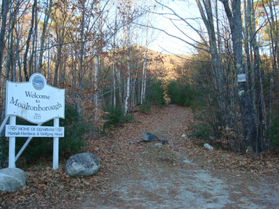
Bald Knob Trail trailhead

Looking southwest at Belknap Mountain and Gunstock Mountain from Bald Knob.
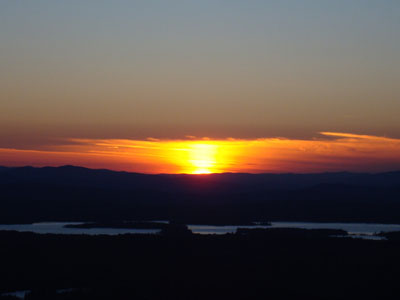
The sunset as seen from Bald Knob
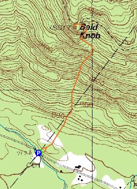

Directions to trailhead: Take Route 109 South from Route 25. Bear left onto Route 171. Shortly after the main Castle in the Clouds entrance, you will arrive at the Moultonboro/Tuftonboro border. The trailhead is next to the Welcome to Moultonboro sign.
Back to Bald Knob Profile
|