Home
States
Colorado
Connecticut
Maine
Massachusetts
New Hampshire
New York
Rhode Island
Utah
Vermont
View All
Lists
NE 4,000 Footers
NE 100 Highest
NH 4,000 Footers
NH 100 Highest
NH 52 With A View
NH Belknap Range
NH Ossipee 10
Links
Trail Conditions
Trip Log
Sunrises
Sunsets
About
|
Bald Knob
Moultonborough, NH, Tuftonboro, NH
Trailheads, measurements, times, distances, and maps are all approximate and relative to the hike(s) as shown below.
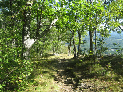
Looking down the Bald Knob Trail
Route: Bald Knob Trail
After having done a few larger hikes in the past few days, I decided to do something a bit shorter and more local.
The Bald Knob Trail was in pretty good shape, though it seemed like there was an additional blowdown or two since my previous visit.
As usual, the views from the knob were excellent.
| Hike Ratings |
|
Getting To Trailhead: |
Easy |
| Destination: |
Bald Knob |
|
Length: |
Moderate |
|
Steepness: |
Difficult |
|
Navigation: |
Easy |
|
Views: |
Excellent |
|
Crowds: |
Minimal |
|
| Hike Stats |
|
Date Hiked: |
Friday, September 19, 2008 |
| Parking Elevation: |
710' |
| Destination: |
Bald Knob |
| Time Elapsed: |
00:31 |
| Trailhead Elevation: |
710' |
| Summit Elevation: |
1,801' |
| Distance: |
1.1 miles |
| Vertical Gain: |
1,116' |
|
|
| Hike Vertical Gain: |
1,141' |
|
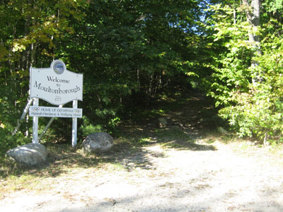
Bald Knob Trail trailhead
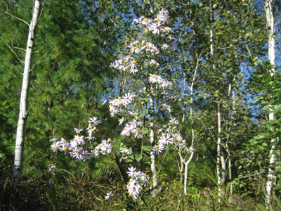
Still some wildflowers left along the trail!
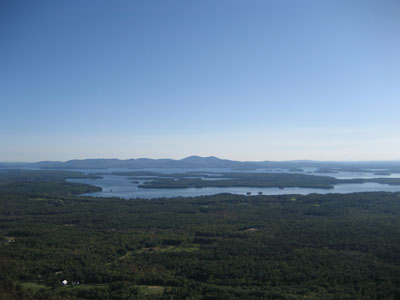
Looking southwest at Belknap Mountain and Gunstock Mountain from Bald Knob.
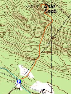

Directions to trailhead: Take Route 109 South from Route 25. Bear left onto Route 171. Shortly after the main Castle in the Clouds entrance, you will arrive at the Moultonboro/Tuftonboro border. The trailhead is next to the Welcome to Moultonboro sign.
Back to Bald Knob Profile
|

