Home
States
Colorado
Connecticut
Maine
Massachusetts
New Hampshire
New York
Rhode Island
Utah
Vermont
View All
Lists
NE 4,000 Footers
NE 100 Highest
NH 4,000 Footers
NH 100 Highest
NH 52 With A View
NH Belknap Range
NH Ossipee 10
Links
Trail Conditions
Trip Log
Sunrises
Sunsets
About
|
Bald Knob
Moultonborough, NH, Tuftonboro, NH
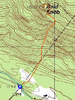
Trailheads, measurements, times, distances, and maps are all approximate and relative to the hike(s) as shown below.
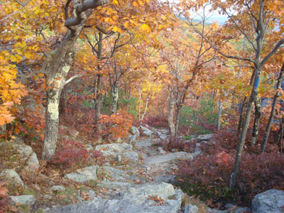
Looking down the Bald Knob Trail
Route: Bald Knob Trail
Though it was a bit cloudy outside, the weather looked good enough for me to do a quick hike before the Sox game.
I was a bit surprised as I pulled up to the trailhead - there were almost half a dozen cars parked along the road - a very busy day for Bald Knob! The bottom of the trail featured excellent fall colors. From there to near the top, however, the colors were decent, but not close to peak.
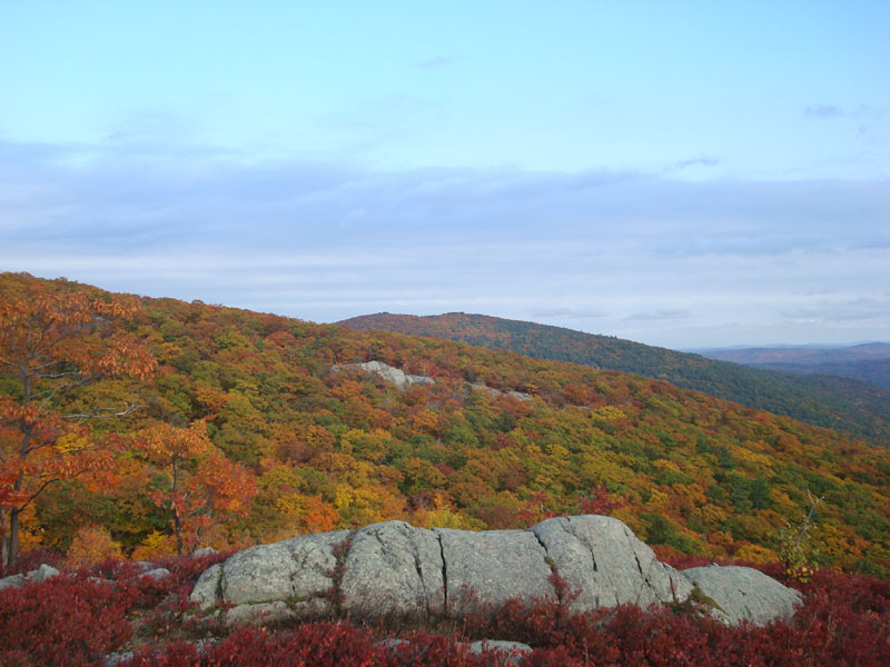
At the top, however, there was plenty of peak color to be seen - looking at the mountainside, that is. The flats below still had plenty of greens. Not wanting to miss much of the game, I didn't loiter for long at the summit.
Unfortunately, the game didn't turn out favorably for the Red Sox.
| Hike Ratings |
|
Getting To Trailhead: |
Easy |
| Destination: |
Bald Knob |
|
Length: |
Moderate |
|
Steepness: |
Difficult |
|
Navigation: |
Moderate |
|
Views: |
Excellent |
|
Crowds: |
Moderate |
|
| Hike Stats |
|
Date Hiked: |
Monday, October 13, 2008 |
| Hike Commenced: |
3:30 PM |
| Parking Elevation: |
710' |
| Destination: |
Bald Knob |
| Ascent Commenced: |
3:30 PM |
| Summit Reached: |
4:02 PM |
| Time Elapsed: |
00:32 |
| Trailhead Elevation: |
710' |
| Summit Elevation: |
1,801' |
| Distance: |
1.1 miles |
| Vertical Gain: |
1,116' |
|
|
| Hike Ended: |
4:50 PM |
| Hike Time Elapsed: |
01:20 |
| Hike Vertical Gain: |
1,141' |
|
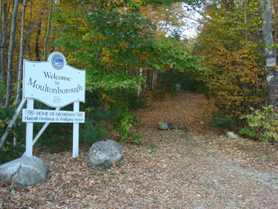
Bald Knob Trail trailhead

Looking at Big Ball Mountain from Bald Knob

Directions to trailhead: Take Route 109 South from Route 25. Bear left onto Route 171. Shortly after the main Castle in the Clouds entrance, you will arrive at the Moultonboro/Tuftonboro border. The trailhead is next to the Welcome to Moultonboro sign.
Back to Bald Knob Profile
|