Home
States
Colorado
Connecticut
Maine
Massachusetts
New Hampshire
New York
Rhode Island
Utah
Vermont
View All
Lists
NE 4,000 Footers
NE 100 Highest
NH 4,000 Footers
NH 100 Highest
NH 52 With A View
NH Belknap Range
NH Ossipee 10
Links
Trail Conditions
Trip Log
Sunrises
Sunsets
About
|
Bald Knob
Moultonborough, NH, Tuftonboro, NH
Trailheads, measurements, times, distances, and maps are all approximate and relative to the hike(s) as shown below.
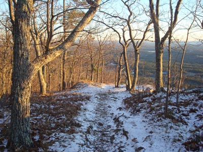
Looking down the Bald Knob Trail
Route: Bald Knob Trail
Since the upcoming days looked to be poor weatherwise, I decided to get out of work a few minutes early so that I could get a halfway decent, short hike in prior to the sunset. With the temperature at 15 degrees, it was going to be a cold one!
The Bald Knob Trail was mostly snow free, save for the occasional dusting here and there. The ledge slab portion of the trail was rather neat looking, as thick patches of blue ice had formed on either side of the trail.
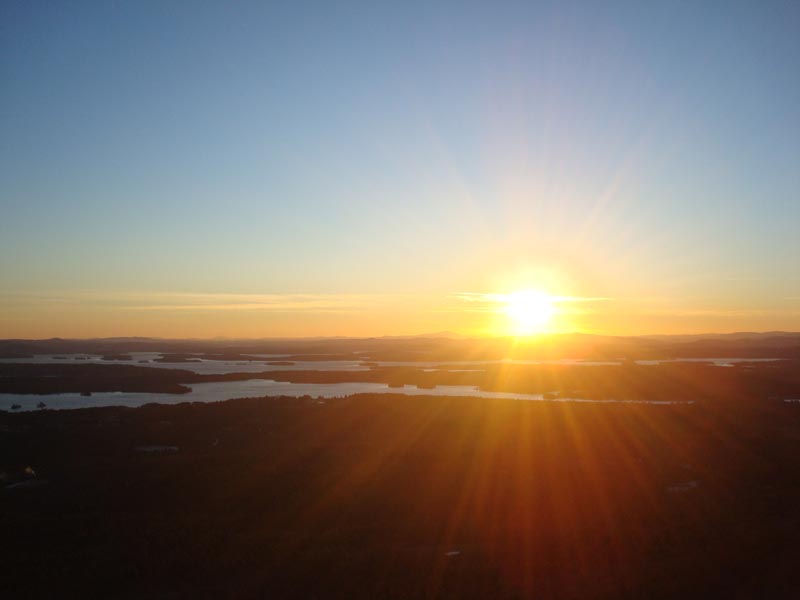
The views from the top were tremendous - the visibility was excellent, allowing for even the distant lookout tower on Kearsarge Mountain to be seen by the naked eye.
Determined to be warmer for these winter sunset hikes, I decided to bring snowpants with me. Huddling out of the wind, I put on snowpants, a fleece, a shell, a balaclava, and winter hat. Though I was more comfortable than normal on cold sunset hikes, my hands were still absolutely freezing when I was taking photos - if I could somehow figure out how to take photos with my bulky mittens on...
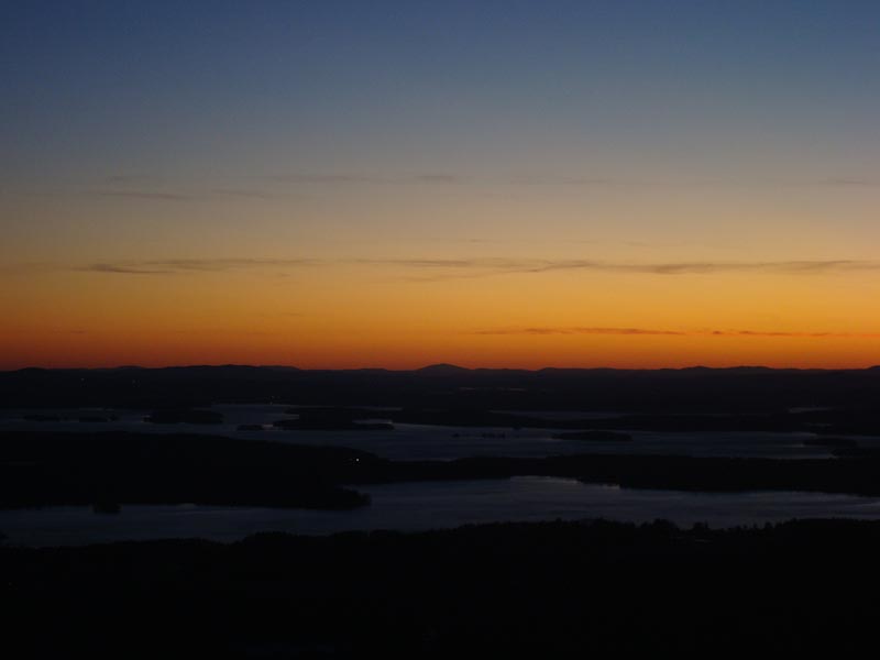
Since I'm still trying to get acclimated to the winter weather, I hung out on the summit for 45 minutes. Though perhaps the colors were must stunning during the actual sunset, the deep reds overtaking the horizon about half an hour were quite nice.
By the time I reached Route 171, the temperature had dropped down to 11 degrees. I'm not sure what the temperature was on top of Bald Knob, but I suspect, with the mild to moderate winds, it must have been close to zero degrees with the windchill.
| Hike Ratings |
|
Getting To Trailhead: |
Easy |
| Destination: |
Bald Knob |
|
Length: |
Moderate |
|
Steepness: |
Difficult |
|
Navigation: |
Easy |
|
Views: |
Excellent |
|
Crowds: |
Minimal |
|
| Hike Stats |
|
Date Hiked: |
Monday, December 8, 2008 |
| Hike Commenced: |
3:24 PM |
| Parking Elevation: |
710' |
| Destination: |
Bald Knob |
| Ascent Commenced: |
3:24 PM |
| Summit Reached: |
3:56 PM |
| Time Elapsed: |
00:32 |
| Trailhead Elevation: |
710' |
| Summit Elevation: |
1,801' |
| Distance: |
1.1 miles |
| Vertical Gain: |
1,116' |
|
|
| Hike Ended: |
5:22 PM |
| Hike Time Elapsed: |
01:58 |
| Hike Vertical Gain: |
1,141' |
|
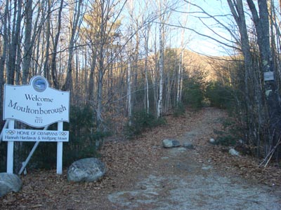
Bald Knob Trail trailhead

Looking at Lake Winnipesaukee from Bald Knob
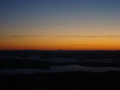
Sunset colors over Lake Winnipesaukee as seen from Bald Knob
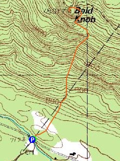

Directions to trailhead: Take Route 109 South from Route 25. Bear left onto Route 171. Shortly after the main Castle in the Clouds entrance, you will arrive at the Moultonboro/Tuftonboro border. The trailhead is next to the Welcome to Moultonboro sign.
Back to Bald Knob Profile
|