Home
States
Colorado
Connecticut
Maine
Massachusetts
New Hampshire
New York
Rhode Island
Utah
Vermont
View All
Lists
NE 4,000 Footers
NE 100 Highest
NH 4,000 Footers
NH 100 Highest
NH 52 With A View
NH Belknap Range
NH Ossipee 10
Links
Trail Conditions
Trip Log
Sunrises
Sunsets
About
|
Bald Knob
Moultonborough, NH, Tuftonboro, NH
Trailheads, measurements, times, distances, and maps are all approximate and relative to the hike(s) as shown below.
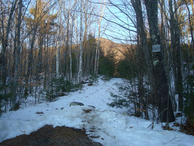
Looking up the Bald Knob Trail
Route: Bald Knob Trail
After watching a beautiful sunny day from my window while working, I was itchy to get out for a quick after work hike. Wanting to get a bit of a workout, I decided to head over to Bald Knob.
I was pleased to see the plows had left some room for roadside parking - it can be tough to hike lot-less trails in the winter months due to snowbanks.
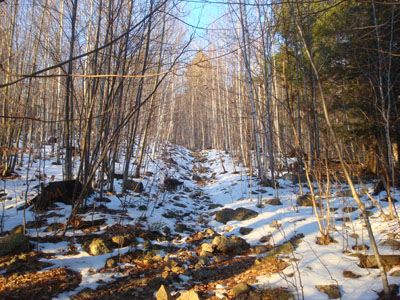
The first section of the Bald Knob Trail was frozen granular. After crossing the slightly higher than normal brook, I was soon making my way up the steeper portions of the trail. Other than some random spots of ice and frozen granular, the trail was in decent shape for barebooting.
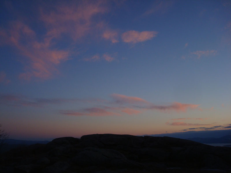
Arriving at the summit, I wasn't quite sure if I'd be getting any sort of sunset display, as a thick band of clouds had formed to the west. Nonetheless, as time passed, the clouds overhead became rather colorful, making it a worthwhile sunset hike.
| Hike Ratings |
|
Getting To Trailhead: |
Easy |
| Destination: |
Bald Knob |
|
Length: |
Moderate |
|
Steepness: |
Difficult |
|
Navigation: |
Easy |
|
Views: |
Excellent |
|
Crowds: |
Minimal |
|
| Hike Stats |
|
Date Hiked: |
Monday, December 29, 2008 |
| Hike Commenced: |
3:34 PM |
| Parking Elevation: |
710' |
| Destination: |
Bald Knob |
| Ascent Commenced: |
3:34 PM |
| Summit Reached: |
4:07 PM |
| Time Elapsed: |
00:33 |
| Trailhead Elevation: |
710' |
| Summit Elevation: |
1,801' |
| Distance: |
1.1 miles |
| Vertical Gain: |
1,116' |
|
|
| Hike Ended: |
5:07 PM |
| Hike Time Elapsed: |
01:33 |
| Hike Vertical Gain: |
1,141' |
|
Bald Knob Trail trailhead
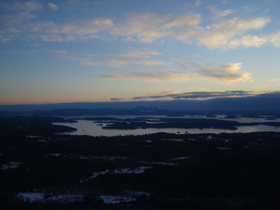
Looking at Lake Winnipesaukee from Bald Knob
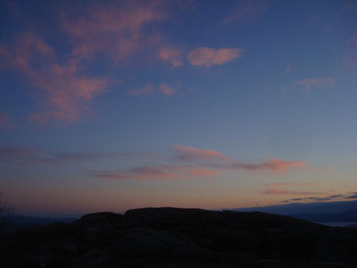
Sunset colors as seen from Bald Knob
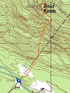

Directions to trailhead: Take Route 109 South from Route 25. Bear left onto Route 171. Shortly after the main Castle in the Clouds entrance, you will arrive at the Moultonboro/Tuftonboro border. The trailhead is next to the Welcome to Moultonboro sign.
Back to Bald Knob Profile
|