Home
States
Colorado
Connecticut
Maine
Massachusetts
New Hampshire
New York
Rhode Island
Utah
Vermont
View All
Lists
NE 4,000 Footers
NE 100 Highest
NH 4,000 Footers
NH 100 Highest
NH 52 With A View
NH Belknap Range
NH Ossipee 10
Links
Trail Conditions
Trip Log
Sunrises
Sunsets
About
|
Bald Knob
Moultonborough, NH, Tuftonboro, NH
Trailheads, measurements, times, distances, and maps are all approximate and relative to the hike(s) as shown below.
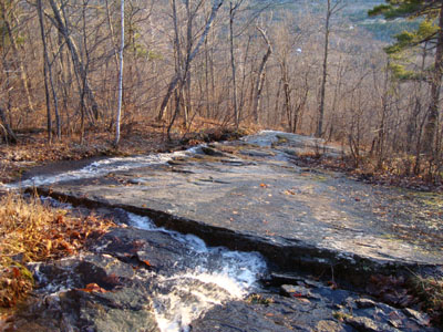
Looking down the Bald Knob Trail
Route: Bald Knob Trail
While my intention the previous day was to hike Bald Knob for the sunset, the amount of rain that morning persuaded me to give the water crossing another day to drop down. 24 dry hours later, I decided to give it a go.
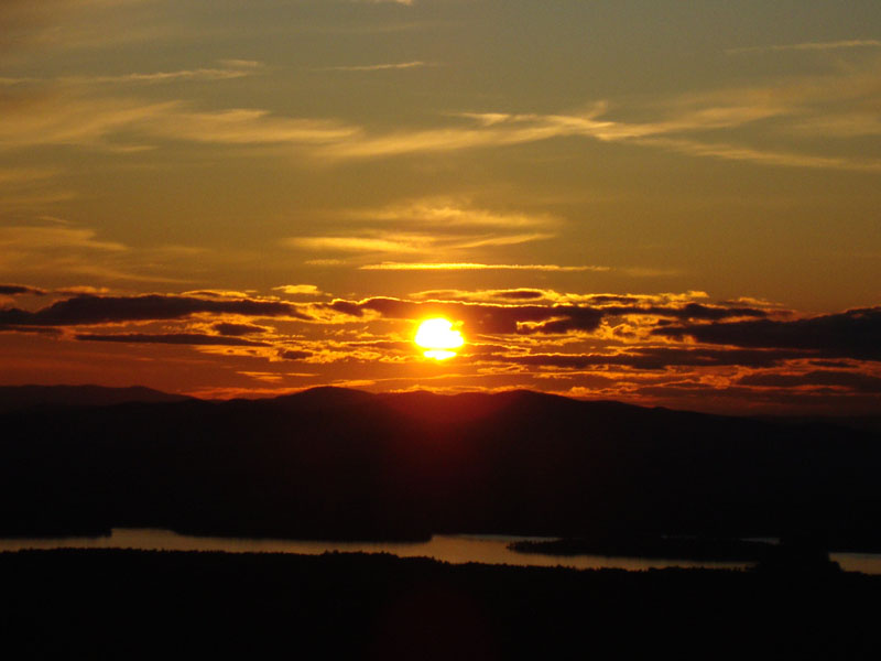
Though not quite as warm as the previous day, it was still pretty comfortable. Rough and steep as always, the Bald Knob Trail fortunately didn't have any ice or snow on it. Reaching the summit, I saw potential for a decent sunset. While not as strong as some others this fall, it was nonetheless a decent display.
| Hike Ratings |
|
Getting To Trailhead: |
Easy |
| Destination: |
Bald Knob |
|
Length: |
Moderate |
|
Steepness: |
Difficult |
|
Navigation: |
Easy |
|
Views: |
Excellent |
|
Crowds: |
Minimal |
|
| Hike Stats |
|
Date Hiked: |
Friday, December 4, 2009 |
| Hike Commenced: |
3:21 PM |
| Parking Elevation: |
710' |
| Destination: |
Bald Knob |
| Ascent Commenced: |
3:21 PM |
| Summit Reached: |
3:49 PM |
| Time Elapsed: |
00:28 |
| Trailhead Elevation: |
710' |
| Summit Elevation: |
1,801' |
| Distance: |
1.1 miles |
| Vertical Gain: |
1,116' |
|
|
| Hike Ended: |
4:50 PM |
| Hike Time Elapsed: |
01:29 |
| Hike Vertical Gain: |
1,141' |
|
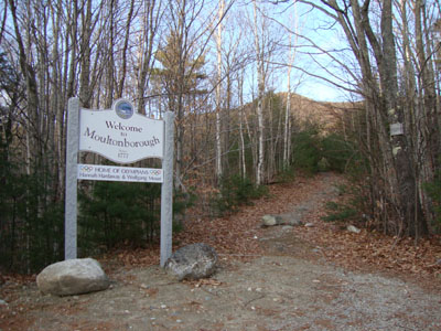
Bald Knob Trail trailhead
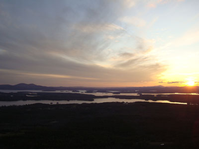
Looking at Lake Winnipesaukee from Bald Knob

Sunset colors as seen from Bald Knob
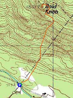

Directions to trailhead: Take Route 109 South from Route 25. Bear left onto Route 171. Shortly after the main Castle in the Clouds entrance, you will arrive at the Moultonboro/Tuftonboro border. The trailhead is next to the Welcome to Moultonboro sign.
Back to Bald Knob Profile
|