Home
States
Colorado
Connecticut
Maine
Massachusetts
New Hampshire
New York
Rhode Island
Utah
Vermont
View All
Lists
NE 4,000 Footers
NE 100 Highest
NH 4,000 Footers
NH 100 Highest
NH 52 With A View
NH Belknap Range
NH Ossipee 10
Links
Trail Conditions
Trip Log
Sunrises
Sunsets
About
|
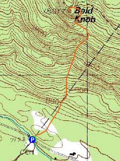
Bald Knob
Moultonborough, NH, Tuftonboro, NH
Trailheads, measurements, times, distances, and maps are all approximate and relative to the hike(s) as shown below.
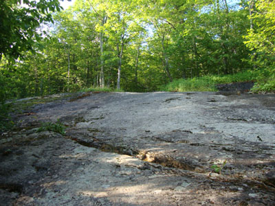
Looking up the Bald Knob Trail prior to the first viewpoint
Route: Bald Knob Trail
With a few hours of daylight at my disposal, I headed down to Bald Knob for a quick hike. While I started out jogging, the steep, rocky nature of the trail resulted in me changing to a normal walk about 1/3 of the way up. While the deer flies were out in the lower elevations, the summit appeared to be bug free.
The views from the Knob were quite strong throughout the Lakes Region, though the mountains to the north were in the fog.
| Hike Ratings |
|
Getting To Trailhead: |
Easy |
| Destination: |
Bald Knob |
|
Length: |
Moderate |
|
Steepness: |
Difficult |
|
Navigation: |
Easy |
|
Views: |
Excellent |
|
Crowds: |
Minimal |
|
| Hike Stats |
|
Date Hiked: |
Tuesday, July 20, 2010 |
| Parking Elevation: |
710' |
| Destination: |
Bald Knob |
| Time Elapsed: |
00:23 |
| Trailhead Elevation: |
710' |
| Summit Elevation: |
1,801' |
| Distance: |
1.1 miles |
| Vertical Gain: |
1,116' |
|
|
| Hike Time Elapsed: |
00:51 |
| Hike Vertical Gain: |
1,141' |
|
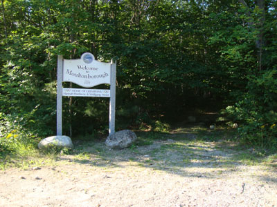
Bald Knob Trail trailhead
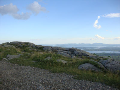
Looking at Belknap Range from Bald Knob

Directions to trailhead: Take Route 109 South from Route 25. Bear left onto Route 171. Shortly after the main Castle in the Clouds entrance, you will arrive at the Moultonboro/Tuftonboro border. The trailhead is next to the Welcome to Moultonborough sign.
Back to Bald Knob Profile
|

