Home
States
Colorado
Connecticut
Maine
Massachusetts
New Hampshire
New York
Rhode Island
Utah
Vermont
View All
Lists
NE 4,000 Footers
NE 100 Highest
NH 4,000 Footers
NH 100 Highest
NH 52 With A View
NH Belknap Range
NH Ossipee 10
Links
Trail Conditions
Trip Log
Sunrises
Sunsets
About
|
Bald Knob
Moultonborough, NH
Trailheads, measurements, times, distances, and maps are all approximate and relative to the hike(s) as shown below.
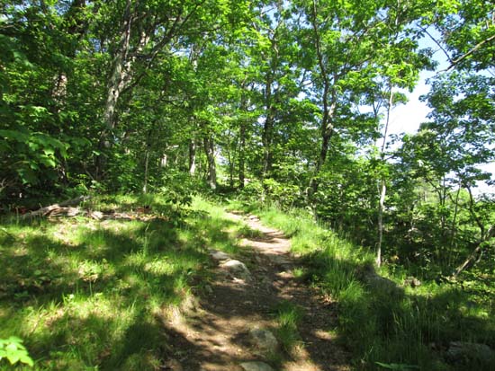
Looking up the Bald Knob Cutoff
Route: Shannon Brook Trail, Bald Knob Cutoff, Bald Knob Trail, (Bald Knob), Bald Knob Trail, Bald Knob Cutoff, Shannon Brook Trail
Trails were generally dry, with the exception of minor mud in the normally wet spot in the col before reaching the upper carriage road portion of the hike. Upper carriage road portion (ie Bald Knob Trail) is a little more grassy than I remember in the past. Good views from the summit, amidst the steady rumbling of Harleys.
| Hike Ratings |
|
Getting To Trailhead: |
Easy |
| Destination: |
Bald Knob |
|
Length: |
Moderate |
|
Steepness: |
Moderate |
|
Navigation: |
Easy |
|
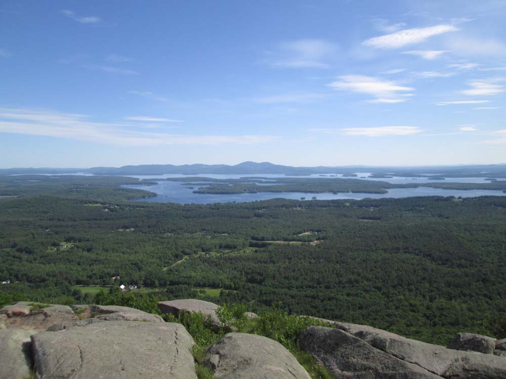
Views: |
Excellent |
|
Crowds: |
Minimal |
|
| Hike Stats |
|
Date Hiked: |
Monday, June 16, 2014 |
| Parking Elevation: |
720' |
| Destination: |
Bald Knob |
| Time Elapsed: |
00:36 |
| Trailhead Elevation: |
730' |
| Summit Elevation: |
1,801' |
| Distance: |
2 miles |
| Vertical Gain: |
1,171' |
|
|
| Hike Time Elapsed: |
01:10 |
| Hike Distance: |
4 miles |
| Hike Vertical Gain: |
1,281' |
|
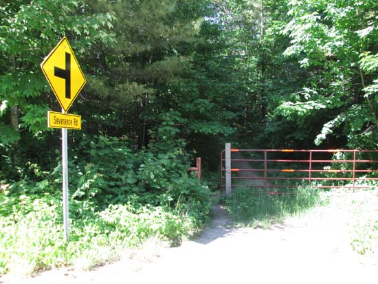
Shannon Brook Trail trailhead
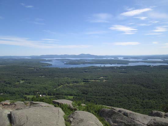
The Belknaps as seen from Bald Knob
Directions to trailhead: Take Route 109 South from Route 25. Bear left onto Route 171. Shortly after the main Castle in the Clouds entrance, there will be a hiker parking lot on the right side of the road. Trailhead is directly across from it.
Back to Bald Knob Profile
|