Home
States
Colorado
Connecticut
Maine
Massachusetts
New Hampshire
New York
Rhode Island
Utah
Vermont
View All
Lists
NE 4,000 Footers
NE 100 Highest
NH 4,000 Footers
NH 100 Highest
NH 52 With A View
NH Belknap Range
NH Ossipee 10
Links
Trail Conditions
Trip Log
Sunrises
Sunsets
About
|
Bald Knob
Moultonborough, NH
Trailheads, measurements, times, distances, and maps are all approximate and relative to the hike(s) as shown below.
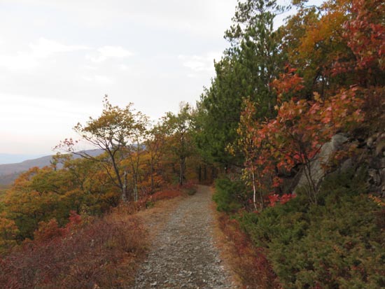
Looking down the Bald Knob Trail
Route: Turtleback Mountain Trail, Bald Knob Trail
Trails were covered in damp leaves from showers earlier in day. Fantastic fall foliage colors atop Bald Knob, but otherwise colors generally past peak.
| Hike Ratings |
|
Getting To Trailhead: |
Easy |
| Destination: |
Bald Knob |
|
Length: |
Moderate |
|
Steepness: |
Easy |
|
Navigation: |
Easy |
|
Views: |
Excellent |
|
Crowds: |
Moderate |
|
| Hike Stats |
|
Date Hiked: |
Thursday, October 22, 2015 |
| Parking Elevation: |
1,240' |
| Destination: |
Bald Knob |
| Time Elapsed: |
00:33 |
| Trailhead Elevation: |
1,230' |
| Summit Elevation: |
1,801' |
| Distance: |
2.75 miles |
| Vertical Gain: |
671' |
|
|
| Hike Time Elapsed: |
01:43 |
| Hike Distance: |
5.5 miles |
| Hike Vertical Gain: |
771' |
|

The sunset from Bald Knob
Directions to trailhead: Take Route 109 South from Route 25. Bear left onto Route 171. Shortly thereafter, take a left onto Ossipee Park Road. The small hiker parking lot is located just after the gatehouse, on the right. Continue on the road on foot, then proceed to the right of the pond. The Turtleback Mountain Trail starts soon thereafter.
Back to Bald Knob Profile
|

