Home
States
Colorado
Connecticut
Maine
Massachusetts
New Hampshire
New York
Rhode Island
Utah
Vermont
View All
Lists
NE 4,000 Footers
NE 100 Highest
NH 4,000 Footers
NH 100 Highest
NH 52 With A View
NH Belknap Range
NH Ossipee 10
Links
Trail Conditions
Trip Log
Sunrises
Sunsets
About
|
Bald Ledge
New Hampton, NH
Trailheads, measurements, times, distances, and maps are all approximate and relative to the hike(s) as shown below.
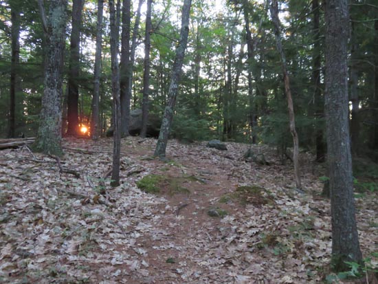
The Bald Ledge Trail
Route: Bald Ledge Trail
Trail was mostly dry with some minor mud in the normal places at the low point. Nice sunrise over Big Ball Mountain.
| Hike Ratings |
|
Getting To Trailhead: |
Easy |
| Destination: |
Bald Ledge |
|
Length: |
Easy |
|
Steepness: |
Easy |
|
Navigation: |
Moderate |
|
Views: |
Excellent |
|
Crowds: |
Minimal |
|
| Hike Stats |
|
Date Hiked: |
Friday, August 28, 2015 |
| Parking Elevation: |
1,100' |
| Destination: |
Bald Ledge |
| Time Elapsed: |
00:07 |
| Trailhead Elevation: |
1,100' |
| Summit Elevation: |
1,130' |
| Distance: |
0.8 miles |
| Vertical Gain: |
100' |
|
|
| Hike Time Elapsed: |
00:43 |
| Hike Distance: |
1.6 miles |
| Hike Vertical Gain: |
160' |
|
The start of the Bald Ledge Trail at the end of the maintained portion of Sky Pond Road

The sunrise from Bald Ledge
Directions to trailhead: From Ashland, take Route 132 south, then bear left onto Winona Road. Take a right onto Dana Hill Road. Take a left onto Lower Oxbow Road. Take a left onto Sky Pond Road. The Sky Pond boat launch and parking area will be on the right just prior to the end of the road (not plowed in winter). The Bald Ledge Trail starts as the continuation of Sky Pond Road.
Back to Bald Ledge Profile
|