Home
States
Colorado
Connecticut
Maine
Massachusetts
New Hampshire
New York
Rhode Island
Utah
Vermont
View All
Lists
NE 4,000 Footers
NE 100 Highest
NH 4,000 Footers
NH 100 Highest
NH 52 With A View
NH Belknap Range
NH Ossipee 10
Links
Trail Conditions
Trip Log
Sunrises
Sunsets
About
|
Bear Mountain
Bartlett, NH
Trailheads, measurements, times, distances, and maps are all approximate and relative to the hike(s) as shown below.
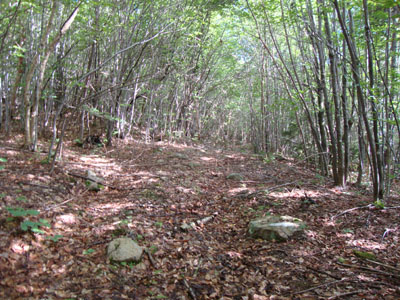
Looking up the abandoned Bear Mountain Ski Trail
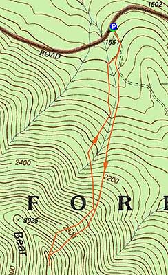
Route: Bear Mountain Ski Trail, bushwhack, (Bear Mountain), bushwhack, Bear Mountain Ski Trail
Having long been interested in finding the old CCC ski trail up Bear Mountain, a mediocre weather forecast provided a good opportunity.
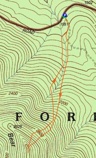
Starting at the entrance to the old logging road off Bear Notch Road, we followed it for a bit until it looked like the ski trail left it and continued to follow near a brook. While the trail has been abandoned for nearly 60 years, it was fairly obvious in places. Logging roads cross all over the lower elevations, however the much wider ski trailbed was identifiable.
While the ski trail and logging roads have grown in over the years, we had fairly open woods for quite some time. As the terrain eventually steepened, the trail was harder to find (due to it using switchbacks). Eventually, circa 2,700 feet, we gave up trying to find the trail and instead pushed uphill through some thick junk for a bit, eventually reaching moderate woods. We then popped out on the old Bear Mountain Trail, about 20 feet west of the summit register.
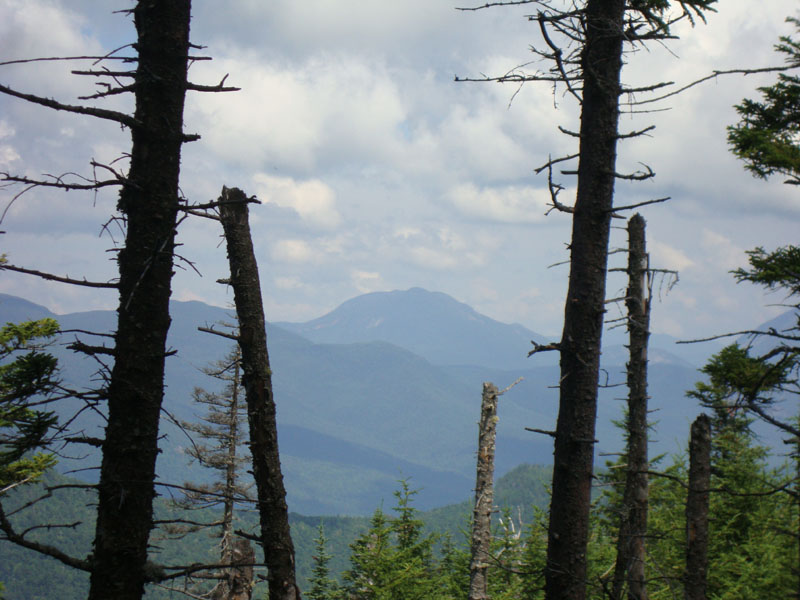
From near the summit, we had partial views through the trees of places to the northwest - quite a unique perspective.
For the descent, we stayed a little bit west of the approximate route of the ski trail and found thicker, nastier woods. We eventually hit good hardwoods down low and eventually crossed back over to the trail on the grassy lower portion of the logging road.
| Hike Ratings |
|
Getting To Trailhead: |
Easy |
| Destination: |
Bear Mountain |
|
Length: |
Moderate |
|
Steepness: |
Difficult |
|
Navigation: |
Difficult |
|
Views: |
Moderate |
|
Crowds: |
Minimal |
|
| Hike Stats |
|
Date Hiked: |
Sunday, July 11, 2010 |
| Hike Commenced: |
8:37 AM |
| Parking Elevation: |
1,551' |
| Destination: |
Bear Mountain |
| Ascent Commenced: |
8:37 AM |
| Summit Reached: |
10:48 AM |
| Time Elapsed: |
02:11 |
| Trailhead Elevation: |
1,551' |
| Summit Elevation: |
3,220' |
| Vertical Gain: |
1,684' |
|
|
| Hike Ended: |
1:15 PM |
| Hike Time Elapsed: |
04:38 |
| Hike Vertical Gain: |
1,724' |
|
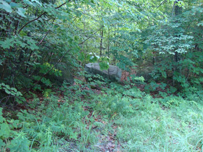
The Bear Mountain Ski Trail trailhead on Bear Notch Road

Looking at Mt. Willey from Bear Mountain

Directions to trailhead: From Route 112, take Bear Notch Road north over the height of land. Shortly after passing a viewpoint on the left, look for a vague logging road on the right (on a left turning curve), blocked with boulders. There is limited room for parking alongside Bear Notch Road.
Back to Bear Mountain Profile
|