Home
States
Colorado
Connecticut
Maine
Massachusetts
New Hampshire
New York
Rhode Island
Utah
Vermont
View All
Lists
NE 4,000 Footers
NE 100 Highest
NH 4,000 Footers
NH 100 Highest
NH 52 With A View
NH Belknap Range
NH Ossipee 10
Links
Trail Conditions
Trip Log
Sunrises
Sunsets
About
|
Belknap Mountain
Gilford, NH
Trailheads, measurements, times, distances, and maps are all approximate and relative to the hike(s) as shown below.
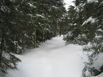
Heading up the unbroken Green Trail to the Belknap Mountain summit
Route: Auto Road, Green Trail, Auto Road
What better thing to do on a Friday the 13th than to go hike in some weird weather?
Since I was in the area, I decided to hike Belknap Mountain. My intent for a long time was to hike this via Gunstock. Since I didn't feel like hiking Gunstock poor weather (mostly cloudy, windy, sprinkles/flurries), I decided to ascend via the Carriage Road trailhead on my snowshoes.
The road, closed at the first gate in the winter, was well packed by previous skiers and snowshoers. Upon reaching the Green Trail trailhead (nearly 40 minutes later), I was greeted by an unbroken trail.
The Green Trail, despite its warnings, isn't overly steep. Though generally well blazed, I found one section tricky, as there was a reroute marked with a small piece of paper and some faded orange ribbon...only problem was, it was marked into the woods, but not back out. After realizing the ribbons had disappeared, I bushwacked a few feet back to the powerline cut and found the trail and continued up.
Though I did most of the hike in a tee shirt, things became cold on top - the wind was so strong on the firetower that I was blown into the railing a few times. I didn't realize how cold it really was until I bit into a frozen Snickers bar.
I toyed with following the cross country ski tracks back to the base, but my patience ran out after about 30 feet or so. I quickly doubled back and descended on the Green Trail.
| Hike Ratings |
|
Getting To Trailhead: |
Difficult (Relatively long hike) |
| Destination: |
Belknap Mountain |
|
Length: |
Moderate |
|
Steepness: |
Moderate |
|
Navigation: |
Moderate |
|
Views: |
Excellent |
|
Crowds: |
Minimal |
|
| Hike Stats |
|
Date Hiked: |
Friday, April 13, 2007 |
| Hike Commenced: |
4:38 PM |
| Parking Elevation: |
1,030' |
| Destination: |
Belknap Mountain |
| Ascent Commenced: |
5:16 PM |
| Summit Reached: |
5:50 PM |
| Time Elapsed: |
00:34 |
| Trailhead Elevation: |
1,710' |
| Summit Elevation: |
2,382' |
| Distance: |
.8 mile |
| Vertical Gain: |
682' |
|
|
| Hike Ended: |
7:13 PM |
| Hike Time Elapsed: |
02:35 |
| Hike Vertical Gain: |
1,412' |
|
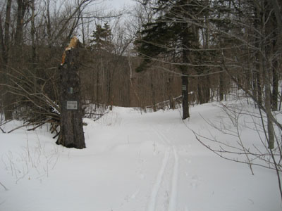
Green Trail trailhead
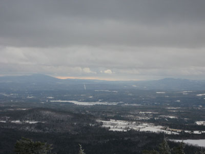
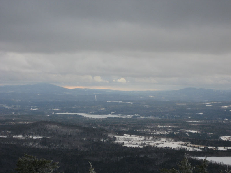
Looking west at Kearsarge Mountain and Ragged Mountain from the Belknap Mountain fire tower

Directions to trailhead: From Route 11A East (from Route 3), take a right on Hoyt Road. Continue down this road as it becomes Belknap Mountain Road. Look for Carriage Road on your left - offseason parking is at the gate.
Back to Belknap Mountain Profile
|