Home
States
Colorado
Connecticut
Maine
Massachusetts
New Hampshire
New York
Rhode Island
Utah
Vermont
View All
Lists
NE 4,000 Footers
NE 100 Highest
NH 4,000 Footers
NH 100 Highest
NH 52 With A View
NH Belknap Range
NH Ossipee 10
Links
Trail Conditions
Trip Log
Sunrises
Sunsets
About
|
Belknap Mountain
Gilford, NH
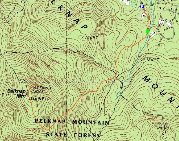
Trailheads, measurements, times, distances, and maps are all approximate and relative to the hike(s) as shown below.
Looking down the East Gilford Trail on the way to the Belknap Mountain summit
Route: East Gilford Road, (Belknap Mountain), blue blazed trail, herd path, (1972 plane crash), herd path, blue blazed trail, (Belknap Mountain), East Gilford Road
Today's hike was Belknap Mountain. Previous times, I had hiked Belknap via the Carriage Road and via Gunstock. This time, I decided to ascend from the north side. After parking at the Bickford Road junction, we quickly headed up the dirt road, through the gravel pit-ish area, then right onto the East Gilford Trail (after a gate, before a bridge).
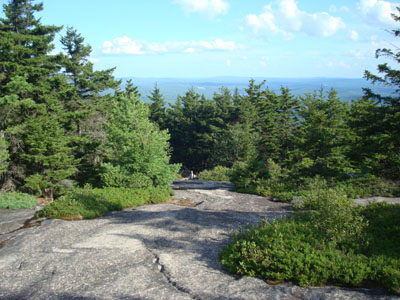
The first part of the trail was somewhat bland and flat, prior to steepening up. Awhile after becoming somewhat steep, the trail turned ledgy, bringing forth some decent views along the way.
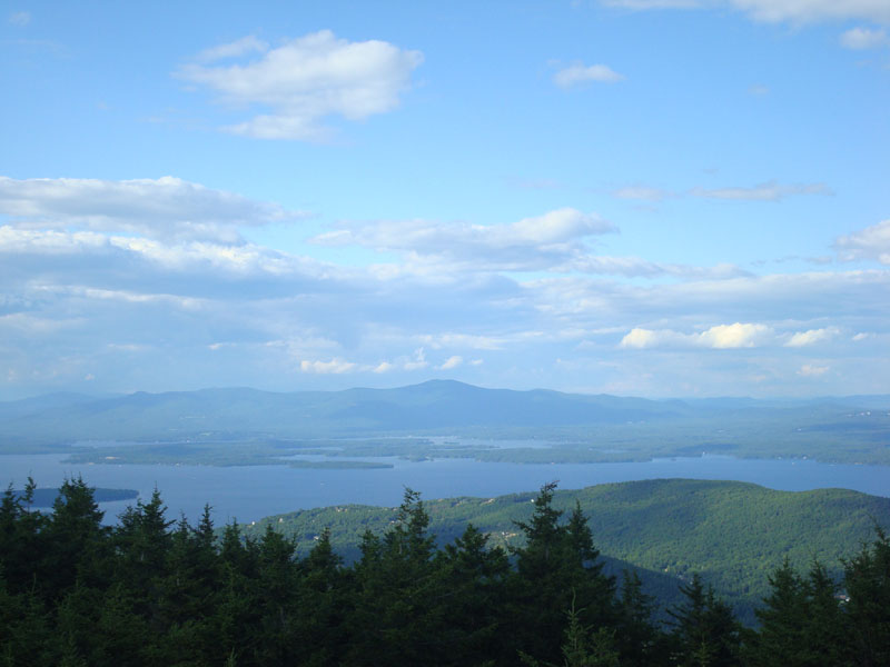
Soon, we were climbing up the shoulder and then along the flats to the empty summit. The views from the fire tower were good, though not as good as they would be if there weren't as many pieces of communications equipment blocking the vista.
After taking in the views, we headed down the tower and hiked the blue blazed trail for perhaps 100 feet, taking a right off the trail onto a progressively steep herdpath down to a June 18, 1972 plane crash. Not discovered until June 3, 1973, both people in the plane died. The site is basically a collection of tangled plane wreckage.
After climbing back up to the summit, we descended back down the East Gilford Trail, stopping for blueberries many times along the way.
| Hike Ratings |
|
Getting To Trailhead: |
Easy |
| Destination: |
Belknap Mountain |
|
Length: |
Moderate |
|
Steepness: |
Difficult |
|
Navigation: |
Easy |
|
Views: |
Excellent |
|
Crowds: |
Minimal |
|
| Hike Stats |
|
Date Hiked: |
Tuesday, July 29, 2008 |
| Hike Commenced: |
4:44 PM |
| Parking Elevation: |
1,060' |
| Destination: |
Belknap Mountain |
| Ascent Commenced: |
4:49 PM |
| Summit Reached: |
5:33 PM |
| Time Elapsed: |
00:44 |
| Trailhead Elevation: |
1,100' |
| Summit Elevation: |
2,382' |
| Vertical Gain: |
1,297' |
|
|
| Hike Ended: |
6:55 PM |
| Hike Time Elapsed: |
02:11 |
| Hike Vertical Gain: |
1,624' |
|
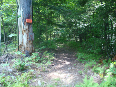
The East Gilford Trail trailhead
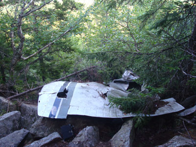
The 1972 Piper plane wreckage on the northern shoulder of Belknap Mountain

Looking at the Ossipee Mountains from the Belknap Mountain fire tower
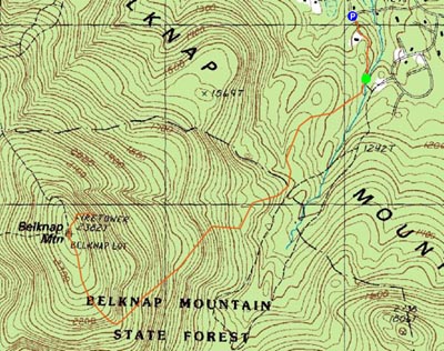

Directions to trailhead: From Alton, take Route 11 West to Route 11A West. Take a left onto Bickford Road. Park along the side of the road at the junction after the bridge, then (with your back toward the bridge), take the left branch, walk up the road, continuing straight to the left of a driveway, then across a sandy area, past a gate. The trail proper starts on the right just before a bridge.
Back to Belknap Mountain Profile
|