Home
States
Colorado
Connecticut
Maine
Massachusetts
New Hampshire
New York
Rhode Island
Utah
Vermont
View All
Lists
NE 4,000 Footers
NE 100 Highest
NH 4,000 Footers
NH 100 Highest
NH 52 With A View
NH Belknap Range
NH Ossipee 10
Links
Trail Conditions
Trip Log
Sunrises
Sunsets
About
|
Big Ball Mountain, Black Snoot, Mt. Shaw
Tuftonboro, NH, Moultonboro, NH
Trailheads, measurements, times, distances, and maps are all approximate and relative to the hike(s) as shown below.
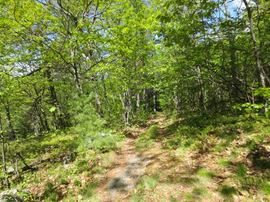
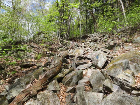
Looking up the Tate Mountain Trail
Route: Mt. Shaw Trail, Tate Mountain Trail, Banana Trail, (Big Ball Mountain), Banana Trail, Black Snout Spur Trail, (Black Snoot), Black Snout Spur Trail, Black Snout Trail, (Mt. Shaw), Black Snout Trail, Mt. Shaw Trail
Trails were mostly dry and in good shape. While Mt. Shaw is just under 3,000 feet in elevation, it packs over 2,000 vertical feet. The climb up Black Snoot from Big Ball Mountain is a decent workout.
Lots of wildflowers in bloom (fringed polygala, bellwort, trillium, blueberry blooms, lady slippers). The cascades on the lower Mt. Shaw Trail were also impressive.
| Hike Ratings |
|
Getting To Trailhead: |
Easy |
| Destination: |
Big Ball Mountain |
|
Length: |
Moderate |
|
Steepness: |
Difficult |
|
Navigation: |
Easy |
|
Views: |
Excellent |
|
Crowds: |
Minimal |
| Destination: |
Black Snoot |
|
Length: |
Moderate |
|
Steepness: |
Difficult |
|
Navigation: |
Easy |
|
Views: |
Excellent |
|
Crowds: |
Minimal |
| Destination: |
Mt. Shaw |
|
Length: |
Moderate |
|
Steepness: |
Easy |
|
Navigation: |
Easy |
|
Views: |
Excellent |
|
Crowds: |
Minimal |
|
| Hike Stats |
|
Date Hiked: |
Saturday, May 18, 2013 |
| Parking Elevation: |
675' |
| Destination: |
Big Ball Mountain |
| Time Elapsed: |
01:05 |
| Trailhead Elevation: |
675' |
| Summit Elevation: |
2,060' |
| Vertical Gain: |
1,455' |
| Destination: |
Black Snoot |
| Time Elapsed: |
00:50 |
| Trailhead Elevation: |
2,060' |
| Summit Elevation: |
2,803' |
| Vertical Gain: |
903' |
| Destination: |
Mt. Shaw |
| Time Elapsed: |
00:23 |
| Trailhead Elevation: |
2,803' |
| Summit Elevation: |
2,990' |
| Vertical Gain: |
285' |
|
|
| Hike Vertical Gain: |
2,728' |
|
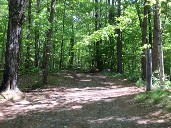
The Mt. Shaw Trail trailhead
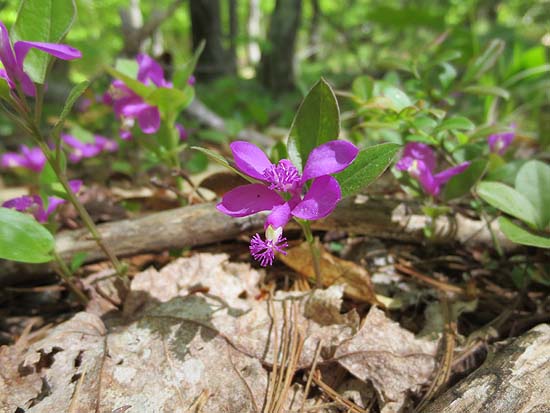
Fringed polygala on the Tate Mountain Trail
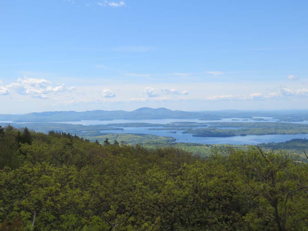
Looking at the Belknaps from the Big Ball Mountain summit
The Banana Trail on the way to Black Snoot
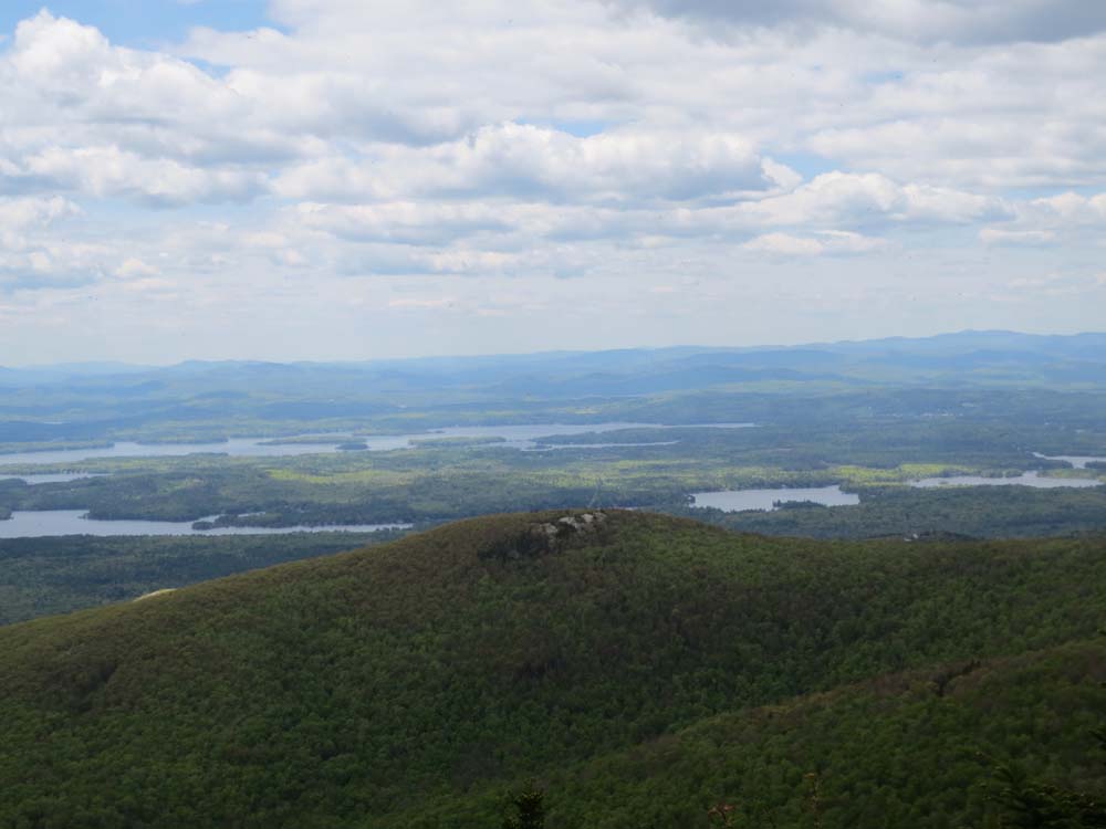
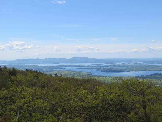
Looking over Turtleback Mountain at the Lakes Region from Black Snoot

The Black Snout Spur Trail on the way to Mt. Shaw
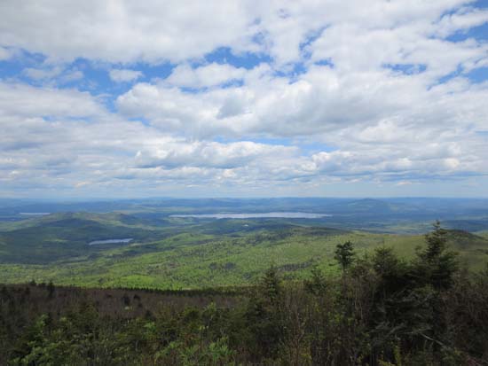
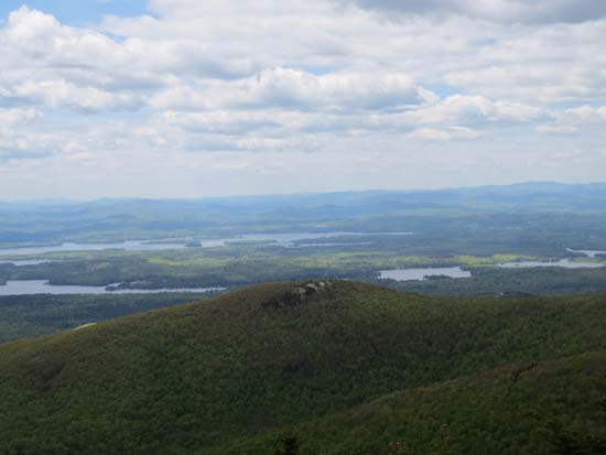
Looking at Ossipee Lake from Mt. Shaw
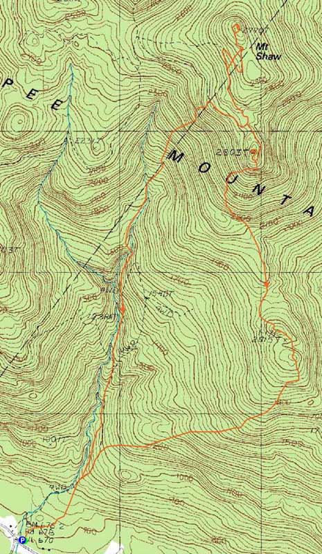

Directions to trailhead: Take 171 southeast from Route 25, past Castle in the Clouds. Shortly after crossing the Tuftonboro town line, there is a bridge/brook crossing. Immediately after this, there is an informal parking lot on the left (maybe 4 cars). The unmarked trail starts at the back of this lot.
Back to Big Ball Mountain Profile
Back to Black Snoot Profile
Back to Mt. Shaw Profile
|