Home
States
Colorado
Connecticut
Maine
Massachusetts
New Hampshire
New York
Rhode Island
Utah
Vermont
View All
Lists
NE 4,000 Footers
NE 100 Highest
NH 4,000 Footers
NH 100 Highest
NH 52 With A View
NH Belknap Range
NH Ossipee 10
Links
Trail Conditions
Trip Log
Sunrises
Sunsets
About
|
Big Ball Mountain, Black Snoot, Mt. Shaw
Tuftonboro, NH, Moultonboro, NH
Trailheads, measurements, times, distances, and maps are all approximate and relative to the hike(s) as shown below.
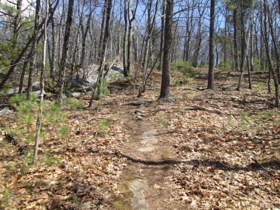
Looking up the Tate Mountain Trail
Route: Mt. Shaw Trail, Tate Mountain Trail, Banana Trail, (Big Ball Mountain), Banana Trail, Black Snout Spur Trail, (Black Snoot), Black Snout Spur Trail, Black Snout Trail, (Mt. Shaw), Black Snout Trail, Mt. Shaw Trail
Initial portion of the Mt. Shaw Trail has been recently logged (selective cut of pine), but there's no impact to the hiking trail at this time.
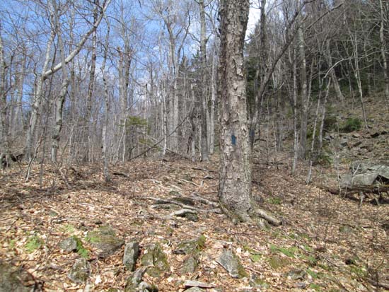
Tate Mountain Trail turnoff is easy to miss (no sign and blazing doesn't start until a few dozen feet up the trail). Trail was dry and snow free.
Banana Trail was dry and snow free to Big Ball Mountain.
Banana Trail was mostly dry between Big Ball Mountain and Black Snoot (I refer to it as Black Snoot, as a very old map labels this peak Black Snoot and the trailless peak on the northern side of the range as Black Snout). Portions of the trail are hard to follow, as the woods are open but there's a lot of deadfall (including on the trail).
Black Snout Spur (carriage road) has some patches of foot deep snow on the east side, but novelty sized. Otherwise, dry trail.
Black Snout Trail from there to Mt. Shaw was initially dry, but then had alternating patches of snow (which generally support foot traffic due to snowmobile use on the upper portion). Probably about 95% snow free.
Mt. Shaw Trail was snow free and mostly dry.
A few trailing arbutus (Tate Mountain Trail, Banana Trail) and trillium (Mt. Shaw Trail) in bloom.
Good to get a 4K-sized hike in without dealing with ice/mud/monorail.
| Hike Ratings |
|
Getting To Trailhead: |
Easy |
| Destination: |
Big Ball Mountain |
|
Length: |
Moderate |
|
Steepness: |
Difficult |
|
Navigation: |
Easy |
|
Views: |
Excellent |
|
Crowds: |
Minimal |
| Destination: |
Black Snoot |
|
Length: |
Moderate |
|
Steepness: |
Difficult |
|
Navigation: |
Moderate |
|
Views: |
Excellent |
|
Crowds: |
Minimal |
| Destination: |
Mt. Shaw |
|
Length: |
Moderate |
|
Steepness: |
Easy |
|
Navigation: |
Easy |
|
Views: |
Excellent |
|
Crowds: |
Moderate |
|
| Hike Stats |
|
Date Hiked: |
Sunday, May 3, 2015 |
| Parking Elevation: |
675' |
| Destination: |
Big Ball Mountain |
| Time Elapsed: |
00:46 |
| Trailhead Elevation: |
675' |
| Summit Elevation: |
2,060' |
| Vertical Gain: |
1,455' |
| Destination: |
Black Snoot |
| Time Elapsed: |
00:40 |
| Trailhead Elevation: |
2,060' |
| Summit Elevation: |
2,803' |
| Vertical Gain: |
903' |
| Destination: |
Mt. Shaw |
| Time Elapsed: |
00:24 |
| Trailhead Elevation: |
2,803' |
| Summit Elevation: |
2,990' |
| Vertical Gain: |
285' |
|
|
| Hike Time Elapsed: |
03:45 |
| Hike Vertical Gain: |
2,728' |
|
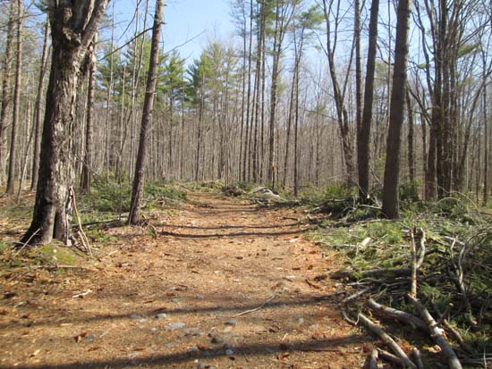
The Mt. Shaw Trail trailhead
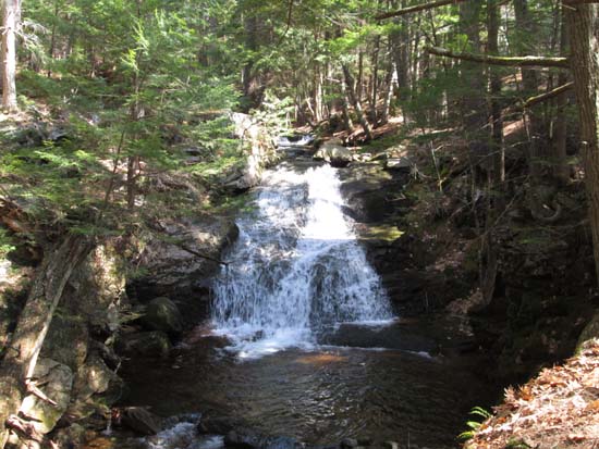
Cascades along the Mt. Shaw Trail just before the Tate Mountain Trail junction
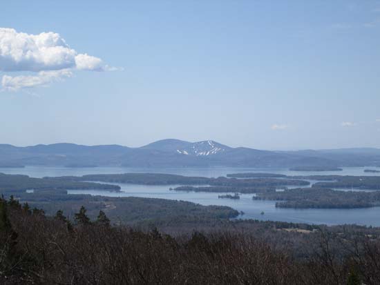
Looking at the Belknaps from the Big Ball Mountain summit
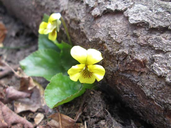
Yellow violet on the Banana Trail
Looking at Mt. Flagg from Black Snoot

The Black Snout Trail on the way to Mt. Shaw
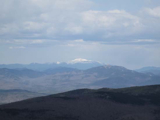
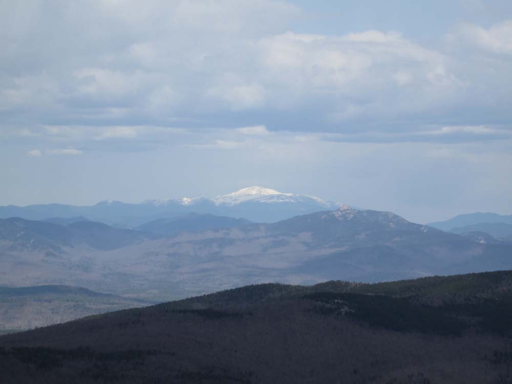
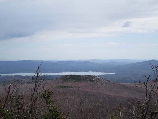
Looking Mt. Washington from Mt. Shaw
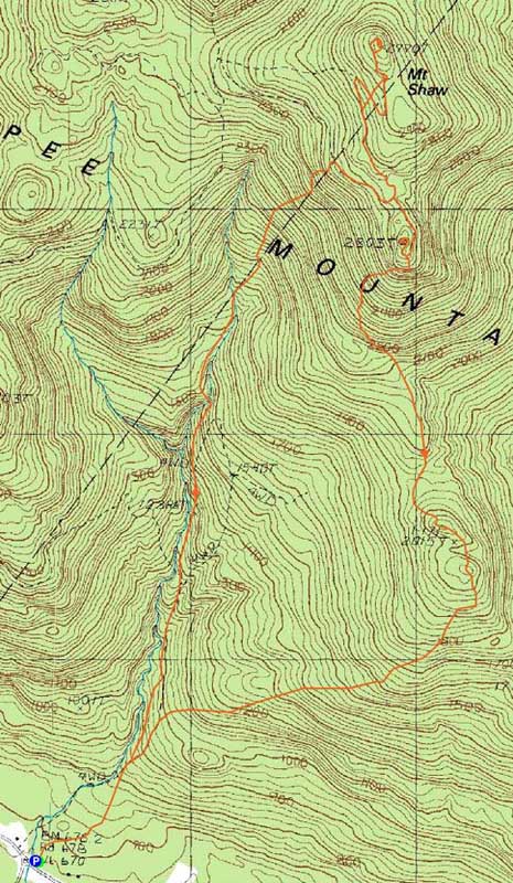

Directions to trailhead: Take 171 southeast from Route 25, past Castle in the Clouds. Shortly after crossing the Tuftonboro town line, there is a bridge/brook crossing. Immediately after this, there is an informal parking lot on the left (maybe 4 cars). The unmarked trail starts at the back of this lot.
Back to Big Ball Mountain Profile
Back to Black Snoot Profile
Back to Mt. Shaw Profile
|