Home
States
Colorado
Connecticut
Maine
Massachusetts
New Hampshire
New York
Rhode Island
Utah
Vermont
View All
Lists
NE 4,000 Footers
NE 100 Highest
NH 4,000 Footers
NH 100 Highest
NH 52 With A View
NH Belknap Range
NH Ossipee 10
Links
Trail Conditions
Trip Log
Sunrises
Sunsets
About
|
Black Cap
Conway, NH
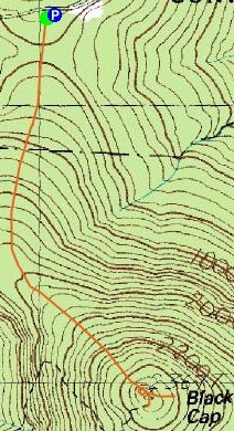
Trailheads, measurements, times, distances, and maps are all approximate and relative to the hike(s) as shown below.
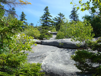
Looking up the Black Cap Trail
Route: Black Cap Trail
With visitors coming up to, well, visit, I took a half day from work and decided to take them on an easy local hike. Black Cap was my choice, due to the rocky summit, the sweeping views of NH and Maine, and the relatively easy pitch and short length.
We started at Hurricane Mountain Road - a full parking lot! I had seen very few people my last time on Black Cap, so the relative hoards of people (it wasn't really that bad, but there were definitely a few dozen people passed during the 2.6 mile walk), was a bit of a change.
The views from the summit were great - the mild temperature and mostly sunny sky allowed for great visibility in all directions.
After pointing out notable mountains and posing for some photos, we called it a day and headed back for a post-hike meal at Wendy's.
A nice day and a nice hike!
| Hike Ratings |
|
Getting To Trailhead: |
Easy |
| Destination: |
Black Cap |
|
Length: |
Easy |
|
Steepness: |
Moderate |
|
Navigation: |
Easy |
|
Views: |
Excellent |
|
Crowds: |
Heavy |
|
| Hike Stats |
|
Date Hiked: |
Wednesday, May 22, 2007 |
| Hike Commenced: |
12:40 PM |
| Parking Elevation: |
1,705' |
| Destination: |
Black Cap |
| Ascent Commenced: |
12:41 PM |
| Summit Reached: |
1:06 PM |
| Time Elapsed: |
00:25 |
| Trailhead Elevation: |
1,705' |
| Summit Elevation: |
2,369' |
| Distance: |
1.3 miles |
| Vertical Gain: |
679' |
|
|
| Hike Ended: |
1:54 PM |
| Hike Time Elapsed: |
01:14 |
| Hike Distance: |
2.6 miles |
| Hike Vertical Gain: |
734' |
|
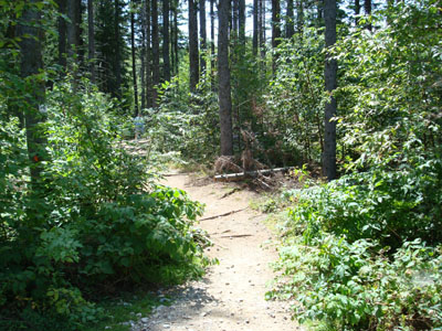
Black Cap Trail trailhead
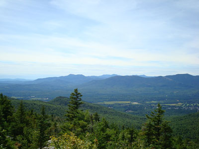
Looking west from Black Cap at Mt. Chocorua and South Moat Mountain, amongst many others

Directions to trailhead: Take Route 16 North from North Conway. Take a right onto Hurricane Mountain Road. Go past the Kearsarge North Trail trailhead, past the gate, and to the top of the mountain. Parking area and trailhead are on the right.
Back to Black Cap Profile
|

