Home
States
Colorado
Connecticut
Maine
Massachusetts
New Hampshire
New York
Rhode Island
Utah
Vermont
View All
Lists
NE 4,000 Footers
NE 100 Highest
NH 4,000 Footers
NH 100 Highest
NH 52 With A View
NH Belknap Range
NH Ossipee 10
Links
Trail Conditions
Trip Log
Sunrises
Sunsets
About
|
Black Cap
Conway, NH
Trailheads, measurements, times, distances, and maps are all approximate and relative to the hike(s) as shown below.
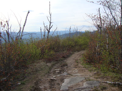
Looking down the Black Cap Connector
Route: Black Cap Trail, Black Cap Connector
With Hurricane Mountain Road open, I opted to go for a quick jog to Black Cap. For jogging, I decided to avoid the minor scrambles of the upper Black Cap Trail by taking the Black Cap Connector for the final portion of the ascent, resulting in fairly gentle grades.
Though clouds were moving into the region, the views from the summit were still quite good, as the Presidentials were still in the clear. Surprisingly, there were no bugs to contend with.
| Hike Ratings |
|
Getting To Trailhead: |
Easy |
| Destination: |
Black Cap |
|
Length: |
Easy |
|
Steepness: |
Easy |
|
Navigation: |
Easy |
|
Views: |
Excellent |
|
Crowds: |
Minimal |
|
| Hike Stats |
|
Date Hiked: |
Tuesday, May 11, 2010 |
| Hike Commenced: |
5:57 PM |
| Parking Elevation: |
1,705' |
| Destination: |
Black Cap |
| Ascent Commenced: |
5:57 PM |
| Summit Reached: |
6:13 PM |
| Time Elapsed: |
00:16 |
| Trailhead Elevation: |
1,705' |
| Summit Elevation: |
2,369' |
| Distance: |
1.3 miles |
| Vertical Gain: |
689' |
|
|
| Hike Ended: |
6:31 PM |
| Hike Time Elapsed: |
00:34 |
| Hike Distance: |
2.6 miles |
| Hike Vertical Gain: |
754' |
|
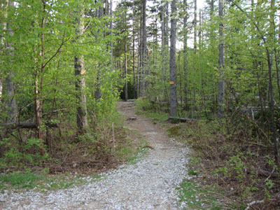
Black Cap Trail trailhead
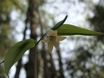
Bellwort along the Black Cap Trail
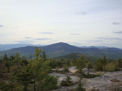
Looking at Kearsarge North Mountain from Black Cap
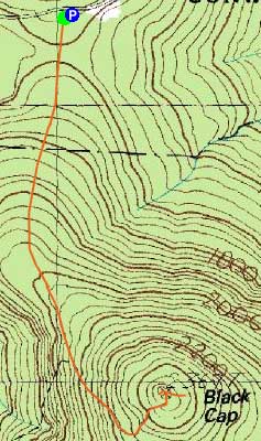

Directions to trailhead: Take Route 16 North from North Conway. Take a right onto Hurricane Mountain Road. Go past the Kearsarge North Trail trailhead, past the gate, and to the top of the mountain. Parking area and trailhead are on the right.
Back to Black Cap Profile
|

