Home
States
Colorado
Connecticut
Maine
Massachusetts
New Hampshire
New York
Rhode Island
Utah
Vermont
View All
Lists
NE 4,000 Footers
NE 100 Highest
NH 4,000 Footers
NH 100 Highest
NH 52 With A View
NH Belknap Range
NH Ossipee 10
Links
Trail Conditions
Trip Log
Sunrises
Sunsets
About
|
Black Mountain
Haverhill, NH, Benton, NH
Trailheads, measurements, times, distances, and maps are all approximate and relative to the hike(s) as shown below.

The lower Black Mountain Trail
Route: Black Mountain Trail
The first third of this trail is unsightly at the moment from logging equipment. The actual clearing did not have much visual impact on the trail (large clearcut above it, which might actually be interesting to explore). However, the trail itself was impacted, as it's a rutty, (dried at the moment) muddy walk. Trail could be easily lost at the logging landing, as it looks like one would go straight onto a skid road. The trail is actually to the left, behind a pile of debris. No blazes or markers to signal hikers, and the clearing leaves little visual memory from previous trips.
Beyond that, apart from ATV and dirt bike traffic, the trail is unaffected. Erosion continues to get worse since the dedicated volunteer trail maintainers gave up the trail due to the aforementioned wheeled traffic. Quite a few blowdowns.
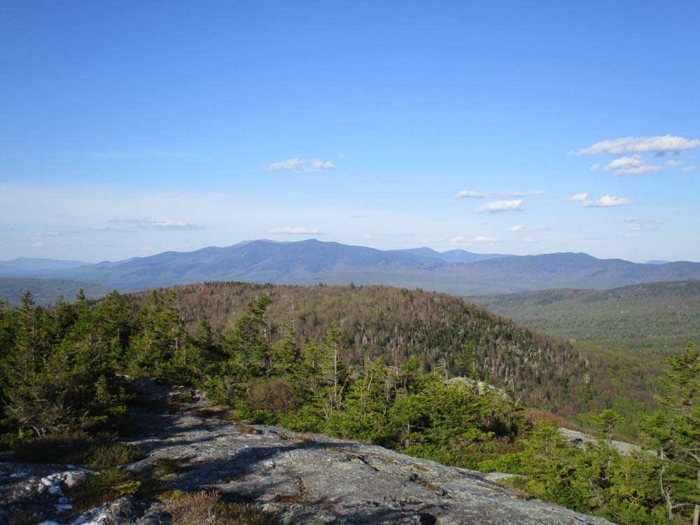
Beautiful afternoon/evening weather. Lots of wildflowers in bloom. Tremendous views.
| Hike Ratings |
|
Getting To Trailhead: |
Easy |
| Destination: |
Black Mountain |
|
Length: |
Moderate |
|
Steepness: |
Moderate |
|
Navigation: |
Easy |
|
Views: |
Excellent |
|
Crowds: |
Minimal |
|
| Hike Stats |
|
Date Hiked: |
Monday, May 21, 2018 |
| Parking Elevation: |
1,560' |
| Destination: |
Black Mountain |
| Time Elapsed: |
01:00 |
| Trailhead Elevation: |
1,560' |
| Summit Elevation: |
2,830' |
| Distance: |
2.4 miles |
| Vertical Gain: |
1,604' |
|
|
| Hike Time Elapsed: |
02:09 |
| Hike Vertical Gain: |
1,649' |
|

The Black Mountain Trail trailhead

The upper Black Mountain Trail

Looking at the Kinsman Ridge from the Black Mountain ledges
Directions to trailhead: From Route 116 in Benton, take Howe Hill Road south. The Black Mountain Trail trailhead and parking area are located just beyond the last house on the road.
Back to Black Mountain Profile
|