Home
States
Colorado
Connecticut
Maine
Massachusetts
New Hampshire
New York
Rhode Island
Utah
Vermont
View All
Lists
NE 4,000 Footers
NE 100 Highest
NH 4,000 Footers
NH 100 Highest
NH 52 With A View
NH Belknap Range
NH Ossipee 10
Links
Trail Conditions
Trip Log
Sunrises
Sunsets
About
|
Black Mountain (Middle Peak)
Jackson, NH
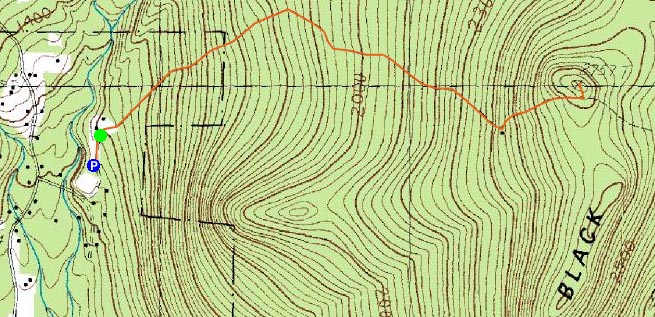
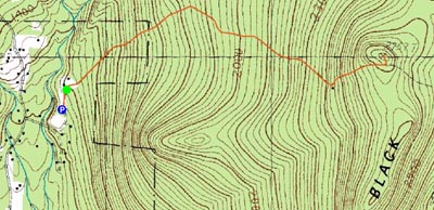
Trailheads, measurements, times, distances, and maps are all approximate and relative to the hike(s) as shown below.
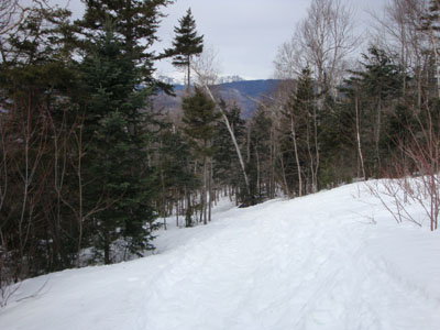
Looking down the Black Mountain Ski Trail
Route: Black Mountain Ski Trail, East Pasture XC Ski Trail, (Black Mountain Middle Peak), East Pasture XC Ski Trail, Black Mountain Ski Trail
After getting back late from a Franconia Ridge traverse and having a cloudy day forecasted, I wasn't feeling particularly ambitious. Black Mountain had been a peak I had been thinking about doing for awhile, so I figured it would be a perfect lazy day hike.
Arriving at the parking area, I barebooted to the bottom of the ski trail, then donned snowshoes. While I could have barebooted up the frozen granular trail, I chose snowshoes for a variety of reasons (rather wear than carry, foot injury, traction, etc.). The ski trail was fairly tame until steepening up a bit near the cabin.
At the cabin there were nice views of the Presidentials. Continuing to the left of the cabin, I soon reached the height of land and took a left onto the East Pasture XC Ski Trail, emerging at the summit of the middle peak of Black Mountain soon thereafter.
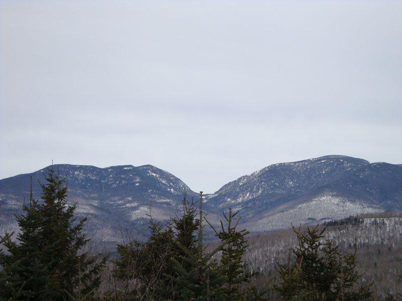
While I had expected stronger views (considering this peak replaced Carr Mountain on the 52-with-a-view list), the views were nonetheless quite good - perhaps the most striking site was the direct view of Carter Notch, with glimpses of Mt. Washington and the Baldfaces on either side.
The descent was fairly non-eventful. While things were somewhat scenic for a cloudy day, I can imagine this trail would be quite neat to check out on a nice, warm, sunny spring day.
| Hike Ratings |
|
Getting To Trailhead: |
Easy |
| Destination: |
Black Mountain (Middle Peak) |
|
Length: |
Moderate |
|
Steepness: |
Moderate |
|
Navigation: |
Easy |
|
Views: |
Excellent |
|
Crowds: |
Minimal |
|
| Hike Stats |
|
Date Hiked: |
Sunday, March 1, 2009 |
| Hike Commenced: |
10:40 AM |
| Parking Elevation: |
1,270' |
| Destination: |
Black Mountain (Middle Peak) |
| Ascent Commenced: |
10:43 AM |
| Summit Reached: |
11:31 AM |
| Time Elapsed: |
00:48 |
| Trailhead Elevation: |
1,280' |
| Summit Elevation: |
2,757' |
| Vertical Gain: |
1,487' |
|
|
| Hike Ended: |
12:17 PM |
| Hike Time Elapsed: |
01:37 |
| Hike Vertical Gain: |
1,507' |
|
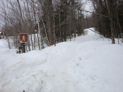
The Black Mountain Ski Trail trailhead

Looking at Carter Notch from the middle peak of Black Mountain

Directions to trailhead: Take Route 16 North to Jackson, then take a right onto 16A. Take a left onto Carter Notch Road. Head up this road for a few minutes, then take a right onto Meloon Road. Cross the bridge, bearing left at the fork in the road. Around the curve, the parking area will be on the left. Back on the road, continue on foot for a few hundred feet. The Black Mountain Ski Trail will be on the right.
Back to Black Mountain (Middle Peak) Profile
|