Home
States
Colorado
Connecticut
Maine
Massachusetts
New Hampshire
New York
Rhode Island
Utah
Vermont
View All
Lists
NE 4,000 Footers
NE 100 Highest
NH 4,000 Footers
NH 100 Highest
NH 52 With A View
NH Belknap Range
NH Ossipee 10
Links
Trail Conditions
Trip Log
Sunrises
Sunsets
About
|
Black Mountain (Middle Peak), Black Mountain
Jackson, NH
Trailheads, measurements, times, distances, and maps are all approximate and relative to the hike(s) as shown below.
The East Pasture XC Ski Trail
Route: East Pasture XC Ski Trail, summit spur, (Black Mountain Middle Peak), bushwhack, (Black Mountain), bushwhack, logging roads, Bald Land Trail, East Pasture XC Ski Trail
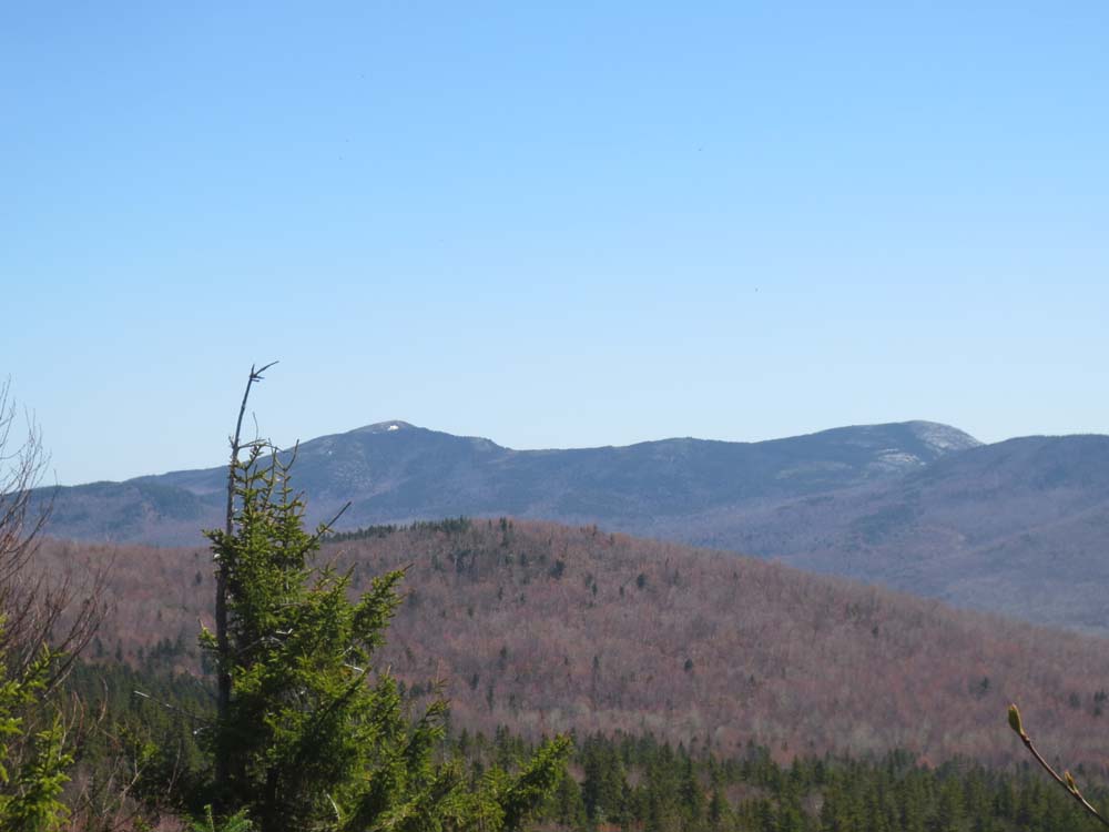
To start the hike, we took the East Pasture ski trail up to the Black Mountain peak above the cabin (2,757'). While there were a few muddy areas, as well as a few small patches of snow, it was generally smooth sailing. While the peak is near or at the bottom of the list of 52-With-A-View peaks, the views were a bit improved since my last visit. Decent directional view of Carter Notch (Presidentials also visible), as well as the Baldfaces.
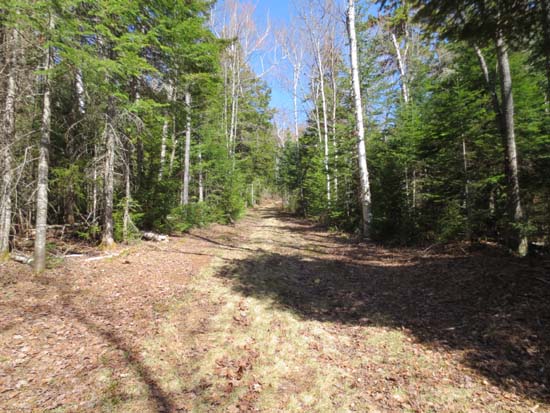
From there, we bushwhacked along the ridge, perhaps following the long-lost ridge trail in places. With the leaves down and nice weather, we were able to navigate the ridge without pulling out a compass. While there were a few areas of spruce, prickers, and blowdowns, there were also some nice stretches of open woods. There were a few patches of snow in the shade, but the ridge was generally snow free.
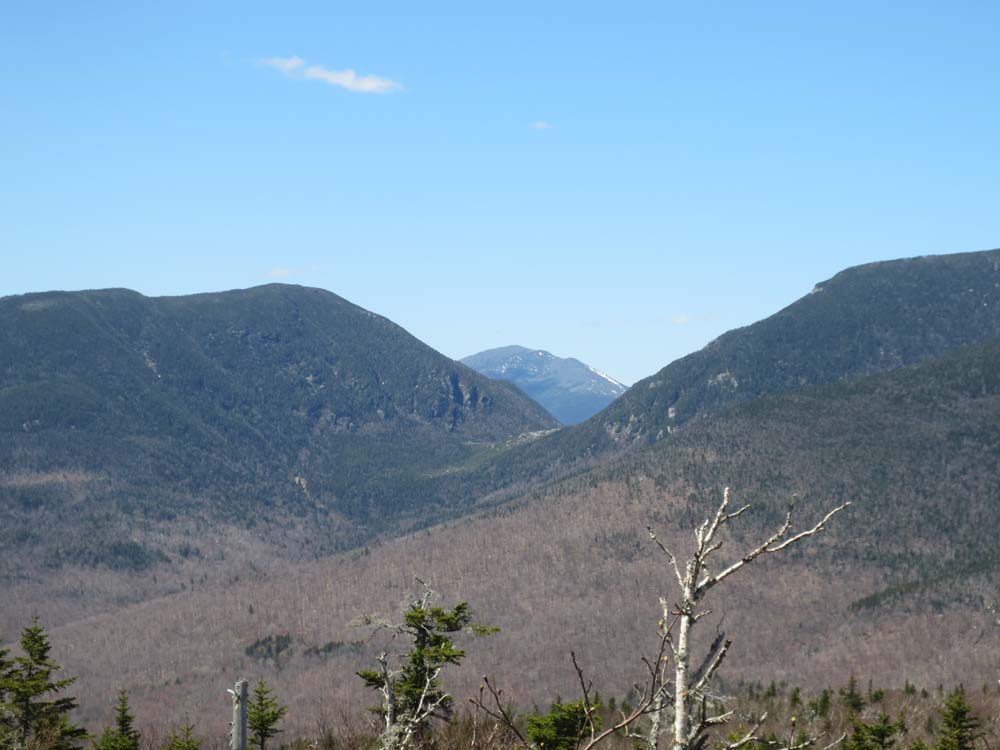
The recognized highpoint is atop a large rock in a fairly open area. One can walk around the area and get pretty much 360 degrees of views, including some great looks at Carter Notch and the Presidentials.
From there, we dropped down the eastern side (steep at first, but generally open woods) and seredipitously ran into the top of the logging road we had thought about using for the descent (the top landing stood out, as it was lined with spruce in an otherwise hardwood stand). From there, we descended via this grown in set of roads down to the logging road that shows on some of the maps (FR238B I think), which we then followed (many ups and downs, a few vague areas and a few junctions) to the Bald Lands Trail.
After a brief stop at the Scenic Vista (expecting a view there is like expecting good music at a Phil Collins concert) to look at what looks to be a route up to Doublehead, we headed back to the East Pasture Trail via th Bald Lands Trail (quite muddy in the middle section).
| Hike Ratings |
|
Getting To Trailhead: |
Easy |
| Destination: |
Black Mountain (Middle Peak) |
|
Length: |
Moderate |
|
Steepness: |
Easy |
|
Navigation: |
Easy |
|
Views: |
Excellent |
|
Crowds: |
Minimal |
| Destination: |
Black Mountain |
|
Length: |
Moderate |
|
Steepness: |
Moderate |
|
Navigation: |
Easy |
|
Views: |
Excellent |
|
Crowds: |
Minimal |
|
| Hike Stats |
|
Date Hiked: |
Sunday, May 5, 2013 |
| Parking Elevation: |
1,580' |
| Destination: |
Black Mountain (Middle Peak) |
| Time Elapsed: |
00:54 |
| Trailhead Elevation: |
1,585' |
| Summit Elevation: |
2,757' |
| Vertical Gain: |
1,212' |
| Destination: |
Black Mountain |
| Time Elapsed: |
02:27 |
| Trailhead Elevation: |
2,757' |
| Summit Elevation: |
3,304' |
| Vertical Gain: |
954' |
|
|
| Hike Time Elapsed: |
07:46 |
| Hike Vertical Gain: |
2,706' |
|
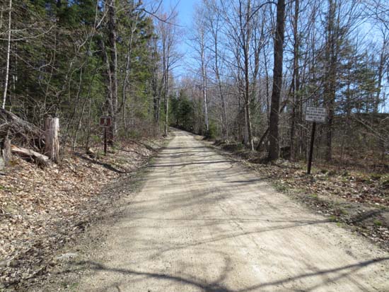
The East Pasture XC Ski Trail trailhead

Looking at the Baldfaces from the middle peak of Black Mountain
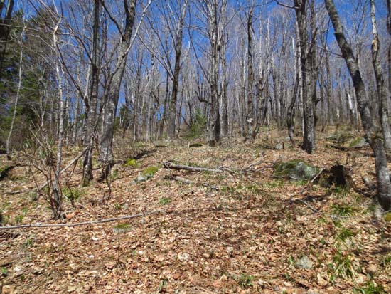
A stretch of open woods along the Black Mountain ridge

Looking at Carter Notch and Mt. Madison from near the summit of Black Mountain
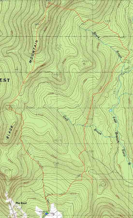

Directions to trailhead: Take Route 16 North to Jackson, then take a right onto 16A. Once downtown, take a left onto 16B, eventually passing the Black Mountain Ski Area. Shortly thereafter, bear left to continue on Black Mountain Road (where Dundee Road goes right). There is a large dirt parking area on the right at the end of the pavement (just before Windy Hill Road). The East Pasture XC Ski Trail starts as a roadwalk straight ahead.
Back to Black Mountain - Middle Peak Profile
Back to Black Mountain Profile
|