Home
States
Colorado
Connecticut
Maine
Massachusetts
New Hampshire
New York
Rhode Island
Utah
Vermont
View All
Lists
NE 4,000 Footers
NE 100 Highest
NH 4,000 Footers
NH 100 Highest
NH 52 With A View
NH Belknap Range
NH Ossipee 10
Links
Trail Conditions
Trip Log
Sunrises
Sunsets
About
|
Bog Mountain
Wilmot, NH
Trailheads, measurements, times, distances, and maps are all approximate and relative to the hike(s) as shown below.
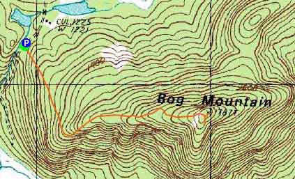
The Bog Mountain Trail
Route: Bog Mountain Trail
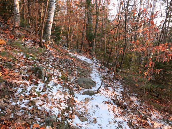
While there was a dusting/coat of snow/ice in the woods, the trail footbed was generally snow free and dry. A few minor patches of black ice and one patch of blue ice at the foot of the near-summit ledge, but easily avoided and no traction needed at this juncture.
| Hike Ratings |
|
Getting To Trailhead: |
Easy |
| Destination: |
Bog Mountain |
|
Length: |
Moderate |
|
Steepness: |
Moderate |
|
Navigation: |
Easy |
|
Views: |
Excellent |
|
Crowds: |
Minimal |
|
| Hike Stats |
|
Date Hiked: |
Friday, November 21, 2014 |
| Parking Elevation: |
1,210' |
| Destination: |
Bog Mountain |
| Time Elapsed: |
00:17 |
| Trailhead Elevation: |
1,205' |
| Summit Elevation: |
1,787' |
| Distance: |
1.1 miles |
| Vertical Gain: |
602' |
|
|
| Hike Time Elapsed: |
00:44 |
| Hike Vertical Gain: |
637' |
|
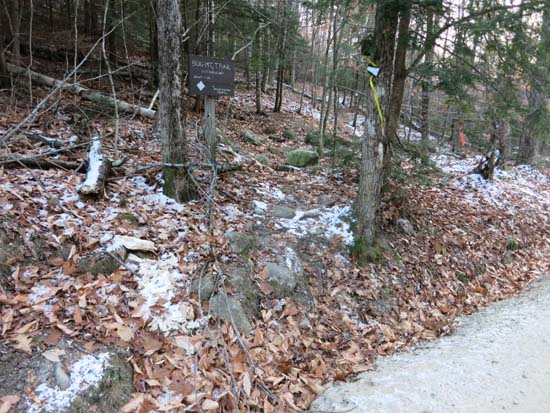
The Bog Mountain Trail trailhead on Stearns Road

Mt. Sunapee as seen from the Bog Mountain ledges

The sunset as seen from the Bog Mountain ledges

Directions to trailhead: From Wilmot, take Route 4A northwest, then take a right onto Stearns Road. Shortly after passing a boggy area, the Bog Mountain Trail trailhead will be on the right. There is a small pull off for parking on the left, just uphill from the trailhead.
Back to Bog Mountain Profile
|