Home
States
Colorado
Connecticut
Maine
Massachusetts
New Hampshire
New York
Rhode Island
Utah
Vermont
View All
Lists
NE 4,000 Footers
NE 100 Highest
NH 4,000 Footers
NH 100 Highest
NH 52 With A View
NH Belknap Range
NH Ossipee 10
Links
Trail Conditions
Trip Log
Sunrises
Sunsets
About
|
Bondcliff, Mt. Bond, Mt. Bond (West Peak), Mt. Guyot, Zealand Mountain
Lincoln, NH, Bethlehem, NH, Livermore, NH
Trailheads, measurements, times, distances, and maps are all approximate and relative to the hike(s) as shown below.
The Wilderness Trail - actually interesting for once!
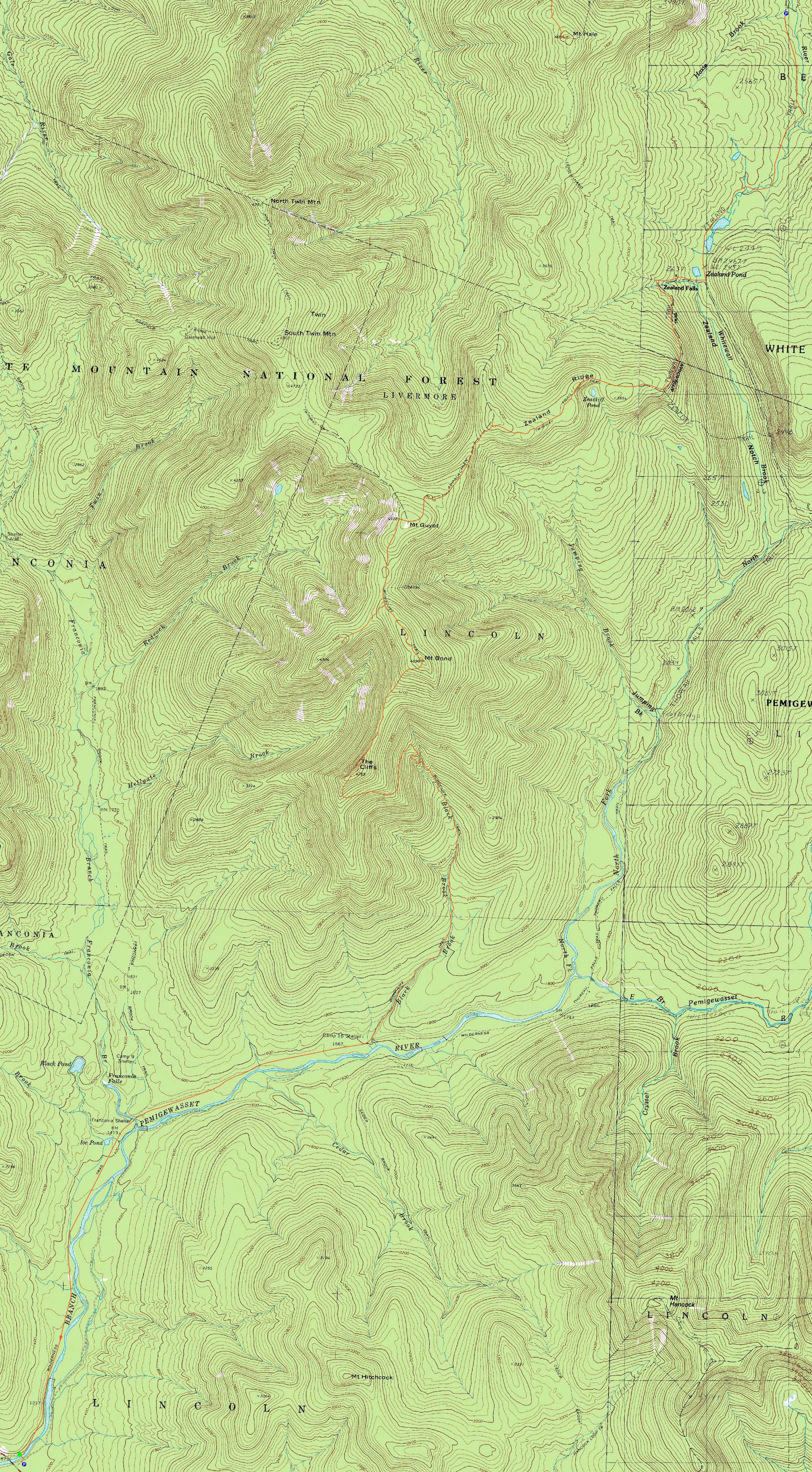
Route: Lincoln Woods Trail, Wilderness Trail, Bondcliff Trail, (Bondcliff), Bondcliff Trail, (Mt. Bond), Bondcliff Trail, West Bond Trail, (West Bond), West Bond Trail, Bondcliff Trail, Twinway, (Mt. Guyot), Twinway, spur trail, (Zealand Mountain), spur trail, Twinway, Zealand Trail
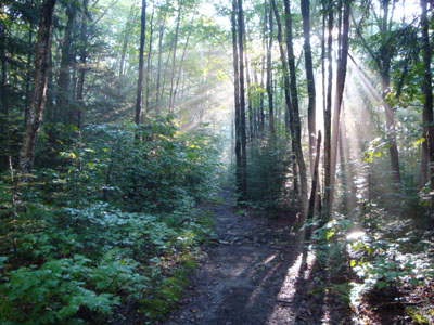
With a decent weekend day forecast, it was time to return to the Bonds. Starting at Lincoln Woods, we made decent time to the Bondcliff Trail junction. Normally very bland, the Wilderness Trail was actually a bit scenic as rays of sunlight broke through the misty air.
While the lower portion of the Bondcliff Trail was a bit muddy, the upper portion was in decent shape. Reaching Bondcliff, we had excellent views in all directions, enhanced by lush alpine zone vegetation.
The ascent up Mt. Bond was steep and rough, as usual. The views from the summit were great, as usual.
The next stop was West Bond. Upon reaching the summit, we had lunch while taking in the excellent views.
Mt. Guyot was the next stop. Taking in the unique views, a light breeze was welcome in the warm, humid weather.
Crowds started to build as we neared Zealand, as folks worked their way to campsites and huts. Though there were no views from the summit of Zealand (as usual), there were a few peeks of neighboring peaks through the trees.
From Zealand Mountain to Zealand Hut, the Twinway was well endowed with healthy vegetation, thanks to the monsoon of a July (and June). Reaching the hut, I enjoyed a few cups of decent lemonade - not the typical AMC watered down stuff!
My feet waited until the last mile of the hike to protest. A nice day for a Bonds traverse!
| Hike Ratings |
|
Getting To Trailhead: |
Easy |
| Destination: |
Bondcliff |
|
Length: |
Very Difficult |
|
Steepness: |
Difficult |
|
Navigation: |
Easy |
|
Views: |
Excellent |
|
Crowds: |
Minimal |
| Destination: |
Mt. Bond |
|
Length: |
Very Difficult |
|
Steepness: |
Difficult |
|
Navigation: |
Easy |
|
Views: |
Excellent |
|
Crowds: |
Moderate |
| Destination: |
Mt. Bond (West Peak) |
|
Length: |
Very Difficult |
|
Steepness: |
Difficult |
|
Navigation: |
Easy |
|
Views: |
Excellent |
|
Crowds: |
Moderate |
| Destination: |
Mt. Guyot |
|
Length: |
Very Difficult |
|
Steepness: |
Difficult |
|
Navigation: |
Easy |
|
Views: |
Excellent |
|
Crowds: |
Minimal |
| Destination: |
Zealand Mountain |
|
Length: |
Very Difficult |
|
Steepness: |
Difficult |
|
Navigation: |
Easy |
|
Views: |
Minimal |
|
Crowds: |
Heavy |
|
| Hike Stats |
|
Date Hiked: |
Saturday, August 1, 2009 |
| Hike Commenced: |
6:39 AM |
| Parking Elevation: |
1,170' |
| Destination: |
Bondcliff |
| Ascent Commenced: |
6:41 AM |
| Summit Reached: |
11:02 AM |
| Time Elapsed: |
04:21 |
| Trailhead Elevation: |
1,170' |
| Summit Elevation: |
4,265' |
| Distance: |
9.1 miles |
| Vertical Gain: |
3,245' |
| Destination: |
Mt. Bond |
| Ascent Commenced: |
11:22 AM |
| Summit Reached: |
12:10 PM |
| Time Elapsed: |
00:48 |
| Trailhead Elevation: |
4,265' |
| Summit Elevation: |
4,698' |
| Distance: |
1.2 miles |
| Vertical Gain: |
718' |
| Destination: |
Mt. Bond (West Peak) |
| Ascent Commenced: |
12:26 PM |
| Summit Reached: |
1:03 PM |
| Time Elapsed: |
00:37 |
| Trailhead Elevation: |
4,698' |
| Summit Elevation: |
4,540' |
| Distance: |
1 mile |
| Vertical Gain: |
420' |
| Destination: |
Mt. Guyot |
| Ascent Commenced: |
1:33 PM |
| Summit Reached: |
2:21 PM |
| Time Elapsed: |
00:48 |
| Trailhead Elevation: |
4,540' |
| Summit Elevation: |
4,580' |
| Distance: |
1.3 miles |
| Vertical Gain: |
510' |
| Destination: |
Zealand Mountain |
| Ascent Commenced: |
2:35 PM |
| Summit Reached: |
3:37 PM |
| Time Elapsed: |
01:02 |
| Trailhead Elevation: |
1,170' |
| Summit Elevation: |
4,260' |
| Vertical Gain: |
320' |
|
|
| Hike Ended: |
6:30 PM |
| Hike Time Elapsed: |
10:41 |
| Hike Vertical Gain: |
5,259' |
|
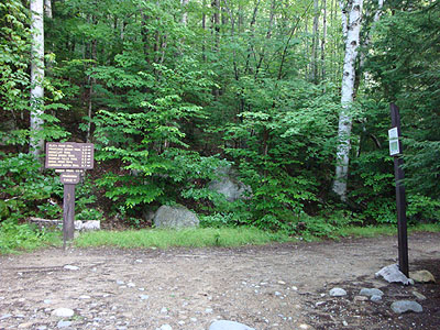
The Lincoln Woods Trail trailhead
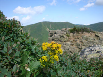
Alpine goldenrod on Bondcliff

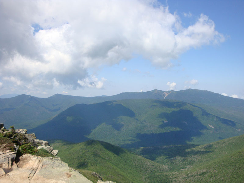
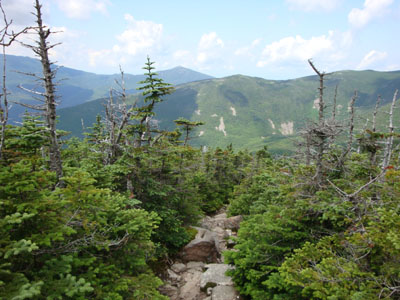
Looking at Owl's Head and the Franconia Ridge from near the Bondcliff summit
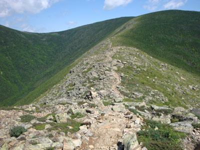
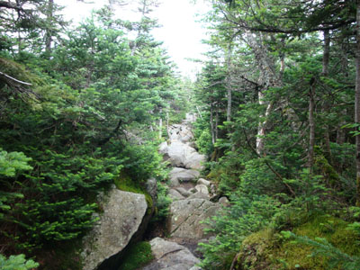
The Bondcliff Trail on the way to Mt. Bond
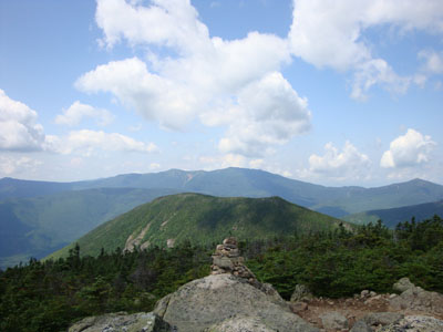
Looking at West Bond, the Franconia Ridge, and Mt. Garfield from Mt. Bond
Looking down the Bondcliff Trail on the way to West Bond

Looking at South Twin from the West Bond summit
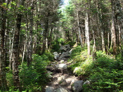
The Bondcliff Trail on the way to Mt. Guyot
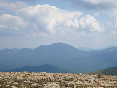
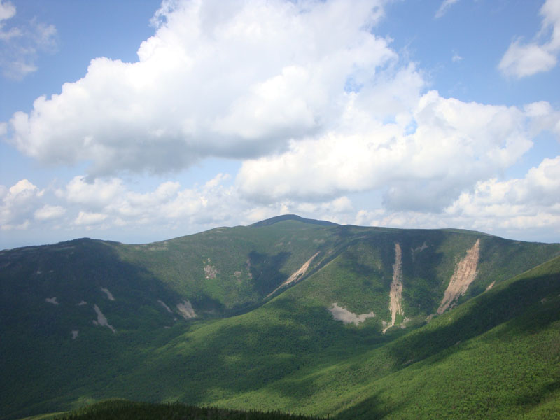
Looking at Mt. Carrigain from Mt. Guyot
The rocky Twinway on the way to Zealand Mountain
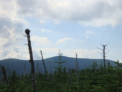
South Twin as seen from near the summit of Zealand Mountain
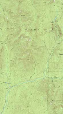

Directions to trailhead: To get to Lincoln Woods, take Route 112 East from I-93 past Loon to the Lincoln Woods WMNF fee parking area (left side of road). To get to the Zealand Trail trailhead, take US 302 west from Bartlett past Bretton Woods Ski Area. A few minutes after, take a left onto Zealand Road. The Zealand WMNF fee parking area and Zealand Trail trailhead are located at the end of the road.
Back to Bondcliff Profile
Back to Mt. Bond Profile
Back to Mt. Bond (West Peak) Profile
Back to Mt. Guyot Profile
Back to Zealand Mountain Profile
|