Home
States
Colorado
Connecticut
Maine
Massachusetts
New Hampshire
New York
Rhode Island
Utah
Vermont
View All
Lists
NE 4,000 Footers
NE 100 Highest
NH 4,000 Footers
NH 100 Highest
NH 52 With A View
NH Belknap Range
NH Ossipee 10
Links
Trail Conditions
Trip Log
Sunrises
Sunsets
About
|
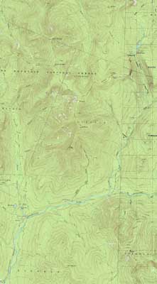
Bondcliff, Mt. Bond, Mt. Bond (West Peak), Mt. Guyot, Zealand Mountain
Lincoln, NH, Bethlehem, NH, Livermore, NH
Trailheads, measurements, times, distances, and maps are all approximate and relative to the hike(s) as shown below.
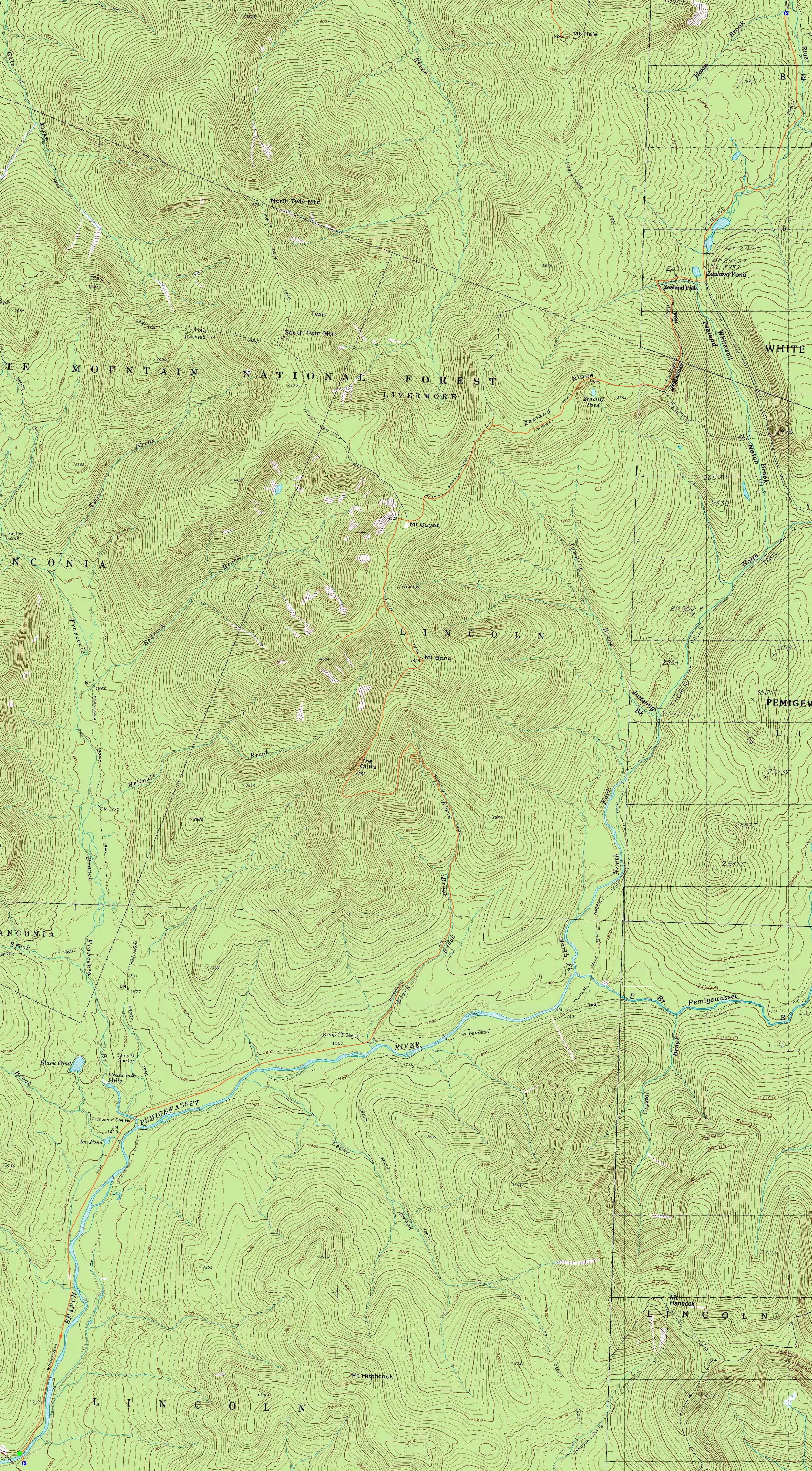
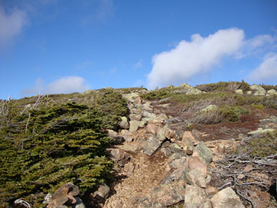
The scramble on the Bondcliff Trail near Bondcliff
Route: Lincoln Woods Trail, Wilderness Trail, Bondcliff Trail, (Bondcliff), Bondcliff Trail, (Mt. Bond), Bondcliff Trail, West Bond Trail, (West Bond), West Bond Trail, Bondcliff Trail, Twinway, (Mt. Guyot), Twinway, spur trail, (Zealand Mountain), spur trail, Twinway, Zeacliff spur trail, (Zeacliff), Zeacliff spur trail, Twinway, Zealand Trail
While the forecast was pretty bad during the week, it improved dramatically as Sunday approached. After spotting a vehicle at Zealand, we soon arrived at Lincoln Woods in mild temperatures with no precip.
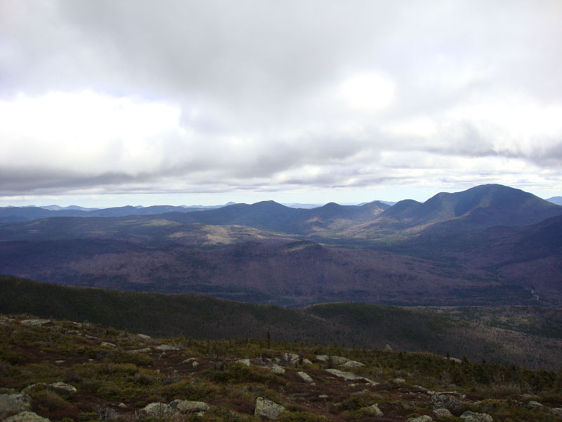
The flat railbed walk was quite boring as usual - and a bit muddy. After checking out the Black Brook Bridge which is being ridiculously removed next year, we headed up the Bondcliff Trail. Generally pretty gradual, the few short steep parts were a workout. Reaching Bondcliff, we had decent views, though things were a bit more cloudy than hoped - and windy!
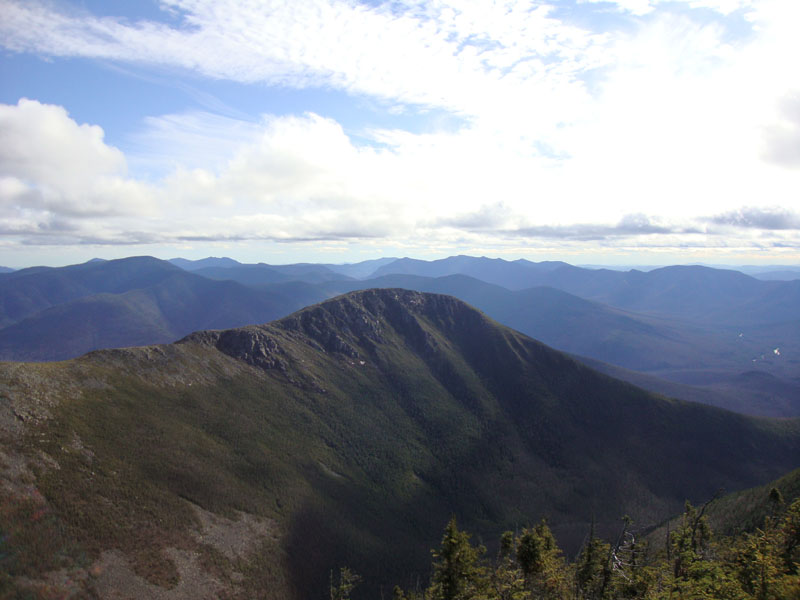
After heading across the windy ridge, we climbed up to a rime-covered Bond. The views were increasing as the day progressed. After having lunch here, we headed to West Bond and had even better views, with some neat shadows being seen on the side of Bondcliff.
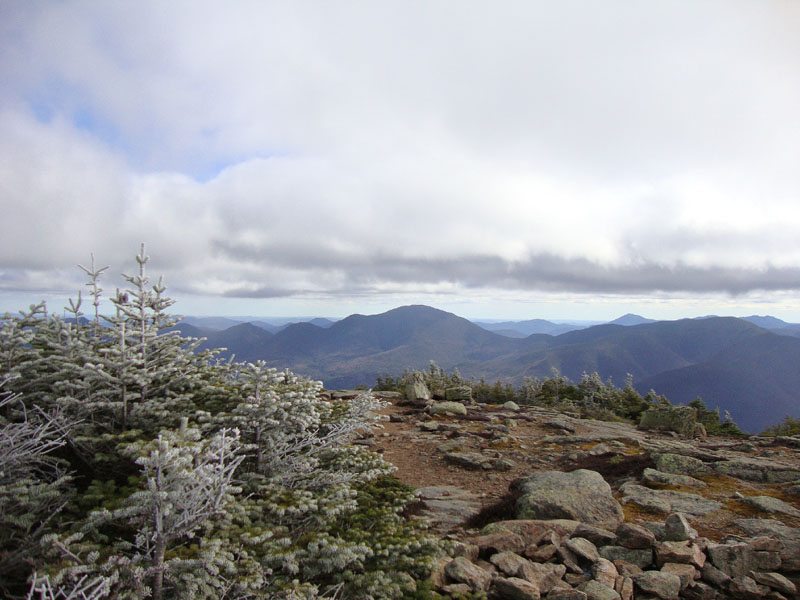
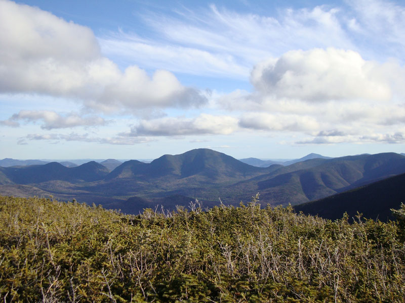
Reaching the southwest peak of Guyot, blue sky was starting to take over, resulting in even better views. Beyond Guyot, my bad knee suddenly became sore - just in time for the roughest section of trail (footing-wise) of the hike. However, after a break on the viewless Zealand Mountain summit, the pain subsided a bit.
Zeacliff provided some great views - the sun set just setting (out of view), resulting in some great cloud and horizon colors. Stubborn, we hiked to the hut without using headlamps - assisted in part by a nearly full moon.
After a hot chocolate break at the self-service-mode hut, we donned our headlamps and walked to the Zealand parking area. A nice day for a Bonds traverse!
| Hike Ratings |
|
Getting To Trailhead: |
Easy |
| Destination: |
Bondcliff |
|
Length: |
Very Difficult |
|
Steepness: |
Difficult |
|
Navigation: |
Easy |
|
Views: |
Excellent |
|
Crowds: |
Minimal |
| Destination: |
Mt. Bond |
|
Length: |
Very Difficult |
|
Steepness: |
Difficult |
|
Navigation: |
Easy |
|
Views: |
Excellent |
|
Crowds: |
Minimal |
| Destination: |
Mt. Bond (West Peak) |
|
Length: |
Very Difficult |
|
Steepness: |
Difficult |
|
Navigation: |
Easy |
|
Views: |
Excellent |
|
Crowds: |
Moderate |
| Destination: |
Mt. Guyot |
|
Length: |
Very Difficult |
|
Steepness: |
Difficult |
|
Navigation: |
Easy |
|
Views: |
Excellent |
|
Crowds: |
Minimal |
| Destination: |
Zealand Mountain |
|
Length: |
Very Difficult |
|
Steepness: |
Difficult |
|
Navigation: |
Easy |
|
Views: |
Minimal |
|
Crowds: |
Moderate |
|
| Hike Stats |
|
Date Hiked: |
Sunday, November 1, 2009 |
| Hike Commenced: |
6:45 AM |
| Parking Elevation: |
1,170' |
| Destination: |
Bondcliff |
| Ascent Commenced: |
6:47 AM |
| Summit Reached: |
11:21 AM |
| Time Elapsed: |
04:34 |
| Trailhead Elevation: |
1,170' |
| Summit Elevation: |
4,265' |
| Distance: |
9.1 miles |
| Vertical Gain: |
3,245' |
| Destination: |
Mt. Bond |
| Ascent Commenced: |
11:30 AM |
| Summit Reached: |
12:23 PM |
| Time Elapsed: |
00:53 |
| Trailhead Elevation: |
4,265' |
| Summit Elevation: |
4,698' |
| Distance: |
1.2 miles |
| Vertical Gain: |
718' |
| Destination: |
Mt. Bond (West Peak) |
| Ascent Commenced: |
12:42 PM |
| Summit Reached: |
1:22 PM |
| Time Elapsed: |
00:40 |
| Trailhead Elevation: |
4,698' |
| Summit Elevation: |
4,540' |
| Distance: |
1 mile |
| Vertical Gain: |
420' |
| Destination: |
Mt. Guyot |
| Ascent Commenced: |
1:32 PM |
| Summit Reached: |
2:25 PM |
| Time Elapsed: |
00:53 |
| Trailhead Elevation: |
4,540' |
| Summit Elevation: |
4,580' |
| Distance: |
1.3 miles |
| Vertical Gain: |
510' |
| Destination: |
Zealand Mountain |
| Ascent Commenced: |
2:27 PM |
| Summit Reached: |
3:09 PM |
| Time Elapsed: |
00:42 |
| Trailhead Elevation: |
1,170' |
| Summit Elevation: |
4,260' |
| Vertical Gain: |
320' |
|
|
| Hike Ended: |
6:50 PM |
| Hike Time Elapsed: |
12:05 |
| Hike Vertical Gain: |
5,273' |
|
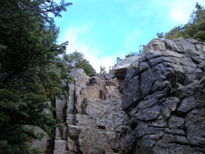
The Lincoln Woods Trail trailhead
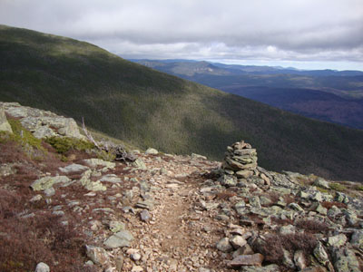
Looking at Mt. Carrigain from near the Bondcliff summit
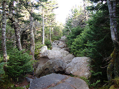
The Bondcliff Trail on the way to Mt. Bond
Looking at Mt. Carrigain and Mt. Hancock from Mt. Bond
Looking down the Bondcliff Trail on the way to West Bond
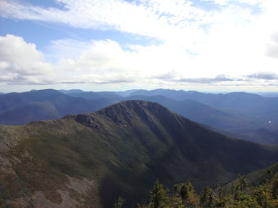
Looking at Bondcliff from the West Bond summit
The Bondcliff Trail on the way to Mt. Guyot

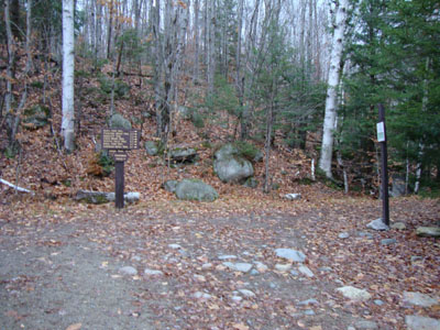
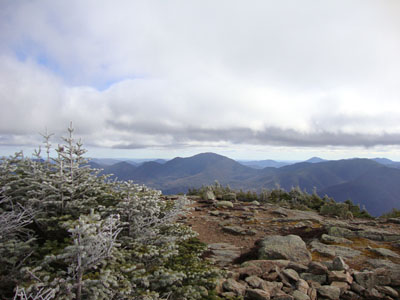
Looking at Mt. Carrigain from Mt. Guyot
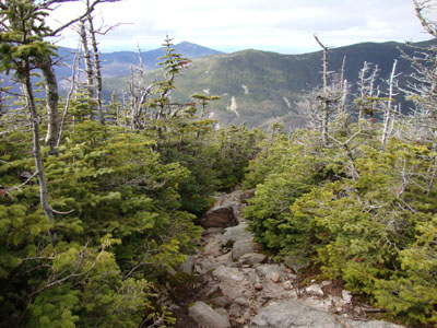
The rocky Twinway on the way to Zealand Mountain
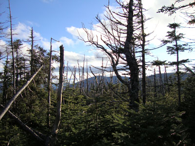
The lack of views from near the summit of Zealand Mountain
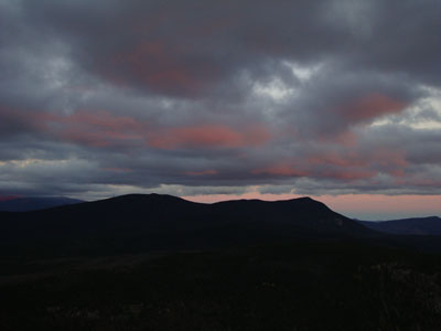
Sunset colors over Mt. Field and Mt. Willey as seen from Zeacliff

Directions to trailhead: To get to Lincoln Woods, take Route 112 East from I-93 past Loon to the Lincoln Woods WMNF fee parking area (left side of road). To get to the Zealand Trail trailhead, take US 302 west from Bartlett past Bretton Woods Ski Area. A few minutes after, take a left onto Zealand Road. The Zealand WMNF fee parking area and Zealand Trail trailhead are located at the end of the road.
Back to Bondcliff Profile
Back to Mt. Bond Profile
Back to Mt. Bond (West Peak) Profile
Back to Mt. Guyot Profile
Back to Zealand Mountain Profile
|