Home
States
Colorado
Connecticut
Maine
Massachusetts
New Hampshire
New York
Rhode Island
Utah
Vermont
View All
Lists
NE 4,000 Footers
NE 100 Highest
NH 4,000 Footers
NH 100 Highest
NH 52 With A View
NH Belknap Range
NH Ossipee 10
Links
Trail Conditions
Trip Log
Sunrises
Sunsets
About
|
Bondcliff, Mt. Bond, Mt. Bond (West Peak), Mt. Guyot, Zealand Mountain
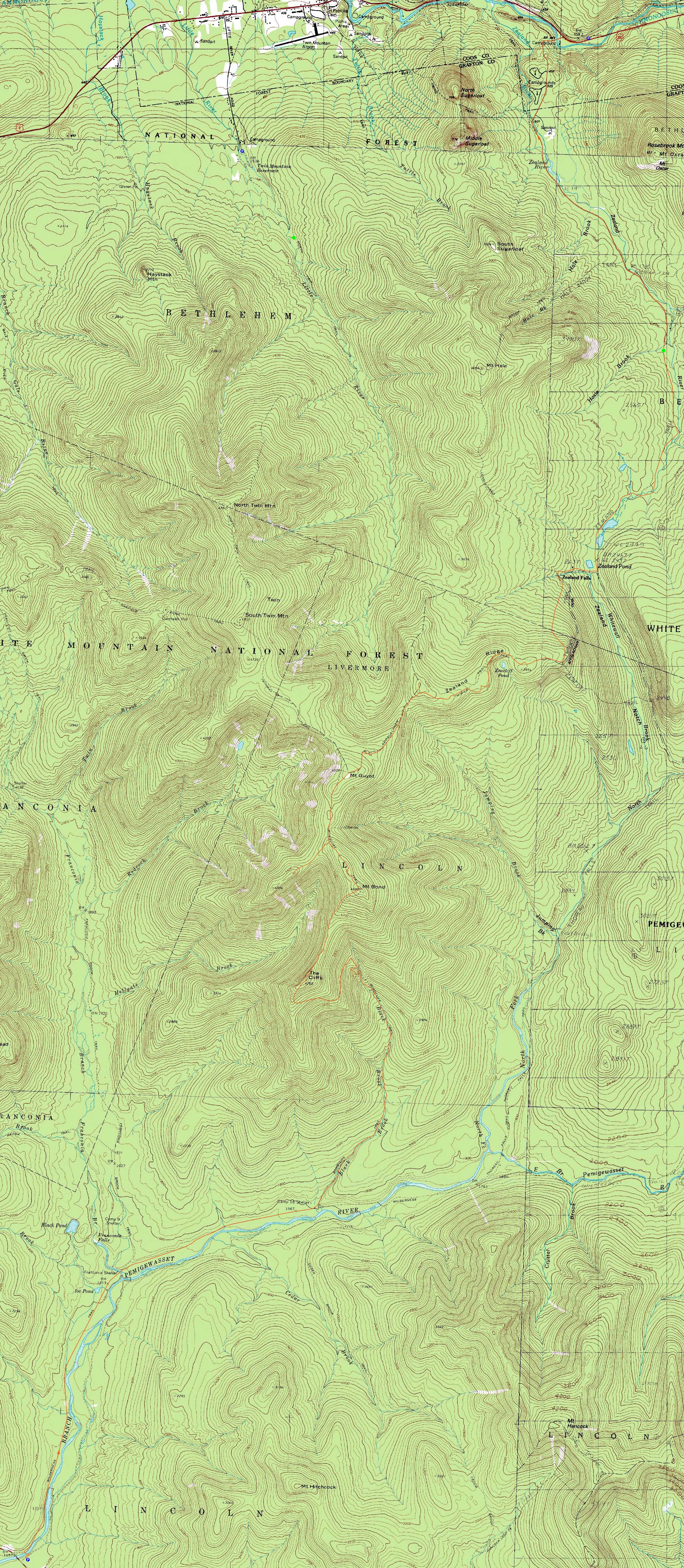
Lincoln, NH, Bethlehem, NH, Livermore, NH
Trailheads, measurements, times, distances, and maps are all approximate and relative to the hike(s) as shown below.
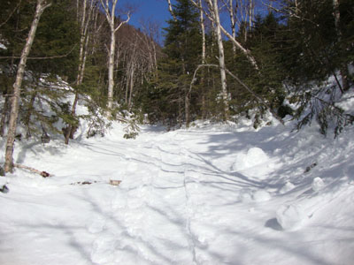
Looking up the Black Brook bed on the way to Bondcliff
Route: Lincoln Woods Trail, Wilderness Trail, Bondcliff Trail, brookbed, Bondcliff Trail, (Bondcliff), Bondcliff Trail, bushwhack, (Mt. Bond), Bondcliff Trail, West Bond Trail, (West Bond), West Bond Trail, Bondcliff Trail, snowfield, (Mt. Guyot), Twinway, bushwhack, (Zealand Mountain), bushwhack, Twinway, Zealand Trail, Zealand Road,
The last day of a string of great weather days, it was time for a Bonds traverse.
Starting at Lincoln Woods, we made decent time up the Lincoln Woods and Wilderness Trails. Our progress slowed on the Bondcliff Trail, due to all sorts of blowdowns and leaners. While the first two water crossings were only partially bridged, the Black Brook was solid above those. As a result, the broken out route hopped onto the snowcovered Black Brook from crossing three to crossing four - a welcome relief from the blowdowns and tree branches.
Back into the spruce, it was slow going until we emerged from the trees - the ledge scramble was gone without a trace!
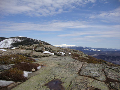
The views from Bondcliff were quite good, though we could see some dark clouds approaching from the south.
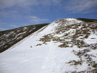
Our next stop was Mt. Bond. While the trail was followed across the ridge, the packed out route above the ridge was a treetop bushwhack. The summit of Mt. Bond sported 360 degree views, thanks to the snowpack - amazing.
From Bond to West Bond, the trail was almost unrecognizable, as the treetops were often at our knees. The West Bond Spur sign was at the snowline.
Eventually reaching West Bond, we once again and great views, though the south continued to darken.
The trail had not been heavily travelled at all from the spur junction to Guyot - a single set of tracks beyond the campsite. Since these tracks meandered, we opted to break out the trail proper to treeline. From the south peak to the highpoint, did a direct line across snowfields, cutting off the drop to the Twinway junction. Like Mt. Bond, the highpoint of Mt. Guyot (as compared to the south peak) had 360 degree views, thanks to the snowpack.
It was rough going between Guyot and Zealand, as the broken out route wandered around numerous blowdowns. Nearing the height of land, we opted to walk out on the treetops, then cut 20 feet into the scrub and the summit line (literally at snowline - some 6 feet of snow). Views could be found in all directions from near the highpoint.
Beyond Zealand, we opted to follow the single set of snowshoe tracks, as we knew these had come from the hut. This proved to be a mistake, as they meandered all over the place, resulting in added distance and vertical. Nearing the Zeacliff ridge, we opted to bail off this track and bushwhack straight to the spur junction area.
Now after sunset, we hustled down to the hut, took a quick break, put on our headlamps, and walked out on the Zealand Trail and then Zealand Road (plowed, but not open). A long day, but superb views nonetheless!
| Hike Ratings |
|
Getting To Trailhead: |
Easy |
| Destination: |
Bondcliff |
|
Length: |
Very Difficult |
|
Steepness: |
Moderate |
|
Navigation: |
Difficult |
|
Views: |
Excellent |
|
Crowds: |
Minimal |
| Destination: |
Mt. Bond |
|
Length: |
Very Difficult |
|
Steepness: |
Moderate |
|
Navigation: |
Difficult |
|
Views: |
Excellent |
|
Crowds: |
Minimal |
| Destination: |
Mt. Bond (West Peak) |
|
Length: |
Very Difficult |
|
Steepness: |
Difficult |
|
Navigation: |
Easy |
|
Views: |
Excellent |
|
Crowds: |
Minimal |
| Destination: |
Mt. Guyot |
|
Length: |
Very Difficult |
|
Steepness: |
Difficult |
|
Navigation: |
Difficult |
|
Views: |
Excellent |
|
Crowds: |
Minimal |
| Destination: |
Zealand Mountain |
|
Length: |
Very Difficult |
|
Steepness: |
Difficult |
|
Navigation: |
Difficult |
|
Views: |
Excellent |
|
Crowds: |
Minimal |
|
| Hike Stats |
|
Date Hiked: |
Thursday, March 11, 2010 |
| Hike Commenced: |
7:18 AM |
| Parking Elevation: |
1,170' |
| Destination: |
Bondcliff |
| Ascent Commenced: |
7:23 AM |
| Summit Reached: |
11:37 AM |
| Time Elapsed: |
04:14 |
| Trailhead Elevation: |
1,170' |
| Summit Elevation: |
4,265' |
| Distance: |
9.1 miles |
| Vertical Gain: |
3,235' |
| Destination: |
Mt. Bond |
| Ascent Commenced: |
11:49 AM |
| Summit Reached: |
12:34 PM |
| Time Elapsed: |
00:45 |
| Trailhead Elevation: |
4,265' |
| Summit Elevation: |
4,698' |
| Distance: |
1.2 miles |
| Vertical Gain: |
718' |
| Destination: |
Mt. Bond (West Peak) |
| Ascent Commenced: |
12:53 PM |
| Summit Reached: |
1:37 PM |
| Time Elapsed: |
00:44 |
| Trailhead Elevation: |
4,698' |
| Summit Elevation: |
4,540' |
| Distance: |
1 mile |
| Vertical Gain: |
420' |
| Destination: |
Mt. Guyot |
| Ascent Commenced: |
1:45 PM |
| Summit Reached: |
2:42 PM |
| Time Elapsed: |
00:57 |
| Trailhead Elevation: |
4,540' |
| Summit Elevation: |
4,580' |
| Vertical Gain: |
490' |
| Destination: |
Zealand Mountain |
| Ascent Commenced: |
2:44 PM |
| Summit Reached: |
3:44 PM |
| Time Elapsed: |
01:00 |
| Trailhead Elevation: |
1,170' |
| Summit Elevation: |
4,260' |
| Vertical Gain: |
320' |
|
|
| Hike Ended: |
8:45 PM |
| Hike Time Elapsed: |
13:27 |
| Hike Vertical Gain: |
5,520' |
|
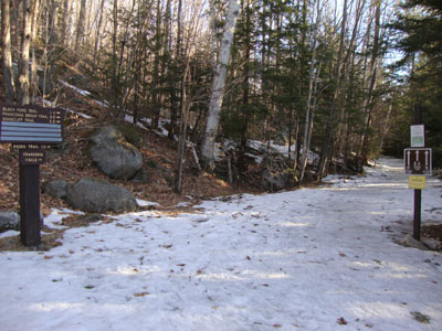
The Lincoln Woods Trail trailhead
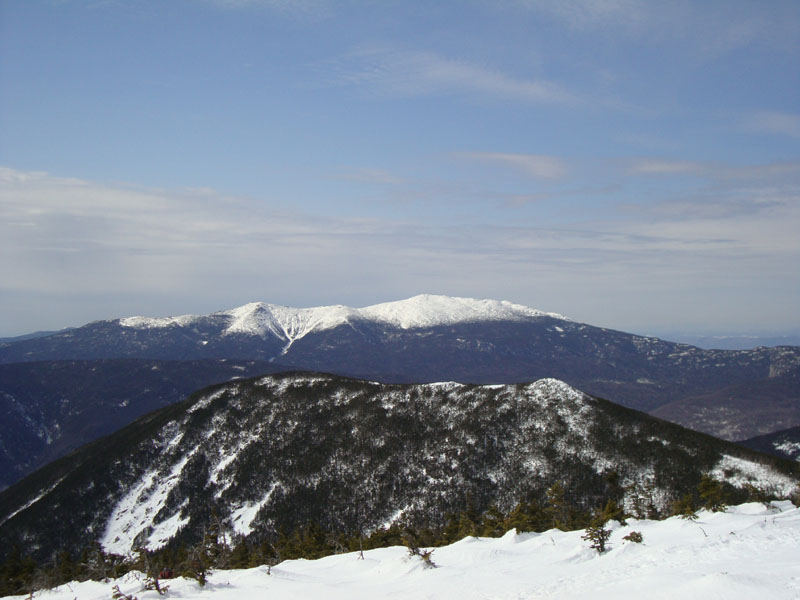
Mt. Bond and Mt. Washington as seen from Bondcliff
Looking up the Bondcliff Trail on the way to Mt. Bond
West Bond and the Franconia Ridge as seen from Mt. Bond
Looking down the Bondcliff Trail on the way to West Bond
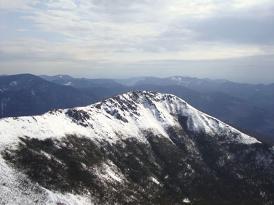
Looking at Bondcliff from West Bond
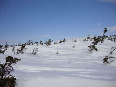
The snowfields between the peaks of Mt. Guyot
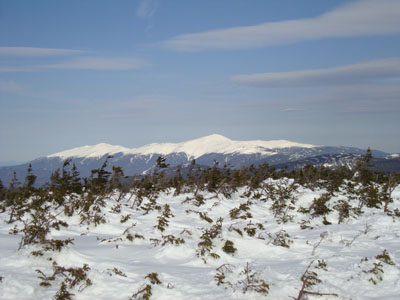
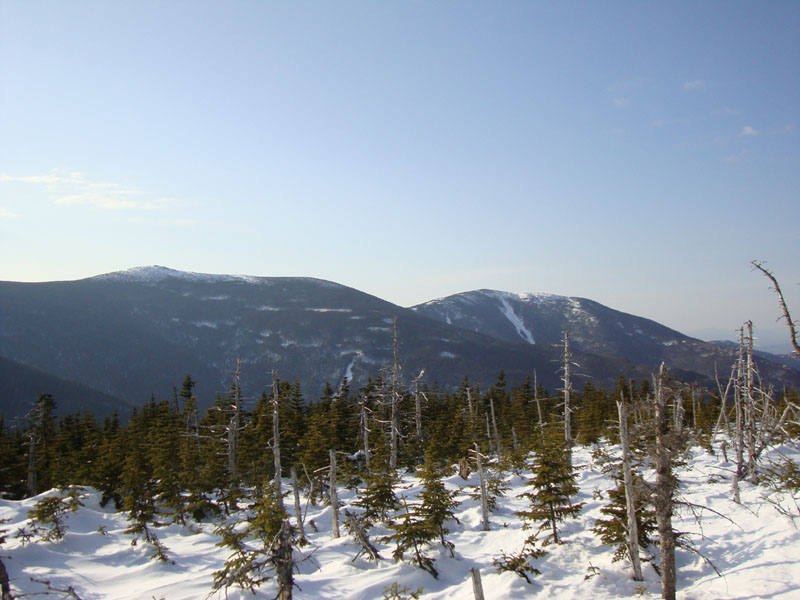
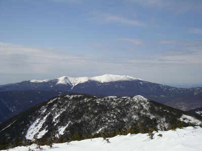
Mt. Washington as seen from Mt. Guyot
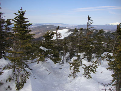
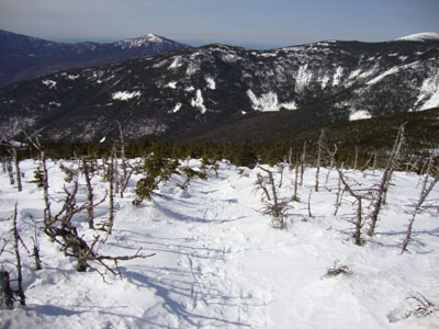
The Twinway on the way to Zealand Mountain

The Twins as seen from Zealand Mountain

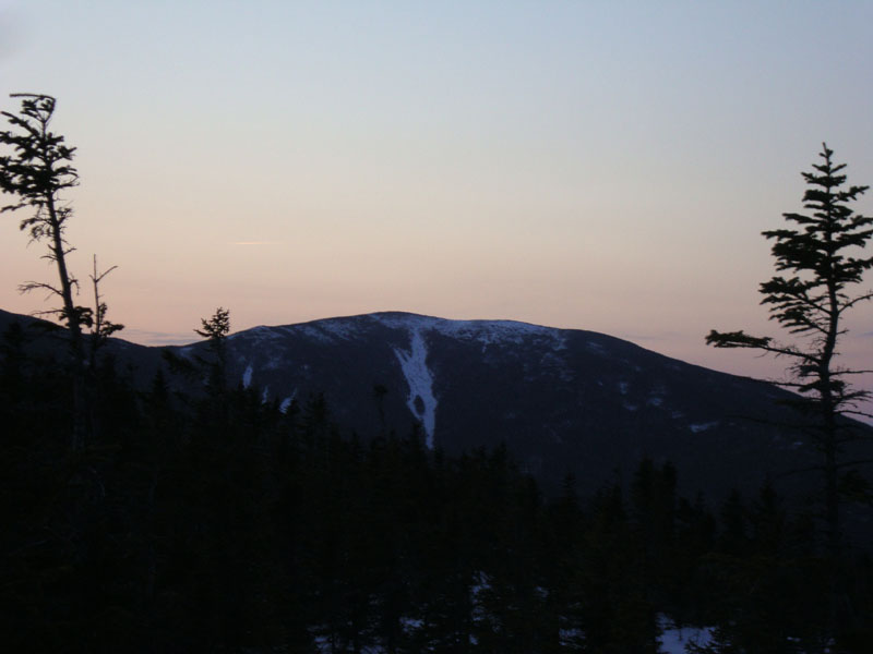
Sunset colors as seen from the Zealand Ridge

Directions to trailhead: To get to Lincoln Woods, take Route 112 East from I-93 past Loon to the Lincoln Woods WMNF fee parking area (left side of road). To get to the Zealand parking area in winter (Zealand Road is closed), take US 302 west from Bartlett past Bretton Woods Ski Area. A few minutes after, the Zealand parking lot will be on the right. Zealand Road (gated) is on the left, around the corner.
Back to Bondcliff Profile
Back to Mt. Bond Profile
Back to Mt. Bond (West Peak) Profile
Back to Mt. Guyot Profile
Back to Zealand Mountain Profile
|