Home
States
Colorado
Connecticut
Maine
Massachusetts
New Hampshire
New York
Rhode Island
Utah
Vermont
View All
Lists
NE 4,000 Footers
NE 100 Highest
NH 4,000 Footers
NH 100 Highest
NH 52 With A View
NH Belknap Range
NH Ossipee 10
Links
Trail Conditions
Trip Log
Sunrises
Sunsets
About
|
Bondcliff, Mt. Bond, Mt. Bond (West Peak), Mt. Guyot, Zealand Mountain
Lincoln, NH, Bethlehem, NH, Livermore, NH
Trailheads, measurements, times, distances, and maps are all approximate and relative to the hike(s) as shown below.
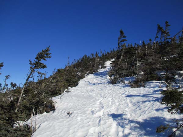
Looking up the Bondcliff Trail
Route: Lincoln Woods Trail, Wilderness Trail, Bondcliff Trail, (Bondcliff), Bondcliff Trail, (Mt. Bond), Bondcliff Trail, West Bond Trail, (West Bond), West Bond Trail, Bondcliff Trail, Twinway, (Mt. Guyot), Twinway, spur trail, (Zealand Mountain), spur trail, Twinway, Zealand Trail, Zealand Road
Lincoln Woods Trail was an uneven, frozen mess from all of the barebooting. We found snowshoes helped keep our ankles in better shape. Bondcliff Trail (aka Wilderness Trail) was much smoother. We kept our snowshoes on, but others were able to Microspike the flats without issue. Maybe 12-18 inches of snowpack.
Ascent on Bondcliff Trail had some areas of running water from the blowouts and erosion. There was also an extended stretch of moose postholes. Some were able Microspike at least the lower half as far as we could tell without too much issue. Above the top water crossing, snowshoes seemed necessary due to the deep snowpack and drifted over (then frozen over) footbed. Pretty decent snowshoeing at this point. Snowpack of perhaps 3 feet.
Snowpack crust is firm enough to support snowshoes pretty much everywhere at elevation. Ideal time to bushwhack. Barebooters will break through, however, and go in deeply.
Hillary's Stumble was doable in snowshoes, as the bottom is filling in and one could sort of traverse around the blue ice on it. Snowshoes helpful in the scrub above there, as lots of spruce traps threatened.
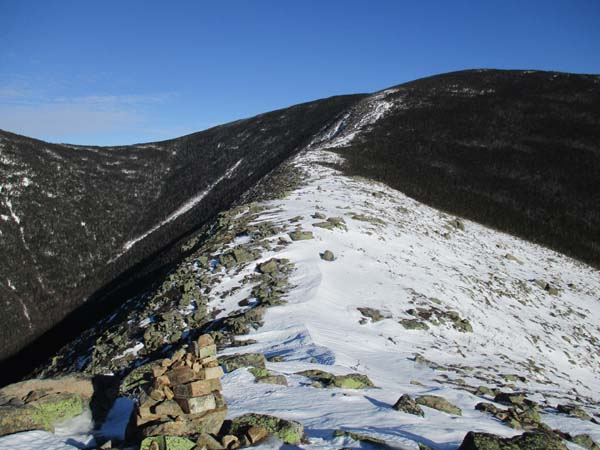
Treeline to Bondcliff was a combination of firm snow, blue ice, and bare rock. We kept our snowshoes on, as the blue ice could have been iffy for Microspikes in a few places on either end of the summit.
Heading across the ridge, there's a good cornice much of the way, which we took instead of the trail since it was smooth sailing. A little spruce trappy when it ran out and we needed to get back to the corridor. From there up to Bond, the snow depth increased and it was fairly decent going.
Bond is windloaded on the northeast side...found a very deep spruce trap when looking at the improved views the drifts provided. From the summit down to the shelter is perhaps 4 feet of snowpack with deeper drifts.
West Bond Spur was a little bit awkward, as it had appeared to have been used between the rain events this week. Fortunately the hiker wore snowshoes, so the snowshoe postholes weren't as deep or dangerous as the barebooted alternative.
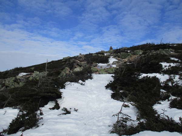
The south face of South Guyot is fairly bare with some ice and frozen granular on the actual trail. Plenty of snow on the back side, but some ice on the ascent up to the true summit as well. Other than a a short stretch up Bond, this was about the only place we felt a breeze the whole day.
Plenty of snow between Guyot and Zealand. Areas of awkward snowshoe postholes. Some deep drifts have set up in places as well, including alongside the Zealand Spur.
Ladder above Zeacliff Pond as a little tricky to descend, but some snow alongside it provided purchase.
Steep descent to the hut is hardpack.
Zealand Trail is a postholed mess in places, courtesy the postholing brigades.
Upper 2.5 miles of Zealand Road are also rough. A vehicle was driven up to the water department area, so to some extend the tracks provided better walking. We opted to boot at this point.
The bottom mile of Zealand Road is glare blue ice. We kept to the side of it, where there was some snow.
The short snowmobile trail section from the end of the road to the US 302 parking lot was also quite icy.
Overall, despite the postholes, this was pretty darned good going as far as winter Bonds traverses go. We started at 6 and were done at 4. No trail breaking, no showstopping ice, etc. Nice blue skies for the first half as well.
| Hike Ratings |
|
Getting To Trailhead: |
Easy |
| Destination: |
Bondcliff |
|
Length: |
Very Difficult |
|
Steepness: |
Difficult |
|
Navigation: |
Easy |
|
Views: |
Excellent |
|
Crowds: |
Moderate |
| Destination: |
Mt. Bond |
|
Length: |
Very Difficult |
|
Steepness: |
Difficult |
|
Navigation: |
Moderate |
|
Views: |
Excellent |
|
Crowds: |
Minimal |
| Destination: |
Mt. Bond (West Peak) |
|
Length: |
Very Difficult |
|
Steepness: |
Difficult |
|
Navigation: |
Easy |
|
Views: |
Excellent |
|
Crowds: |
Minimal |
| Destination: |
Mt. Guyot |
|
Length: |
Very Difficult |
|
Steepness: |
Difficult |
|
Navigation: |
Moderate |
|
Views: |
Excellent |
|
Crowds: |
Minimal |
| Destination: |
Zealand Mountain |
|
Length: |
Very Difficult |
|
Steepness: |
Difficult |
|
Navigation: |
Easy |
|
Views: |
Minimal |
|
Crowds: |
Minimal |
|
| Hike Stats |
|
Date Hiked: |
Saturday, January 14, 2017 |
| Parking Elevation: |
1,170' |
| Destination: |
Bondcliff |
| Time Elapsed: |
03:55 |
| Trailhead Elevation: |
1,170' |
| Summit Elevation: |
4,265' |
| Distance: |
9.1 miles |
| Vertical Gain: |
3,245' |
| Destination: |
Mt. Bond |
| Time Elapsed: |
00:39 |
| Trailhead Elevation: |
4,265' |
| Summit Elevation: |
4,698' |
| Distance: |
1.2 miles |
| Vertical Gain: |
718' |
| Destination: |
Mt. Bond (West Peak) |
| Time Elapsed: |
00:29 |
| Trailhead Elevation: |
4,698' |
| Summit Elevation: |
4,540' |
| Distance: |
1 mile |
| Vertical Gain: |
420' |
| Destination: |
Mt. Guyot |
| Time Elapsed: |
00:47 |
| Trailhead Elevation: |
4,540' |
| Summit Elevation: |
4,580' |
| Distance: |
1.3 miles |
| Vertical Gain: |
510' |
| Destination: |
Zealand Mountain |
| Time Elapsed: |
00:35 |
| Trailhead Elevation: |
1,170' |
| Summit Elevation: |
4,260' |
| Vertical Gain: |
320' |
|
|
| Hike Time Elapsed: |
10:06 |
| Hike Vertical Gain: |
5,373' |
|
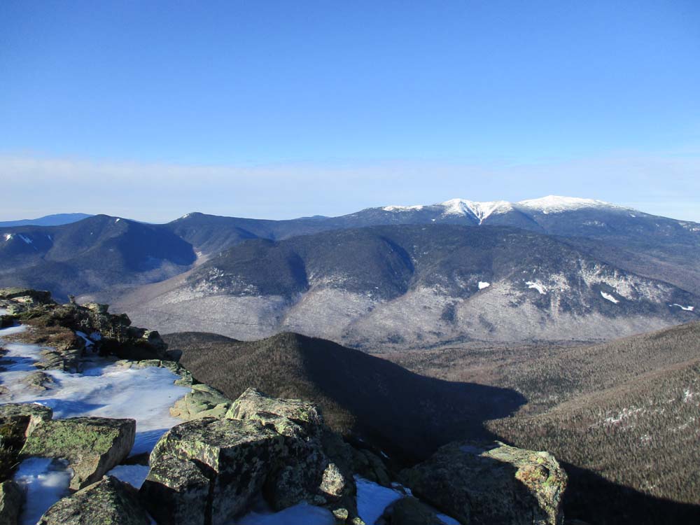
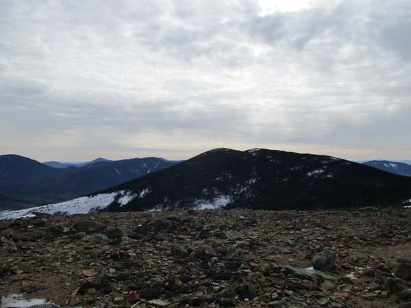
Franconia Ridge as seen from Bondcliff
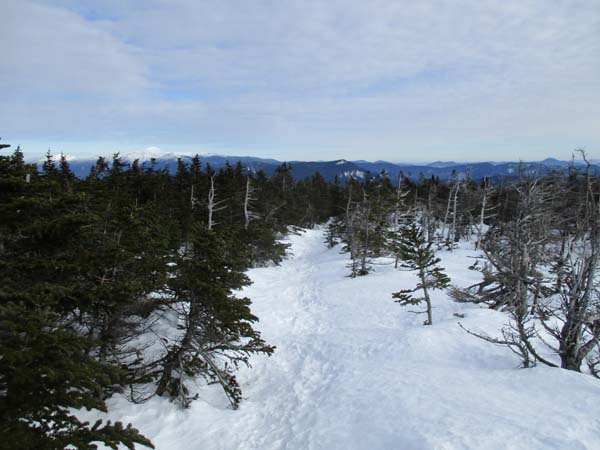
The Bondcliff Trail on the way to Mt. Bond

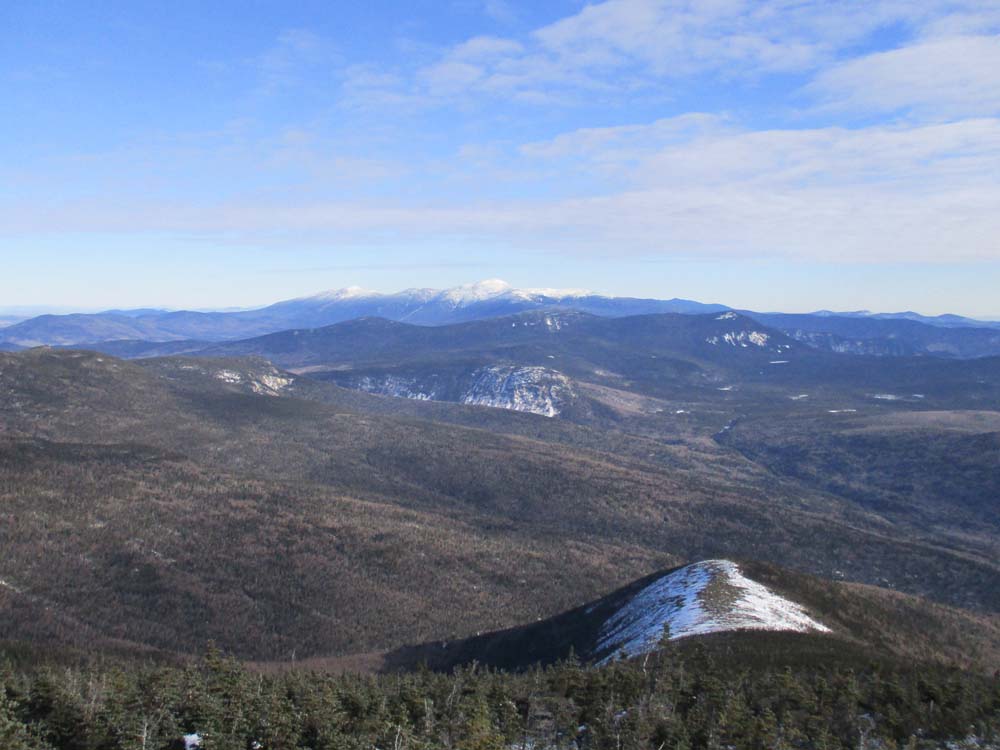
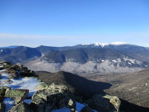
Looking at Mt. Washington from Mt. Bond
The Bondcliff Trail on the way to West Bond

Mt. Garfield as seen from West Bond
The Bondcliff Trail on the way to Mt. Guyot
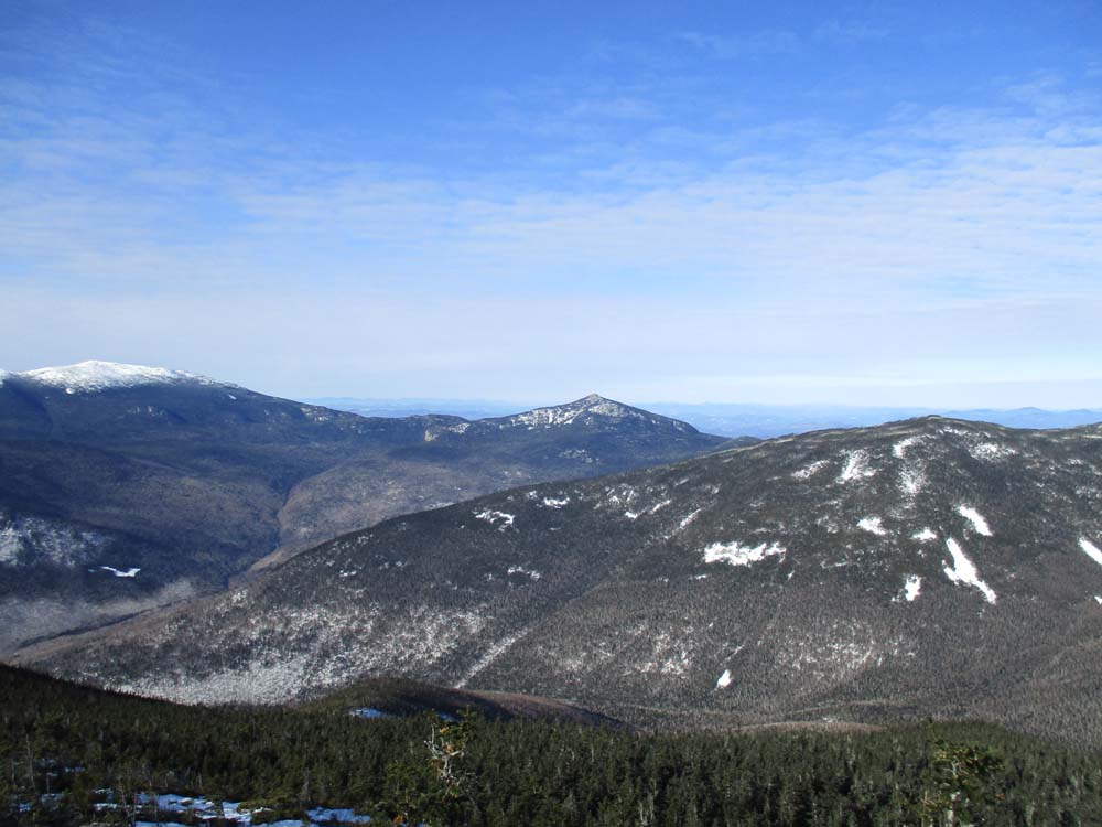
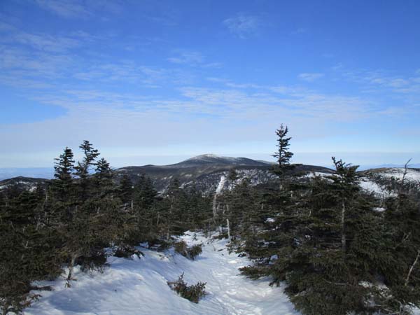
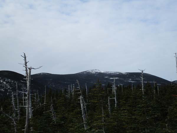
Mt. Bond as seen from Mt. Guyot
The Twinway on the way to Zealand Mountain
South Twin as seen from near the summit of Zealand Mountain
Directions to trailhead: To get to Lincoln Woods, take Route 112 East from I-93 past Loon to the Lincoln Woods WMNF fee parking area (left side of road). To get to the Zealand parking area in winter (Zealand Road is closed), take US 302 west from Bartlett past Bretton Woods Ski Area. A few minutes after, the Zealand parking lot will be on the right. Zealand Road (gated) is on the left, around the corner.
Back to Bondcliff Profile
Back to Mt. Bond Profile
Back to Mt. Bond (West Peak) Profile
Back to Mt. Guyot Profile
Back to Zealand Mountain Profile
|