Home
States
Colorado
Connecticut
Maine
Massachusetts
New Hampshire
New York
Rhode Island
Utah
Vermont
View All
Lists
NE 4,000 Footers
NE 100 Highest
NH 4,000 Footers
NH 100 Highest
NH 52 With A View
NH Belknap Range
NH Ossipee 10
Links
Trail Conditions
Trip Log
Sunrises
Sunsets
About
|
Bondcliff, Mt. Bond, Mt. Bond (West Peak), Mt. Guyot, Zealand Mountain
Lincoln, NH, Bethlehem, NH, Livermore, NH
Trailheads, measurements, times, distances, and maps are all approximate and relative to the hike(s) as shown below.
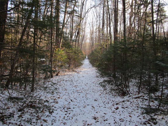
The lower Bondcliff Trail
Route: Lincoln Woods Trail, Bondcliff Trail, (Bondcliff), Bondcliff Trail, (Mt. Bond), Bondcliff Trail, West Bond Trail, (West Bond), West Bond Trail, Bondcliff Trail, Twinway, (Mt. Guyot), Twinway, spur trail, (Zealand Mountain), spur trail, Twinway, Zealand Trail
Generally 1-3" of snow throughout, with the exception of some drifting up on the ridge. I barebooted the entire hike, but others found it to be decent Microspiking north of Bond. I only briefly considered putting spikes on for the rocky stretch below the hut, but otherwise never thought about putting them on. Considering the ground is not frozen, some of the packed snow could turn to ice, so it would be a good idea to carry them anyway. Not enough snow yet to think about snowshoes, but one storm could change that.
Trails were generally snow covered throughout, with the exception of some perks and some rocky areas. No issues with Hillary Stumble below Bondcliff (could wipe off the powder). Trickiest part of the day was ascending Bond, as the powder was obscuring the crevasses and rocks. Only drifting of significance was around Guyot, where it was a foot or so deep. Otherwise, the snowpack was pretty steadily 1-3" deep. The floating bog bridges near the Zeacliff Spur are currently frozen in place, so not an issue. Some mud melting through in some places on the Twinway and Zealand Trail. Hut is on caretaker basis now.
Nice weather with blue skies and not much wind (just a little bit above Hellgate on the Bondcliff ridge). Plenty of folks out, but not too busy.
| Hike Ratings |
|
Getting To Trailhead: |
Easy |
| Destination: |
Bondcliff |
|
Length: |
Very Difficult |
|
Steepness: |
Difficult |
|
Navigation: |
Easy |
|
Views: |
Excellent |
|
Crowds: |
Moderate |
| Destination: |
Mt. Bond |
|
Length: |
Very Difficult |
|
Steepness: |
Difficult |
|
Navigation: |
Easy |
|
Views: |
Excellent |
|
Crowds: |
Heavy |
| Destination: |
Mt. Bond (West Peak) |
|
Length: |
Very Difficult |
|
Steepness: |
Difficult |
|
Navigation: |
Easy |
|
Views: |
Excellent |
|
Crowds: |
Heavy |
| Destination: |
Mt. Guyot |
|
Length: |
Very Difficult |
|
Steepness: |
Difficult |
|
Navigation: |
Easy |
|
Views: |
Excellent |
|
Crowds: |
Heavy |
| Destination: |
Zealand Mountain |
|
Length: |
Very Difficult |
|
Steepness: |
Difficult |
|
Navigation: |
Easy |
|
Views: |
Minimal |
|
Crowds: |
Heavy |
|
| Hike Stats |
|
Date Hiked: |
Saturday, November 9, 2019 |
| Parking Elevation: |
1,170' |
| Destination: |
Bondcliff |
| Time Elapsed: |
03:59 |
| Trailhead Elevation: |
1,170' |
| Summit Elevation: |
4,265' |
| Distance: |
9.1 miles |
| Vertical Gain: |
3,245' |
| Destination: |
Mt. Bond |
| Time Elapsed: |
00:44 |
| Trailhead Elevation: |
4,265' |
| Summit Elevation: |
4,698' |
| Distance: |
1.2 miles |
| Vertical Gain: |
718' |
| Destination: |
Mt. Bond (West Peak) |
| Time Elapsed: |
00:36 |
| Trailhead Elevation: |
4,698' |
| Summit Elevation: |
4,540' |
| Distance: |
1 mile |
| Vertical Gain: |
420' |
| Destination: |
Mt. Guyot |
| Time Elapsed: |
00:52 |
| Trailhead Elevation: |
4,540' |
| Summit Elevation: |
4,580' |
| Distance: |
1.3 miles |
| Vertical Gain: |
510' |
| Destination: |
Zealand Mountain |
| Time Elapsed: |
00:47 |
| Trailhead Elevation: |
1,170' |
| Summit Elevation: |
4,260' |
| Vertical Gain: |
320' |
|
|
| Hike Time Elapsed: |
10:11 |
| Hike Vertical Gain: |
5,259' |
|
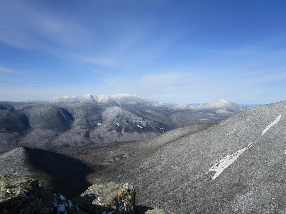
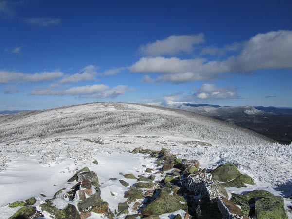
Looking at the Franconia Ridge from Bondcliff
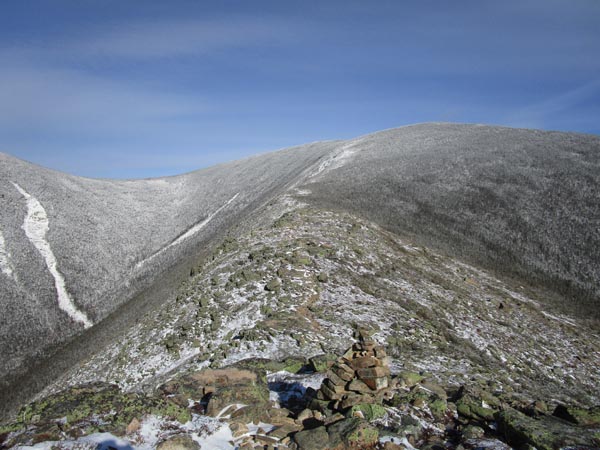
The Bondcliff Trail on the way to Mt. Bond
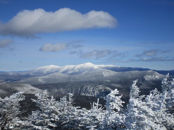
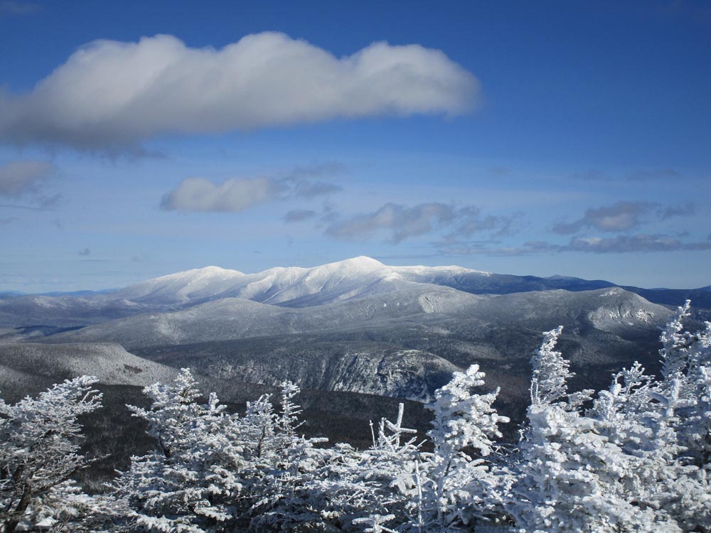
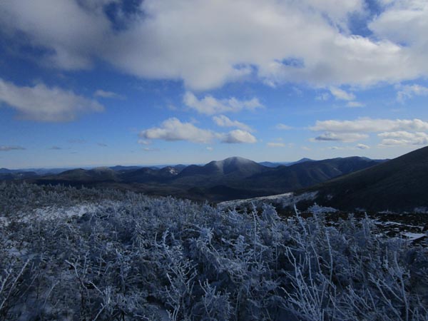
Looking at Mt. Washington from Mt. Bond
Looking down the Bondcliff Trail on the way to West Bond
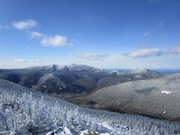
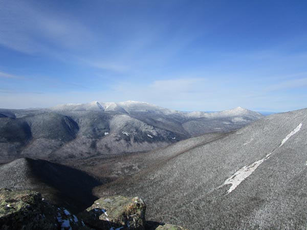
Looking at the Franconia Ridge and Mt. Garfield from West Bond
The Bondcliff Trail on the way to Mt. Guyot
Looking at Mt. Carrigain from Mt. Guyot
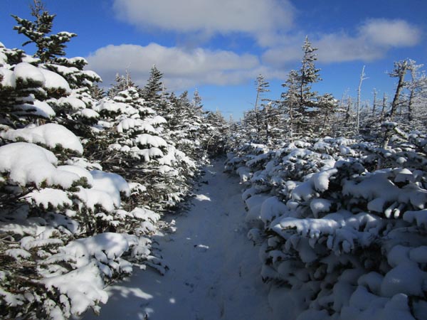
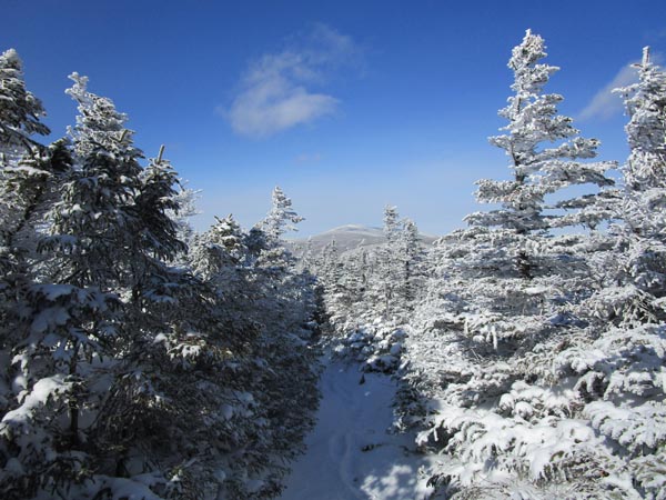
The Twinway on the way to Zealand Mountain
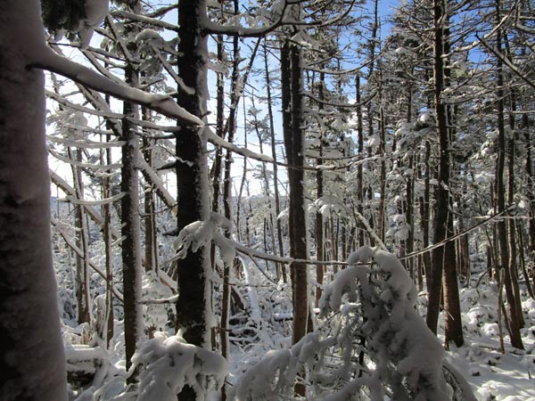
A lack of views from the summit of Zealand Mountain
Directions to trailhead: To get to Lincoln Woods, take Route 112 East from I-93 past Loon to the Lincoln Woods WMNF fee parking area (left side of road). To get to the Zealand Trail trailhead, take US 302 west from Bartlett past Bretton Woods Ski Area. A few minutes after, take a left onto Zealand Road. The Zealand WMNF fee parking area and Zealand Trail trailhead are located at the end of the road.
Back to Bondcliff Profile
Back to Mt. Bond Profile
Back to Mt. Bond (West Peak) Profile
Back to Mt. Guyot Profile
Back to Zealand Mountain Profile
|