Home
States
Colorado
Connecticut
Maine
Massachusetts
New Hampshire
New York
Rhode Island
Utah
Vermont
View All
Lists
NE 4,000 Footers
NE 100 Highest
NH 4,000 Footers
NH 100 Highest
NH 52 With A View
NH Belknap Range
NH Ossipee 10
Links
Trail Conditions
Trip Log
Sunrises
Sunsets
About
|
Boott Spur, Mt. Washington
Pinkham's Grant, NH, Sargent's Purchase, NH
Trailheads, measurements, times, distances, and maps are all approximate and relative to the hike(s) as shown below.
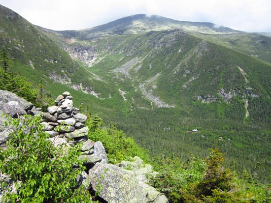
Looking down the Boott Spur Link
Route: Tuckerman Ravine Trail, Huntington Ravine Trail, Raymond Path, Tuckerman Ravine Trail, Boott Spur Link, Boott Spur Trail, Davis Path, Lawn Cutoff, Tuckerman Ravine Trail, Alpine Garden Trail, Lion Head Trail, Tuckerman Ravine Trail, Nelson Crag Trail, Old Jackson Road, Tuckerman Ravine Trail
Lots of trail segments combining into one loop. Still some snow visible in the ravine, but not skiable (undermined). Nelson Crag was rough to descend.
| Hike Ratings |
|
Getting To Trailhead: |
Easy |
| Destination: |
Boott Spur |
|
Length: |
Moderate |
|
Steepness: |
Very Difficult |
|
Navigation: |
Easy |
|
Views: |
Moderate (due to weather) |
|
Crowds: |
Moderate |
| Destination: |
Mt. Washington |
|
Length: |
Difficult |
|
Steepness: |
Difficult |
|
Navigation: |
Moderate |
|
Views: |
Minimal (due to weather) |
|
Crowds: |
Heavy |
|
| Hike Stats |
|
Date Hiked: |
Sunday, June 17, 2012 |
| Parking Elevation: |
2,025' |
| Destination: |
Boott Spur |
| Time Elapsed: |
03:18 |
| Trailhead Elevation: |
2,032' |
| Summit Elevation: |
5,500' |
| Vertical Gain: |
3,725' |
| Destination: |
Mt. Washington |
| Time Elapsed: |
01:28 |
| Trailhead Elevation: |
5,500' |
| Summit Elevation: |
6,288' |
| Vertical Gain: |
1,488' |
|
|
| Hike Time Elapsed: |
08:53 |
| Hike Vertical Gain: |
5,613' |
|
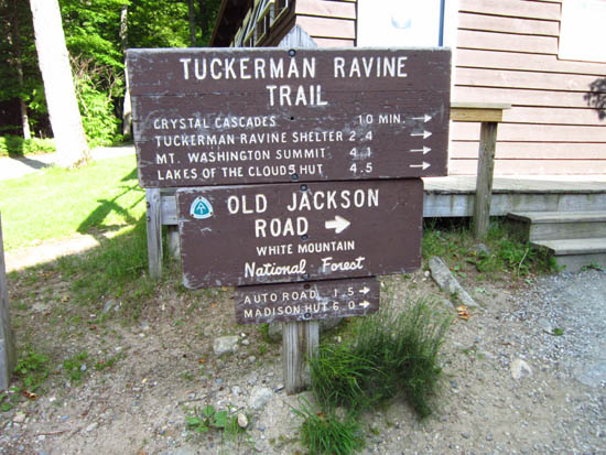
The Tuckerman Ravine Trail trailhead
Looking up the Boott Spur Link
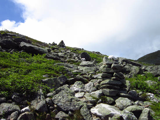
Looking at Wildcat from near the summit of Boott Spur

The Alpine Garden Trail on the way to Mt. Washington

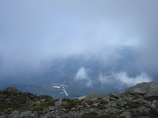
Looking down the Nelson Crag Trail from near the summit of Mt. Washington
Directions to trailhead: Take Route 16 North from Jackson to Pinkham Notch. The Pinkham Notch Visitor Center, parking lots, and Tuckerman Ravine Trail trailhead are on the left, shortly before Wildcat Ski Area.
Back to Boott Spur Profile
Back to Mt. Washington Profile
|


