Home
States
Colorado
Connecticut
Maine
Massachusetts
New Hampshire
New York
Rhode Island
Utah
Vermont
View All
Lists
NE 4,000 Footers
NE 100 Highest
NH 4,000 Footers
NH 100 Highest
NH 52 With A View
NH Belknap Range
NH Ossipee 10
Links
Trail Conditions
Trip Log
Sunrises
Sunsets
About
|
Carter Dome
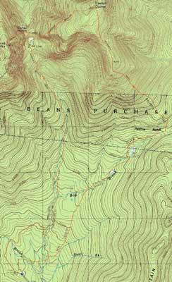
Jackson, NH, Bean's Purchase, NH
Trailheads, measurements, times, distances, and maps are all approximate and relative to the hike(s) as shown below.
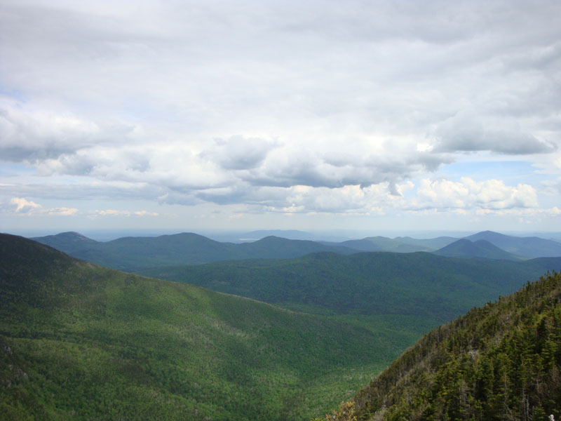
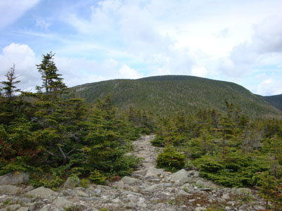
Looking up Rainbow Trail
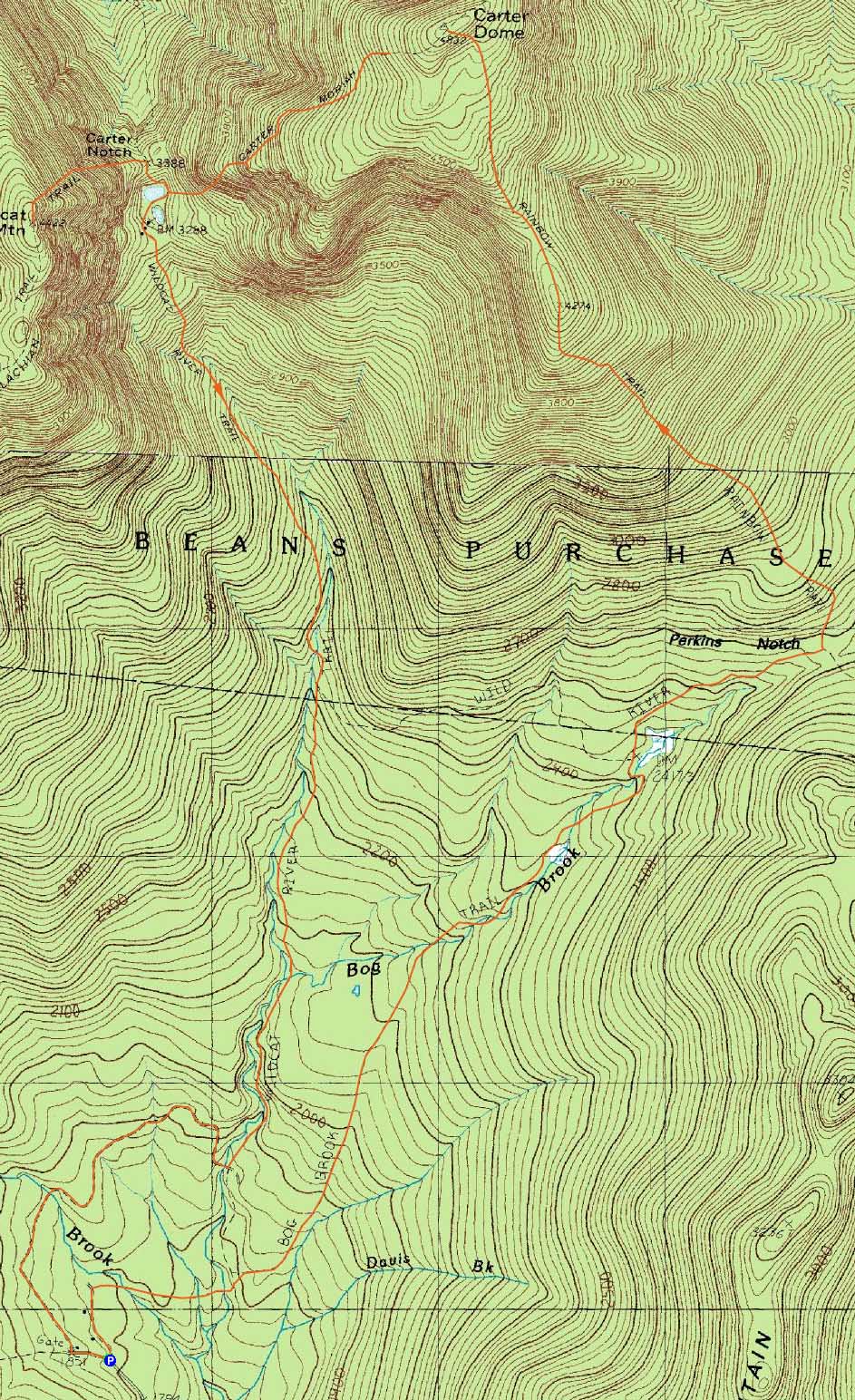
Route: Bog Brook Trail, Rainbow Trail, (Carter Dome), Carter-Moriah Trail, Nineteen Mile Brook Trail, Wildcat Ridge Trail, (Wildcat A), Wildcat Ridge Trail, Nineteen Mile Brook Trail, Wild River Trail, FR 233, Carter Notch Road
Having always ascended Carter Dome via some combination of trails from Nineteen Mile Brook, I was eager to try something new. Having seen the neat terrain of the Rainbow Trail from afar, it looked like an interesting choice.
After parking at the small roadside 'parking area,' we soon set foot on the Bog Brook Trail. The first section of this trail was basically an old logging road of some sort - a bit muddy and, other than the difficult water crossings, not too memorable.
After passing the Wildcat River Trail junction, the Bog Brook Trail became a bit more interesting. Still a bit muddy and very gradual, it started to pass through some nice hardwood glades. Reaching the Rainbow Trail junction, we passed through a marsh and were soon climbing.
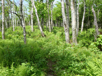
The first part of the climb was through a very nice birch glade - open and filled with greenery. Eventually, the trail climbed into softwood before reaching the subpeak of Carter Dome. At this subpeak, the views were nearly 360 degrees - this would certainly be a popular peak if it had a slightly deeper col (thus putting it on the official 4,000 footer list).
There was a brief moment of confusion on the peak, though, as the trail seemed to lead into an open area without any exit point. Backtracking to the last known trail marking, we realized the blazed rock had been turned. Moving the rock back to its proper orientation, we continued on the trail, dropping into the col and then ascending Carter Dome proper. Never becoming overly steep, it was a nice way to the peak.
Though the sky was clouding over, the views from the near-summit vista were still quite strong. After having some lunch, our next stop was Wildcat A. Other than dealing with thick bug clouds near the ponds in Carter Notch, it was a fairly eventless descent and ascent. As was the case with Carter Dome, the views from the Wildcat A vista were strong under cloudy skies.
After fighting through the bugs again in the notch, we stopped at the Carter Notch Hut for another break. After having some lemonade and baked goods, we set foot on the Wildcat River Trail. Though perhaps not as neat as the Rainbow Trail, it was still new to me and thus a bit interesting. The tricky brook crossings and rotten bogwalks, however, were not much fun. Reaching Forest Road 233, we decided to take it back to Carter Notch Road, rather than deal with the Wildcat River crossing. The skeeters were out at this point, thus making the bland roadwalk even less enjoyable. Nonetheless, it was a refreshingly unique way to hike Carter Dome and Wildcat A.
| Hike Ratings |
|
Getting To Trailhead: |
Easy |
| Destination: |
Carter Dome |
|
Length: |
Moderate |
|
Steepness: |
Moderate |
|
Navigation: |
Moderate |
|
Views: |
Excellent |
|
Crowds: |
Minimal |
| Destination: |
Wildcat A |
|
Length: |
Difficult |
|
Steepness: |
Difficult |
|
Navigation: |
Easy |
|
Views: |
Excellent |
|
Crowds: |
Moderate |
|
| Hike Stats |
|
Date Hiked: |
Saturday, June 13, 2009 |
| Hike Commenced: |
8:58 AM |
| Parking Elevation: |
1,810' |
| Destination: |
Carter Dome |
| Ascent Commenced: |
8:58 AM |
| Summit Reached: |
12:45 PM |
| Time Elapsed: |
03:47 |
| Trailhead Elevation: |
1,810' |
| Summit Elevation: |
4,832' |
| Distance: |
6 miles |
| Vertical Gain: |
3,346' |
| Destination: |
Wildcat A |
| Ascent Commenced: |
1:16 PM |
| Summit Reached: |
3:06 PM |
| Time Elapsed: |
01:50 |
| Trailhead Elevation: |
4,832' |
| Summit Elevation: |
4,422' |
| Vertical Gain: |
1,204' |
|
|
| Hike Ended: |
6:48 PM |
| Hike Time Elapsed: |
9:50 |
| Hike Vertical Gain: |
4,820' |
|
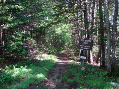
The Bog Brook Trail trailhead on Carter Notch Road
The Rainbow Trail at the subpeak on the way to Carter Dome
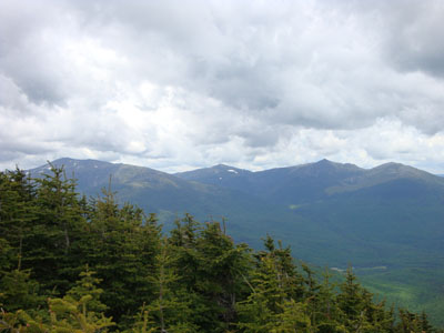
Looking at the Northern Presidentials from the Carter Dome viewpoint
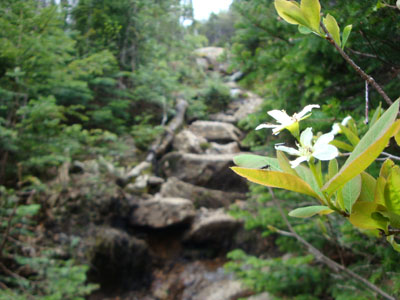
The Wildcat Ridge Trail
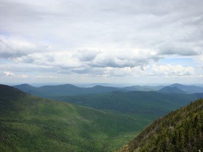
Looking at South Baldface, the Doubleheads, and Kearsarge North Mountain from near the summit of Wildcat A

Directions to trailhead: Take Route 16 North to Jackson, then take a right onto 16A. Take a left onto Carter Notch Road. In late spring, summer, and fall, the Bog Brook Trail trailhead can be reached by driving to near the end of this road. A small parking area is located at the trailhead, on the right side of the dirt road.
Back to Carter Dome Profile
Back to Wildcat A Profile
|