Home
States
Colorado
Connecticut
Maine
Massachusetts
New Hampshire
New York
Rhode Island
Utah
Vermont
View All
Lists
NE 4,000 Footers
NE 100 Highest
NH 4,000 Footers
NH 100 Highest
NH 52 With A View
NH Belknap Range
NH Ossipee 10
Links
Trail Conditions
Trip Log
Sunrises
Sunsets
About
|
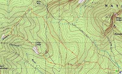
Carter Ledge, Middle Sister
Albany, NH
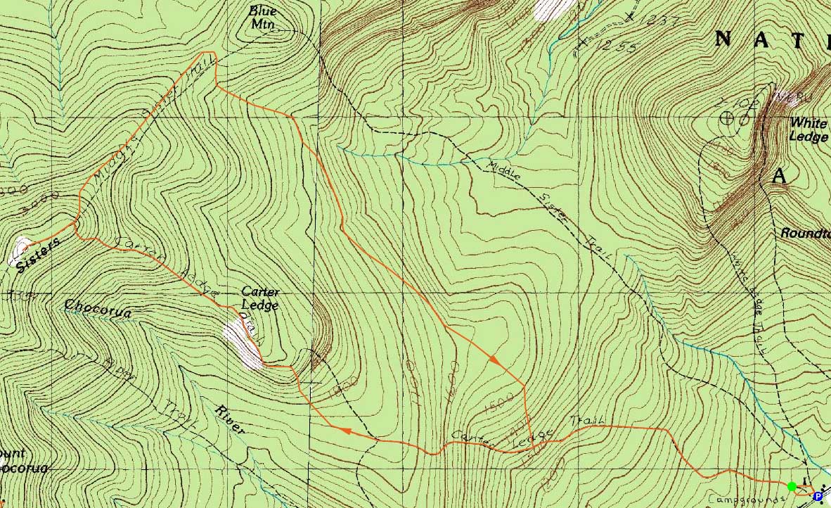
Trailheads, measurements, times, distances, and maps are all approximate and relative to the hike(s) as shown below.
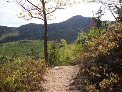
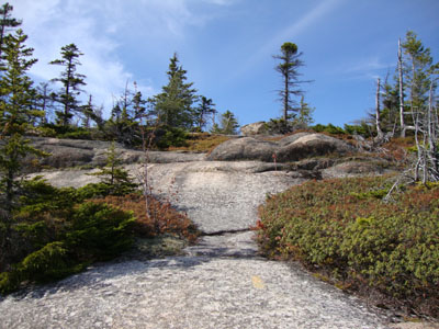
Looking down the Carter Ledge Trail on the way to Carter Ledge
Route: Carter Ledge Trail, (Carter Ledge), Carter Ledge Trail, Middle Sister Trail, (Middle Sister), Middle Sister Trail, Carter Ledge Trail
With White Ledge Campground still closed, I parked outside the gate and headed up the Carter Ledge Trail. The trail was generally fairly tame up to the Nickerson Ledge Trail junction, with the exception of a few rocky areas. Shortly thereafter, I reached the gravel slide, where I took the unmarked sharp right turn. From there, I headed up the nice open trail to Carter Ledge, where there were excellent views in all directions.
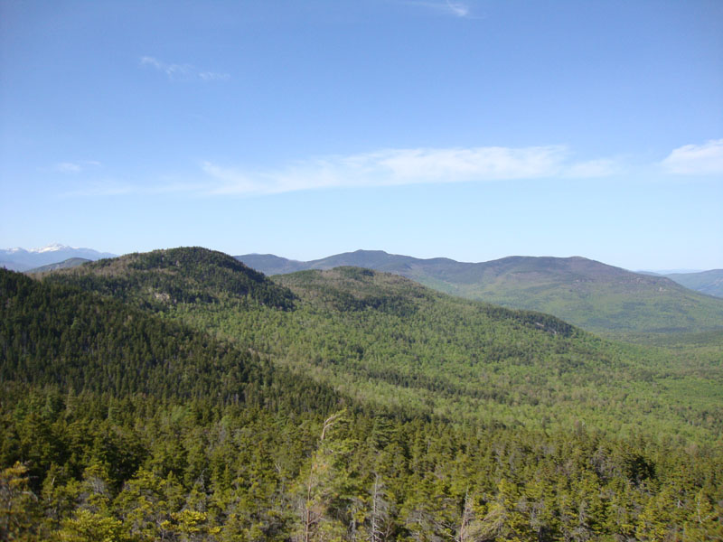
The climb up to Middle Sister was steep, as I remembered it to be. The last portion featured a few tough, small scrambles that wouldn't be much fun in wet conditions. Once again, at the summit of Middle Sister, I had excellent views in all directions, though some clouds were moving in from the southwest.
For the descent, I took the lesser travelled Middle Sister Trail. After dropping steeply off the ridge, it gradually dropped into the Blue Mountain col, passing a few vista ledges on the left (the lower of which had excellent views). While it was tempting to check out Blue Mountain via a short bushwhack, I wanted to make it out by dark. Thusly, I continued down the now-generally gradual Middle Sister Trail, as it slowly worked it's way back to the Carter Ledge Trail with plenty of minor ups and downs.
| Hike Ratings |
|
Getting To Trailhead: |
Easy |
| Destination: |
Carter Ledge |
|
Length: |
Moderate |
|
Steepness: |
Difficult |
|
Navigation: |
Moderate |
|
Views: |
Excellent |
|
Crowds: |
Minimal |
| Destination: |
Middle Sister |
|
Length: |
Moderate |
|
Steepness: |
Very Difficult |
|
Navigation: |
Easy |
|
Views: |
Excellent |
|
Crowds: |
Minimal |
|
| Hike Stats |
|
Date Hiked: |
Thursday, May 13, 2010 |
| Hike Commenced: |
3:15 PM |
| Parking Elevation: |
730' |
| Destination: |
Carter Ledge |
| Ascent Commenced: |
3:18 PM |
| Summit Reached: |
4:28 PM |
| Time Elapsed: |
01:10 |
| Trailhead Elevation: |
740' |
| Summit Elevation: |
2,420' |
| Distance: |
2.8 miles |
| Vertical Gain: |
1,740' |
| Destination: |
Middle Sister |
| Ascent Commenced: |
4:30 PM |
| Summit Reached: |
5:07 PM |
| Time Elapsed: |
00:37 |
| Trailhead Elevation: |
2,420' |
| Summit Elevation: |
3,340' |
| Distance: |
1.2 miles |
| Vertical Gain: |
980' |
|
|
| Hike Ended: |
7:19 PM |
| Hike Time Elapsed: |
04:04 |
| Hike Distance: |
9.6 miles |
| Hike Vertical Gain: |
2,920' |
|
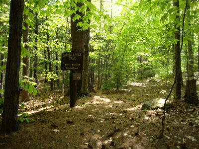
The Carter Ledge Trail trailhead
Looking up the Carter Ledge Trail on the way to Carter Ledge
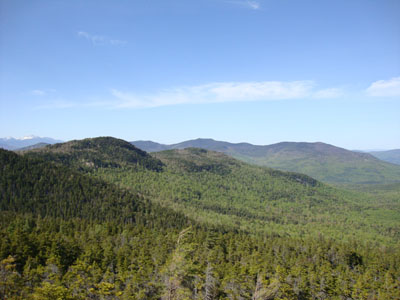
Looking at the Moats from Carter Ledge
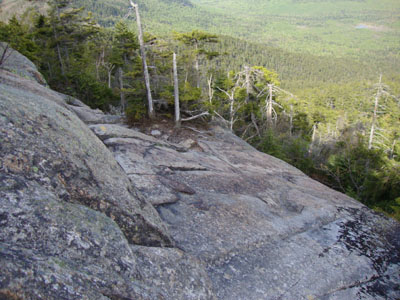
Looking down the Carter Ledge Trail on the way to Middle Sister
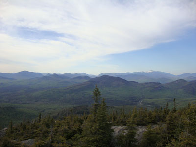
Looking at Crawford Notch (center) from Middle Sister
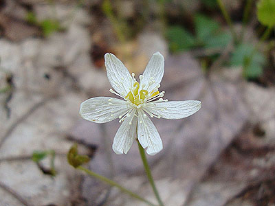
A wild flower along the Middle Sister Trail

Directions to trailhead: Take Route 16 North from Tamworth. Shortly after the Piper Trail entrance, the White Ledge Campground will appear on the left. In the off season, there is limited room for parking outside the gate. Upon walking past the gate, take the first paved road on the left. As this road curves back around, the Carter Ledge Trail trailhead is on the left.
Back to Carter Ledge Profile
Back to Middle Sister Profile
|