Home
States
Colorado
Connecticut
Maine
Massachusetts
New Hampshire
New York
Rhode Island
Utah
Vermont
View All
Lists
NE 4,000 Footers
NE 100 Highest
NH 4,000 Footers
NH 100 Highest
NH 52 With A View
NH Belknap Range
NH Ossipee 10
Links
Trail Conditions
Trip Log
Sunrises
Sunsets
About
|
Cotton Mountain, Mt. Livermore
Holderness, NH
Trailheads, measurements, times, distances, and maps are all approximate and relative to the hike(s) as shown below.
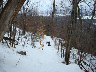
Looking down the Cotton Mountain Trail
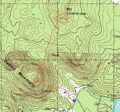
Route: Cotton Mountain Trail, (Cotton Mountain), Crawford-Ridgepole Trail, Prescott Trail, (bushwack), (Mt. Livermore), Crawford-Ridgepole Trail, (Cotton Mountain), Cotton Mountain Trail
With gloomy weather cancelling any sort of significant hike, I was tempted to stay home. In order to get moving, I used the idea of finding new sunset hikes as my motivation.
The Cotton Mountain Trail parking area was plowed out and the trail signed, so it was pretty easy to get going. The first part of the trail weaves gradually through an abandoned gravel pit - kind of ugly, but whatever.
After leaving the gravel pit, the trail gets progressively steeper as it climbs to the southeastern summit of Cotton Mountain. On my way by, I was let down by the lack of views - I didn't stop to look around, however, so I missed the somewhat obvious spur trail to the ledge.
Now on the Crawford-Ridgepole Trail, I did some sliding on my snowshoes down the steeps. Soon thereafter, the trail meanders around some flats, crossing multiple small creeks and brooks.
Arriving at the Prescott Trail junction, I was a little bit confused, as the junction was signed as if it were a 4 way. It wasn't, and I went against my instinct and headed uphill on the Prescott Trail. Realizing I should have gone downhill (and around the side of Mt. Livermore), I decided to bushwack up to the summit.
The bushwack was fairly easy, as the brush wasn't too thick - that is, until I reached the top and had to navigate my way through some somewhat recently cut saplings and trees.
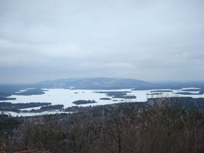
The views from Mt. Livermore were pretty strong, despite the gloomy weather - Red Hill and the lakes were in plain sight, as well as points to the south, such as Mt. Kearsarge.
After poking around a bit, I dropped down the Crawford-Ridgepole Trail and headed back to Cotton Mountain - this time stopping at that ledge, which looks out over Squam Lake.
All things considered, not a bad hike. My finding, however, is that there is no prospect of a good sunset view from Cotton Mountain and possibly a partial view in that direction from Mt. Livermore.
| Hike Ratings |
|
Getting To Trailhead: |
Easy |
| Destination: |
Cotton Mountain |
|
Length: |
Easy |
|
Steepness: |
Difficult |
|
Navigation: |
Easy |
|
Views: |
Excellent |
|
Crowds: |
Minimal |
| Destination: |
Mt. Livermore |
|
Length: |
Moderate |
|
Steepness: |
Difficult |
|
Navigation: |
Moderate |
|
Views: |
Excellent |
|
Crowds: |
Minimal |
|
| Hike Stats |
|
Date Hiked: |
Sunday, February 3, 2008 |
| Hike Commenced: |
12:54 PM |
| Parking Elevation: |
590' |
| Destination: |
Cotton Mountain |
| Ascent Commenced: |
12:54 PM |
| Summit Reached: |
1:18 PM |
| Time Elapsed: |
00:24 |
| Trailhead Elevation: |
590' |
| Summit Elevation: |
1,200' |
| Vertical Gain: |
615' |
| Destination: |
Mt. Livermore |
| Ascent Commenced: |
1:18 PM |
| Summit Reached: |
2:02 PM |
| Time Elapsed: |
00:44 |
| Trailhead Elevation: |
1,200' |
| Summit Elevation: |
1,500' |
| Vertical Gain: |
715' |
|
|
| Hike Ended: |
3:14 PM |
| Hike Time Elapsed: |
02:20 |
| Hike Vertical Gain: |
1,900' |
|
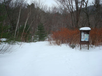
Looking at the Cotton Mountain Trail trailhead on the side of Route 113
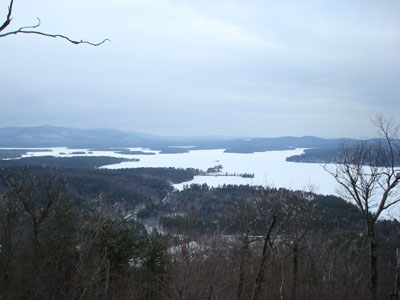
Looking at Squam Lake from the Cotton Mountain southeast summit ledge
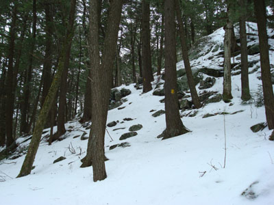
Looking up the Crawford Ridgepole Trail, coming off Cotton Mountain
Looking at Red Hill from the Mt. Livermore summit

Directions to trailhead: From Route 25 in Holderness, take Route 113 East past the Squam Lakes Natural Science Center. The small roadside parking lot and Cotton Mountain Trail trailhead will be on the left shortly thereafter.
Back to Cotton Mountain Profile
Back to Mt. Livermore Profile
|


