Home
States
Colorado
Connecticut
Maine
Massachusetts
New Hampshire
New York
Rhode Island
Utah
Vermont
View All
Lists
NE 4,000 Footers
NE 100 Highest
NH 4,000 Footers
NH 100 Highest
NH 52 With A View
NH Belknap Range
NH Ossipee 10
Links
Trail Conditions
Trip Log
Sunrises
Sunsets
About
|
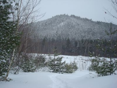
Cotton Mountain
Holderness, NH
Trailheads, measurements, times, distances, and maps are all approximate and relative to the hike(s) as shown below.
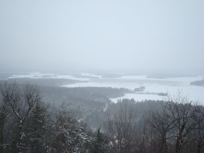
Looking down the Cotton Mountain Trail
Route: Cotton Mountain Trail
Since I was in the area with some time to kill, I decided to do a quick hike. While supposedly the Friday snowstorm was supposed to be done and gone, it was still snowing late in the morning. Arriving at the Cotton Mountain Trail trailhead on Route 113, I could see that I would be breaking trail. Though not a terribly tough task, being that there was only about a foot to a foot and a half of powder on the ground from this storm and the one just before it, I nonetheless knew it would be a little bit of a workout.
The first part of the trail, where it gradually winds through an old gravel pit, was easy enough. Above that, I clanked some hidden rocks with my snowshoes a few times, but otherwise it wasn't too bad - except for the stairway portion. While it would have been logical to just take off my snowshoes, I didn't feel like fussing with them, so I stumbled my way up.
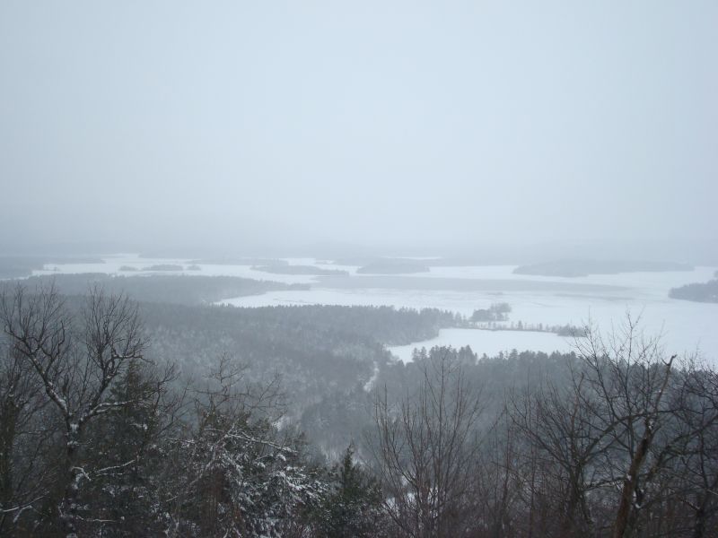
The views from the vista near the southeast summit were decent, despite the light snowfall. While the views weren't far stretching per se, parts of Squam Lake were visible nonetheless.
It was fitting to be hiking in a foot of powder on the last day of this wintery fall.
| Hike Ratings |
|
Getting To Trailhead: |
Easy |
| Destination: |
Cotton Mountain |
|
Length: |
Easy |
|
Steepness: |
Difficult |
|
Navigation: |
Easy |
|
Views: |
Excellent |
|
Crowds: |
Minimal |
|
| Hike Stats |
|
Date Hiked: |
Saturday, December 20, 2008 |
| Hike Commenced: |
11:27 AM |
| Parking Elevation: |
590' |
| Destination: |
Cotton Mountain |
| Ascent Commenced: |
11:27 AM |
| Summit Reached: |
11:55 AM |
| Time Elapsed: |
00:28 |
| Trailhead Elevation: |
590' |
| Summit Elevation: |
1,200' |
| Distance: |
.7 mile |
| Vertical Gain: |
615' |
|
|
| Hike Ended: |
12:17 PM |
| Hike Time Elapsed: |
00:50 |
| Hike Distance: |
1.4 miles |
| Hike Vertical Gain: |
625' |
|
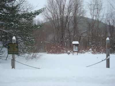
The Cotton Mountain Trail trailhead off Route 113
Looking at Squam Lake from the viewpoint near the southeast peak of Cotton Mountain
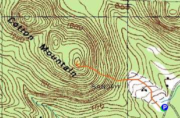

Directions to trailhead: From Route 25 in Holderness, take Route 113 East past the Squam Lakes Natural Science Center. The small roadside parking lot and Cotton Mountain Trail trailhead will be on the left shortly thereafter.
Back to Cotton Mountain Profile
|