Home
States
Colorado
Connecticut
Maine
Massachusetts
New Hampshire
New York
Rhode Island
Utah
Vermont
View All
Lists
NE 4,000 Footers
NE 100 Highest
NH 4,000 Footers
NH 100 Highest
NH 52 With A View
NH Belknap Range
NH Ossipee 10
Links
Trail Conditions
Trip Log
Sunrises
Sunsets
About
|
Eagle Mountain
Jackson, NH
Trailheads, measurements, times, distances, and maps are all approximate and relative to the hike(s) as shown below.
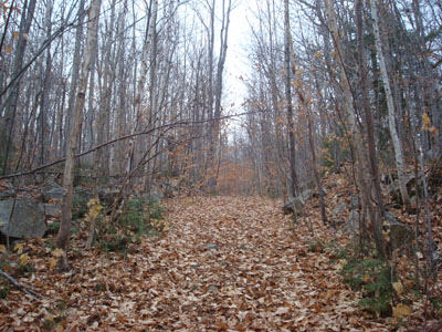
Looking up the Eagle Mountain Path
Despite it being a cloudy day, I needed to go to North Conway, so I decided to continue up the road and do a short hike. Thus, Eagle Mountain.
Arriving at the upper parking lot at the Eagle Mountain House, I headed up the woods road, soon taking a right onto a lesser woods road. Just before an old sugar house, I beared left onto a faint trail, soon meeting up with a deer hunter - good thing I was wearing an orange shirt!
I didn't see much in way of markings, but for awhile the trail bed was fairly accurate. Soon after passing a quasi-pond, the trail became very vague. Heading straight to the cliffs, I followed a line of cairns, which didn't seem to correspond to much of a trail. After a steep scramble between some ledges, I soon emerged at the large cairn (apparently the summit, though I suspect the ground is slightly higher just a bit to the north).
After following a herd path to a moderate viewpoint, I went back to the cairn and found what looked to be the trail. Along the top of the trail, I found another viewpoint which was very similar to the first. Though cloudy, the views ranged from South Doublehead to the Moats. While not terrible, the view wasn't as good as I had expected, as there were some branches/sapplings in the foreground, and lots of development in the distance.
Descending was rather tricky in places, due to the steep nature of it and the slippery leaves. The trail was marked with cairns (a different set of cairns than the ones I followed up), but still a little bit hard to follow near where I missed it on the ascent.
| Hike Ratings |
|
Getting To Trailhead: |
Easy |
| Destination: |
Eagle Mountain |
|
Length: |
Moderate |
|
Steepness: |
Difficult |
|
Navigation: |
Difficult |
|
Views: |
Moderate |
|
Crowds: |
Minimal |
|
| Hike Stats |
|
Date Hiked: |
Wednesday, November 5, 2008 |
| Hike Commenced: |
3:57 PM |
| Parking Elevation: |
1,000' |
| Destination: |
Eagle Mountain |
| Ascent Commenced: |
3:57 PM |
| Summit Reached: |
4:18 PM |
| Time Elapsed: |
00:21 |
| Trailhead Elevation: |
1,000' |
| Summit Elevation: |
1,613' |
| Vertical Gain: |
633' |
|
|
| Hike Ended: |
4:45 PM |
| Hike Time Elapsed: |
00:48 |
| Hike Vertical Gain: |
663' |
|
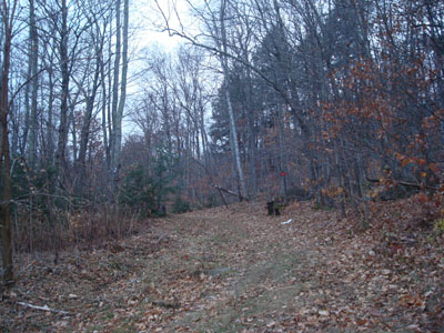
The start of the woods road at the top parking lot
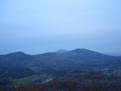
Looking at Thorn Mountain and Kearsarge North Mountain from near the summit of Eagle Mountain

Directions to trailhead: From Jackson, take 16B North (Carter Notch Road) to the Eagle Mountain House. The Eagle Mountain Path starts as a woods road at the top parking lot behind the Eagle Mountain House.
Back to Eagle Mountain Profile
|

