Home
States
Colorado
Connecticut
Maine
Massachusetts
New Hampshire
New York
Rhode Island
Utah
Vermont
View All
Lists
NE 4,000 Footers
NE 100 Highest
NH 4,000 Footers
NH 100 Highest
NH 52 With A View
NH Belknap Range
NH Ossipee 10
Links
Trail Conditions
Trip Log
Sunrises
Sunsets
About
|
Eastman Mountain
Jackson, NH, Chatham, NH
Trailheads, measurements, times, distances, and maps are all approximate and relative to the hike(s) as shown below.
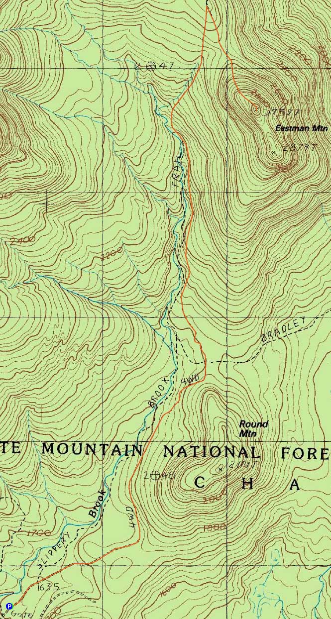
The Slippery Brook Trail
Route: Slippery Brook Trail, Mt. Eastman Trail, (Eastman Mountain), Mt. Eastman Trail, Slippery Brook Trail
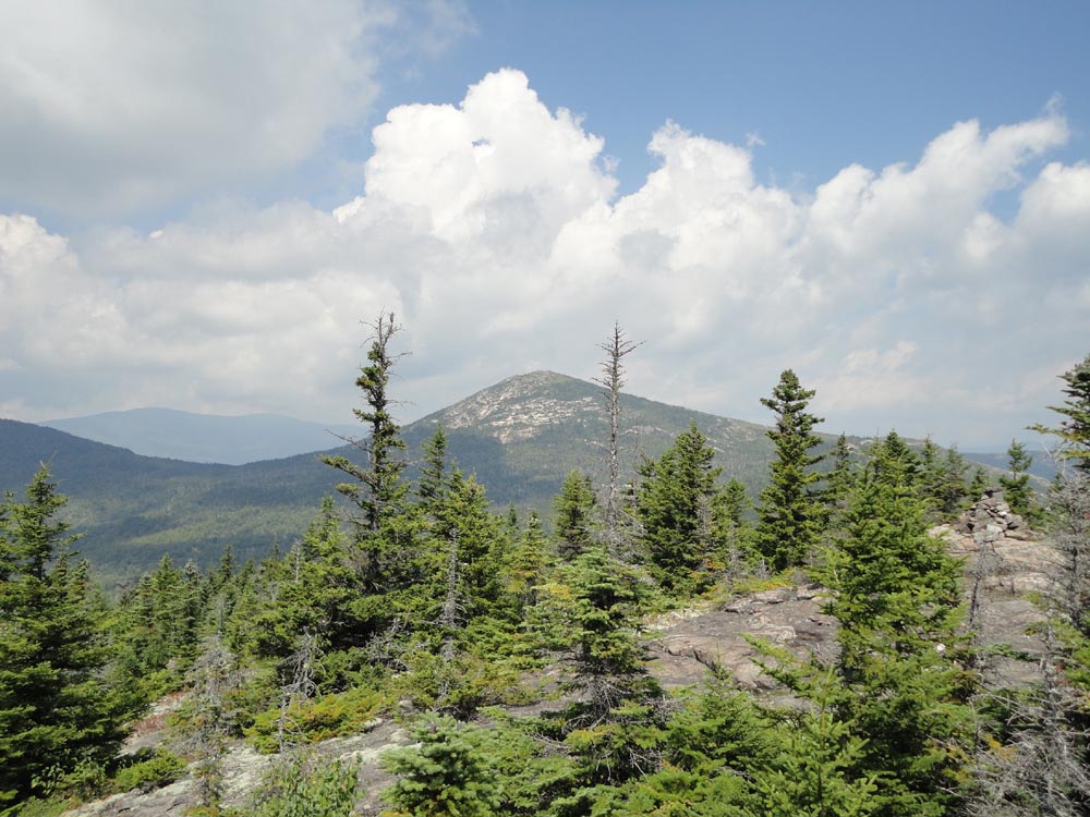
The Slippery Brook forest road portion was fast hiking. Reaching the actual hiking trail portion, progress slowed a bit due to some slippery roots and rocks. Further up, the trail was rather vague as it passed through grown in quasi-meadows. Overall, the grades were generally easy all the way up to the height of land. The Mt. Eastman Trail had or two steep sections as it climbed up to the somewhat ledgy summit, from where there were good views and excellent blueberries.
| Hike Ratings |
|
Getting To Trailhead: |
Easy |
| Destination: |
Eastman Mountain |
|
Length: |
Moderate |
|
Steepness: |
Difficult |
|
Navigation: |
Easy |
|
Views: |
Excellent |
|
Crowds: |
Minimal |
|
| Hike Stats |
|
Date Hiked: |
Saturday, August 20, 2011 |
| Parking Elevation: |
1,610' |
| Destination: |
Eastman Mountain |
| Time Elapsed: |
01:47 |
| Trailhead Elevation: |
1,610' |
| Summit Elevation: |
2,939' |
| Distance: |
4.8 miles |
| Vertical Gain: |
1,479' |
|
|
| Hike Time Elapsed: |
04:08 |
| Hike Distance: |
9.6 miles |
| Hike Vertical Gain: |
1,629' |
|
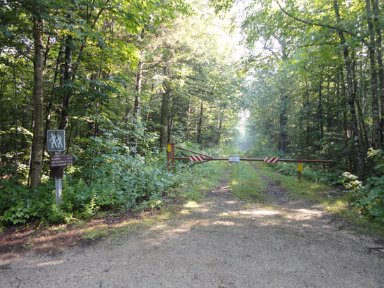
The Slippery Brook Trail trailhead
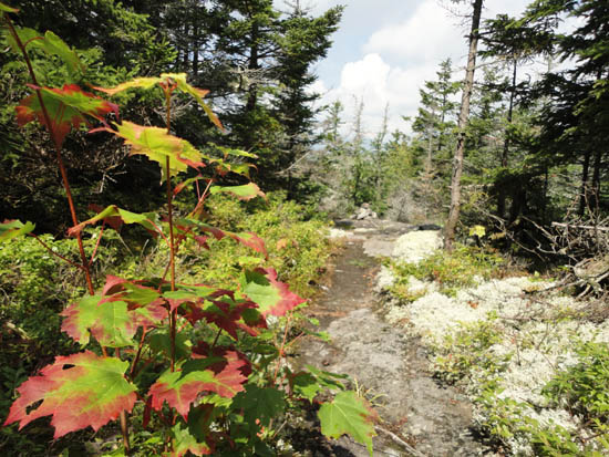
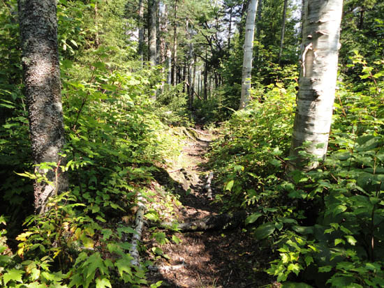
The Mt. Eastman Trail
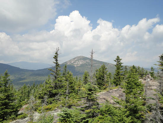
Looking at South Baldface from Eastman Mountain
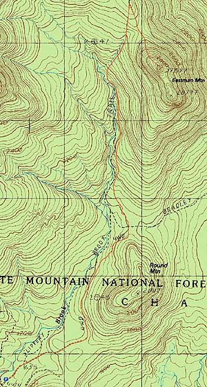

Directions to trailhead: Take Route 16 North from North Conway, then take a right onto Town Hall Road. Continue straight past Route 16A. At a fork in the road, bear left. The Slippery Brook Trail trailhead will be at the end of this dirt road, a few minutes after the Mountain Pond trailhead. There is limited room for parking adjacent to the gate.
Back to Eastman Mountain Profile
|