Home
States
Colorado
Connecticut
Maine
Massachusetts
New Hampshire
New York
Rhode Island
Utah
Vermont
View All
Lists
NE 4,000 Footers
NE 100 Highest
NH 4,000 Footers
NH 100 Highest
NH 52 With A View
NH Belknap Range
NH Ossipee 10
Links
Trail Conditions
Trip Log
Sunrises
Sunsets
About
|
East Rattlesnake
Holderness, NH
Trailheads, measurements, times, distances, and maps are all approximate and relative to the hike(s) as shown below.
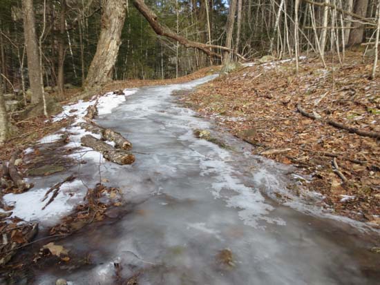
Ice ice baby
Route: East Rattlesnake Trail, (East Rattlesnake), East Rattlesnake Trail, Ridge Trail, Col Trail
Trails were maybe 50/50 bare ground and ice/snow. Some decent ice flows on each trail, though generally avoidable. Snow was never more than 2-4" deep in the shade. Extended portions of bare ground. I was able to do the loop without putting on traction, but others may prefer have it just in case.
| Hike Ratings |
|
Getting To Trailhead: |
Easy |
| Destination: |
East Rattlesnake |
|
Length: |
Easy |
|
Steepness: |
Moderate |
|
Navigation: |
Easy |
|
Views: |
Excellent |
|
Crowds: |
Minimal |
|
| Hike Stats |
|
Date Hiked: |
Sunday, February 3, 2013 |
| Time to Trailhead: |
00:04 |
| Parking Elevation: |
623' |
| Destination: |
East Rattlesnake |
| Time Elapsed: |
00:15 |
| Trailhead Elevation: |
720' |
| Summit Elevation: |
1,289' |
| Vertical Gain: |
584' |
|
|
| Hike Time Elapsed: |
00:54 |
| Hike Vertical Gain: |
711' |
|
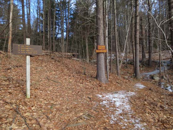
The East Rattlesnake Trail trailhead

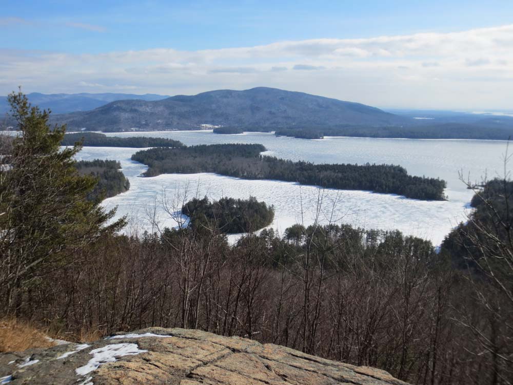
Looking at Red Hill from the East Rattlesnake view point
Directions to trailhead: Take Route 113 West from Center Sandwich. Shortly after the Mt. Morgan parking lot, take a left onto Pinehurst Road. Park outside the private property entranceway (don't block the road!), then follow the road up shortly, taking a left, then a right between two cabins. The East Rattlsnake Trail sign will be a minute or two up the path.
Back to East Rattlesnake Profile
|