Home
States
Colorado
Connecticut
Maine
Massachusetts
New Hampshire
New York
Rhode Island
Utah
Vermont
View All
Lists
NE 4,000 Footers
NE 100 Highest
NH 4,000 Footers
NH 100 Highest
NH 52 With A View
NH Belknap Range
NH Ossipee 10
Links
Trail Conditions
Trip Log
Sunrises
Sunsets
About
|
Green Mountain
Effingham, NH
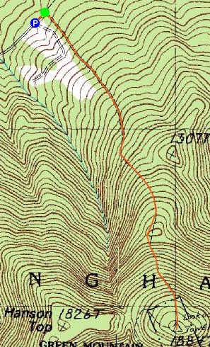
Trailheads, measurements, times, distances, and maps are all approximate and relative to the hike(s) as shown below.
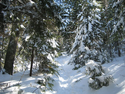
Heading up the High Watch Trail to the Green Mountain summit
Route: High Watch Trail
After skiing Loon on a cold, snowy morning, I decided to bypass my afternoon plans of skiing Wildcat (burrrr) and instead do a short hike.
Despite the mostly cloudy forecast, I arrived at a sunny trailhead. Initially I had planned to snowshoe it, however I discovered the trail was broken out with heavy bareboot traffic, and thus went back to my truck and swapped my shoeshoes for Stablicers.
Though there were moderate winds, there was still an abundance of snow in the trees, making for a really nice hike once I arrived in the evergreen woods. The hike itself gets progressively steep - starting off level, becoming more moderate in the evergreens, and then having a short steeper pitch near the top.
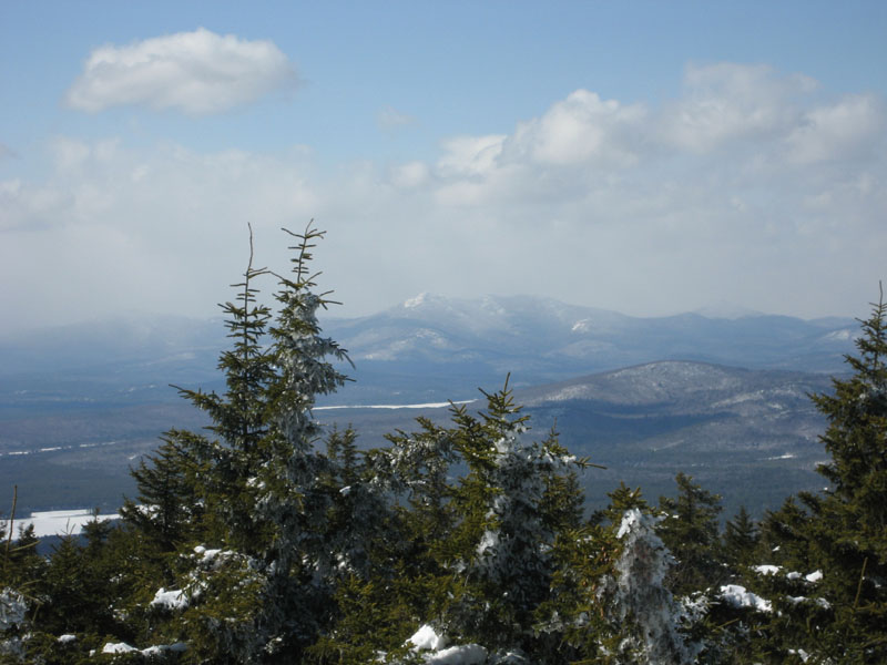
The views of the Whites were obscured due to the snowstorm that had been hanging out since I was there this morning, however pretty much every other direction was clear.
After taking in the scenary for a few minutes, the intense wind drove me back to the ground. Taking advantage of the cushion of the fluffy powder, I jogged half of the way back to the base.
| Hike Ratings |
|
Getting To Trailhead: |
Easy |
| Destination: |
Green Mountain |
|
Length: |
Moderate |
|
Steepness: |
Difficult |
|
Navigation: |
Easy |
|
Views: |
Excellent |
|
Crowds: |
Minimal |
|
| Hike Stats |
|
Date Hiked: |
Sunday, April 8, 2007 |
| Hike Commenced: |
2:33 PM |
| Parking Elevation: |
738' |
| Destination: |
Green Mountain |
| Ascent Commenced: |
2:34 PM |
| Summit Reached: |
3:16 PM |
| Time Elapsed: |
00:42 |
| Trailhead Elevation: |
735' |
| Summit Elevation: |
1,907' |
| Distance: |
1.3 miles |
| Vertical Gain: |
1,182' |
|
|
| Hike Ended: |
3:55 PM |
| Hike Time Elapsed: |
01:21 |
| Hike Distance: |
2.6 miles |
| Hike Vertical Gain: |
1,205' |
|
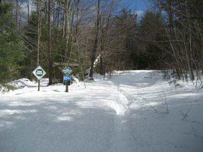
High Watch Trail trailhead

Looking northwest from the Green Mountain summit at Mount Chocorua in a snowstorm

Directions to trailhead: Take Green Mountain Road from Route 25 to High Watch Road (there will be a small 'Fire Tower' sign). At the end of this road, there will be a class four road sign. The trailhead is shortly after this on the right.
Back to Green Mountain Profile
|